Eddystone Rocks (South Shetland Islands)

Last updated
Eddystone Rocks
Rugged-Island-location-map.png
Location of Eddystone Rocks
Geography
Location Antarctica
Coordinates 62°35′54.9″S61°23′11.6″W / 62.598583°S 61.386556°W / -62.598583; -61.386556
Archipelago South Shetland Islands
Administration
Administered under the Antarctic Treaty System
Demographics
Populationuninhabited
Topographic map of Livingston Island and Smith Island Livingston-Island-Map-2010-15.png
Topographic map of Livingston Island and Smith Island
Fragment of George Powell's 1822 chart of the South Shetland Islands and South Orkney Islands featuring Eddystone Rocks Powell-Chart-1822.png
Fragment of George Powell's 1822 chart of the South Shetland Islands and South Orkney Islands featuring Eddystone Rocks

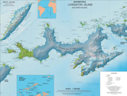
Eddystone Rocks is a group of two rocks (the north one being the larger) lying to the northwest of Rugged Island off western Livingston Island in the South Shetland Islands, Antarctica.

Contents

The feature was charted and named in 1821 by Robert Fildes after the Eddystone Rocks off Plymouth, England.

Location

The rocks are centred at 62°35′54.9″S61°23′11.6″W / 62.598583°S 61.386556°W / -62.598583; -61.386556 which is 3.54 km (2.2 mi) west-southwest of The Pointers, 4.73 km (2.94 mi) west-northwest of Cape Sheffield, Rugged Island, and 4.5 km (2.8 mi) northwest of Bekas Rock (British mapping in 1821, 1822, 1933 and 1968, French in 1937, Argentine in 1946, 1957 and 1980, Chilean in 1971, and Bulgarian in 2009 and 2017).

See also

Maps

Related Research Articles

<span class="mw-page-title-main">Rugged Island (South Shetland Islands)</span> Antarctic island

Rugged Island is an island 3 miles (4.8 km) long and 1 mile (1.6 km) wide, lying west of Livingston Island in the South Shetland Islands. Its surface area is 10.4 square kilometres (4.0 sq mi). The island's summit San Stefano Peak rises to 256 metres (840 ft) above sea level. Rugged Island is located at 62°38′S61°15′W. Rugged Island was known to both American and British sealers as early as 1820, and the name has been well established in international usage for over 100 years.

<span class="mw-page-title-main">Start Point (Livingston Island)</span>

Start Point is a point marking the northwest end of Byers Peninsula, Livingston Island in the South Shetland Islands, Antarctica and forming the southwest side of the entrance to Svishtov Cove and the northeast side of the entrance to the New Plymouth bay. Discovered by Edward Bransfield in January 1820, and so named by him because of its resemblance to a point on the south coast of England by the same name and because it was the place where his operations began.

<span class="mw-page-title-main">Desolation Island (South Shetland Islands)</span> Island in Antarctica

Desolation Island is one of the minor islands in the South Shetlands archipelago, Antarctica situated at the entrance to Hero Bay, Livingston Island. The island is V-shaped with its northern coast indented by Kozma Cove. Surface area is 3.12 square kilometres (1.20 sq mi).

<span class="mw-page-title-main">Maglizh Rocks</span> Group of rocks in Antarctica

Maglizh Rocks are a group of rocks off the northwest coast of Smith Island, South Shetland Islands. The two adjacent principal rocks, extending 460 m (503 yd) in east-west direction and 140 m (153 yd) wide are situated 300 m (328 yd) north of Lista Point, with the third major one, 300 by 100 m, situated 320 m (350 yd) northwest of them. The rocks have a combined surface area of 10.6 hectares. The rocks are named after the town of Maglizh in southern Bulgaria.

<span class="mw-page-title-main">Saparevo Glacier</span> Glacier in Antarctica

Saparevo Glacier is a 1.8 km long and 2 km wide glacier draining the northwest slopes of Imeon Range on Smith Island, South Shetland Islands, Antarctica. It is situated northeast of Kongur Glacier, and flows north-northeast of Mount Christi and southwest of Matochina Peak into Vedena Cove in Drake Passage. Bulgarian early mapping in 2009. The glacier is named after the settlement of Saparevo in Southwestern Bulgaria.

<span class="mw-page-title-main">Kongur Glacier</span> Glacier in Antarctica

Kongur Glacier is a 2.7 kilometres (1.7 mi) long glacier draining the northwest slopes of Imeon Range on Smith Island in the South Shetland Islands, Antarctica. It is situated northeast of Dalgopol Glacier and southwest of Saparevo Glacier, and flows west of Mount Christi into Drake Passage. Bulgarian early mapping in 2009. The glacier is named after the peak and nature reserve of Kongur on Belasitsa Mountain in southwestern Bulgaria.

<span class="mw-page-title-main">Chuprene Glacier</span> Glacier in Antarctica

Chuprene Glacier is a 2.1 nautical miles long glacier draining the northwest slopes of Imeon Range on Smith Island in the South Shetland Islands, Antarctica. It is situated northeast of Bistra Glacier, southwest of Yablanitsa Glacier and northwest of Krivodol Glacier, Pashuk Glacier and Rupite Glacier, and flows southwest of Drinov Peak and Popovo Saddle, and west of Slatina Peak and Varshets Saddle southwestward along the northwest slopes of Antim Peak and Evlogi Peak into Drake Passage south of Villagra Point and north of Garmen Point. Bulgarian early mapping in 2009. The glacier is named after the settlement of Chuprene in northwestern Bulgaria.

<span class="mw-page-title-main">South Bay (Livingston Island)</span>

South Bay is a 11.6 kilometres (7.2 mi) wide bay indenting for 12.5 kilometres (7.8 mi) the south coast of Livingston Island in the South Shetland Islands, Antarctica. The bay is lying northwest of False Bay and east of Walker Bay, and is entered between Hannah Point and Miers Bluff. The glaciers Kamchiya, Pimpirev, Perunika, Contell, Johnsons and Hurd Ice Cap feed the bay.

<span class="mw-page-title-main">McFarlane Strait</span> McFarlane Strait

McFarlane Strait is a strait lying between Greenwich Island and Livingston Island, in the South Shetland Islands off Antarctica. It is 24 kilometres (13 nmi) long and 3 kilometres (1.6 nmi) wide. The name appears on an 1822 chart by Captain George Powell, a British sealer, and is now well established in international usage.

<span class="mw-page-title-main">Morton Strait</span> Strait in the South Shetland Islands, Antarctica

Morton Strait is the 9-kilometre-long (4.9 nmi) and 6.2-kilometre-wide (3.3 nmi) strait between Snow Island on the southwest and Rugged Island and Livingston Island on the northeast, in the South Shetland Islands, Antarctica. The Aim Rocks and Long Rock lie in the strait.

<span class="mw-page-title-main">Renier Point</span> Narrow point on the Burgas Peninsula and Livingston Island

Renier Point is a narrow point forming the east extremity of both Burgas Peninsula and Livingston Island in the South Shetland Islands, Antarctica. The feature was known to sealers as Point Renier as early as 1821. The name ‘Pin Point’, given by Discovery Investigations personnel on the Discovery II in 1935, has been rejected in favor of the original name.

<span class="mw-page-title-main">Hurd Peninsula</span>

Hurd Peninsula lies between South Bay and False Bay on the south coast of Livingston Island in the South Shetland Islands, Antarctica. The Spanish Juan Carlos I Antarctic Base and the Bulgarian St. Kliment Ohridski Base are situated on its west coast.

<span class="mw-page-title-main">New Plymouth (Livingston Island)</span>

New Plymouth is a bay bordered by an extensive line of beaches, lying south of Start Point and between Rugged Island and the west end of Livingston Island in the South Shetland Islands, Antarctica.

<span class="mw-page-title-main">Devils Point</span> Point marking the southwest extremity of Byers Peninsula in Antarctica

Devils Point is a point marking the southwest extremity of Byers Peninsula, Livingston Island in the South Shetland Islands, Antarctica and forming the southeast side of the entrance to Osogovo Bay and the west side of the entrance to Raskuporis Cove. The point is separated from Vardim Rocks to the south by Hell Gates. Lucifer Crags, a rocky bluff rising to 81 m at the south extremity of President Beaches, surmount Devils Point on the southwest, Acheron Lake on the northeast and Siren Lake on the east-southeast. The area was visited by early 19th century sealers.

<span class="mw-page-title-main">Bistra Glacier</span> Glacier in Antarctica

Bistra Glacier is 1 nautical mile long and 0.4 nautical miles wide glacier on the northwest side of Imeon Range on Smith Island in the South Shetland Islands, Antarctica. It is situated southwest of Chuprene Glacier and northwest of Dragoman Glacier, drains the west slopes of Mount Foster and the north slopes of Slaveykov Peak, and flows northwestwards of Zavet Saddle to enter Drake Passage south of Garmen Point.

<span class="mw-page-title-main">Essex Point</span>

Essex Point is a point at the northwest end of Byers Peninsula, Livingston Island in the South Shetland Islands, Antarctica. It forms the west side of the entrance to Barclay Bay and the northeast side of the entrance to Svishtov Cove, and is surmounted by Drong Hill.

<span class="mw-page-title-main">Barlow Island</span>

Barlow Island is a small ice-free island off the north coast of Smith Island in the South Shetland Islands, Antarctica extending 380 by 160 m, surface area 5.28 hectares.

<span class="mw-page-title-main">Window Island</span> Island in Antarctica

Window Island is a small ice-free island off the north coast of Ray Promontory in the northwest of Byers Peninsula, Livingston Island in the South Shetland Islands, Antarctica. The island has a surface area of 23 hectares and rises to 72 m (236 ft). It was known to the early 19th century sealers operating on Byers Peninsula.

<span class="mw-page-title-main">South Beaches (Livingston Island)</span> Series of beaches in Antarctica

South Beaches are the beaches extending along the south side of Byers Peninsula, Livingston Island in the South Shetland Islands, Antarctica between Devils Point to the west and Rish Point to the east. The beaches were visited by 19th century sealers.

<span class="mw-page-title-main">Point Smellie</span>

Point Smellie is a small steep-sided headland extending into Osogovo Bay from President Beaches on Byers Peninsula, Livingston Island in the South Shetland Islands, Antarctica and dominated by Smellie Hill.

References