Frederick Rocks

Last updated
Frederick Rocks
Livingston-Island-location-map.png
Geography
Location Antarctica
Coordinates 62°32′46.5″S60°55′59.7″W / 62.546250°S 60.933250°W / -62.546250; -60.933250
Archipelago South Shetland Islands
Administration
Administered under the Antarctic Treaty System
Demographics
Populationuninhabited
Robbery Beaches and Barclay Bay from near Basalt Lake on Byers Peninsula, Livingston Island, with left to right Lair Point, Frederick Rocks, Cutler Stack, Nedelya Point and the northern part of Urvich Wall in the middle ground, and Cape Shirreff and Ioannes Paulus II Peninsula in the right background Byers Peninsula.jpg
Robbery Beaches and Barclay Bay from near Basalt Lake on Byers Peninsula, Livingston Island, with left to right Lair Point, Frederick Rocks, Cutler Stack, Nedelya Point and the northern part of Urvich Wall in the middle ground, and Cape Shirreff and Ioannes Paulus II Peninsula in the right background
Topographic map of Livingston Island, Greenwich, Robert, Snow and Smith Islands Livingston-Island-Map-2010.jpg
Topographic map of Livingston Island, Greenwich, Robert, Snow and Smith Islands

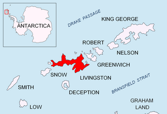
Frederick Rocks is a group of rocks lying in Barclay Bay on the north side of Livingston Island in the South Shetland Islands, Antarctica. The area was visited by early 19th century sealers operating on nearby Byers Peninsula.

Contents

The feature is named after the American brig Frederick under Captain Benjamin Pendleton that visited the South Shetlands in 1820-21 and 1821–22.

Location

The rocks are located at 62°32′46.5″S60°55′59.7″W / 62.546250°S 60.933250°W / -62.546250; -60.933250 which is 12.24 km (7.61 mi)southwest of Cape Shirreff, 4.69 km (2.91 mi) west-southwest of Scesa Point, 5.28 km (3.28 mi) west-northwest of Rowe Point and 13.3 km (8.26 mi) east-northeast of Essex Point (British mapping in 1968, Chilean in 1971, Argentine in 1980, and Bulgarian in 2009).

See also

Maps

Related Research Articles

<span class="mw-page-title-main">Vardim Rocks</span>

Vardim Rocks are a group of rocks situated on the south side of Hell Gates, facing Devils Point in the southwest extremity of Byers Peninsula on Livingston Island in the South Shetland Islands, Antarctica. Extending 1.3 km (0.81 mi) in east-west direction. The two principal islets in the group, Demon and Sprite, are extending 420 by 400 m and 270 by 150 m respectively, with surface area of the former 9 hectares. The area was visited by early 19th century sealers.

<span class="mw-page-title-main">Koynare Rocks</span> Rocks in the South Shetland Islands, Antarctica

Koynare Rocks are a small group of rocks in Hero Bay off the north coast Livingston Island in the South Shetland Islands, Antarctica situated 7.5 km (4.66 mi) northeast of Siddins Point, 5.3 km (3.29 mi) northwest of Bezmer Point, and 1.4 km (0.87 mi) south of Miladinovi Islets. The area was visited by early 19th century sealers.

<span class="mw-page-title-main">Ash Point</span>

Ash Point is a rounded low ice-free point forming the southeast side of the entrance to Discovery Bay in the northeast of Greenwich Island in the South Shetland Islands, Antarctica with an adjacent ice-free area of 201 hectares. Letelier Bank is lying off Ash Point, while Bascopé Point is situated 460 m (503 yd)to the southwest, with the 1 km (0.62 mi) wide Rojas Cove indenting for 310 m (339 yd) the coast between that point and Guesalaga Peninsula. The area was visited by early 19th century sealers.

<span class="mw-page-title-main">Meade Islands</span> Group of islands in Antarctica

The Meade Islands are a group of two large islands, Zverino Island and Cave Island, the minor Pisanitsa Island, and several rocks lying in the north entrance to McFarlane Strait, off Archar Peninsula, Greenwich Island in the South Shetland Islands, Antarctica. The surface areas of the first two islands are 48 hectares and 18 hectares. respectively. The area was visited by early 19th century sealers.

<span class="mw-page-title-main">Ongley Island</span> Island in the South Shetland Islands, Antarctica

Ongley Island is a rugged rocky island lying off the north coast of Greenwich Island in the South Shetland Islands, Antarctica. Extending 1.35 km (0.84 mi) in west-northwest direction and 470 m (510 yd) wide, with a surface area of 44 hectares. The area was visited by early 19th century sealers.

<span class="mw-page-title-main">Romeo Island</span> Island

Romeo Island is a rocky island lying off the north coast of Greenwich Island and west of Aitcho Islands in the South Shetland Islands, Antarctica. Extending 1.35 km (0.84 mi) in west-northwest direction and 470 m (510 yd) wide, with a surface area of 44 hectares. The area was visited by early 19th century sealers.

<span class="mw-page-title-main">Cornwall Island (Antarctica)</span>

Cornwall Island is a low ice-free island off the north coast of Robert Island in the South Shetland Islands, Antarctica. Surface area 15 hectares. Mónica Rock is lying 1.65 km (1.03 mi) west of the island and 3.4 km (2.1 mi) north of Passage Rock, 2.84 km (1.76 mi) east of Table Island and 2 km (1.2 mi) south of Potmess Rocks. The area was visited by early 19th century sealers operating from nearby Clothier Harbour.

<span class="mw-page-title-main">Sally Rocks</span> Rocks in the South Shetland Islands, Antarctica

Sally Rocks is a small group of rocks trending southwestwards in South Bay just off the west coast of Hurd Peninsula, Livingston Island in the South Shetland Islands, Antarctica.

<span class="mw-page-title-main">Lynx Rocks</span> Rocks in the South Shetland Islands, Antarctica

Lynx Rocks is a group of rocks in southwestern Hero Bay on the north side of Livingston Island in the South Shetland Islands, Antarctica. The area was visited by early 19th century sealers operating from nearby Blythe Bay.

<span class="mw-page-title-main">Chapman Rocks</span> Group of rocks in the South Shetland Islands, Antarctica

Chapman Rocks is a group of rocks in central Hero Bay on the north side of Livingston Island in the South Shetland Islands, Antarctica. The area was visited by early 19th century sealers operating from nearby Blythe Bay.

<span class="mw-page-title-main">Eliza Rocks</span> Group of rocks in the South Shetland Islands, Antarctica

Eliza Rocks is a chain of rocks lying between Desolation Island and Zed Islands off the north coast of Livingston Island in the South Shetland Islands, Antarctica and extending 1 km in west-northwest direction. The area was visited by early 19th century sealers operating from Blythe Bay, Desolation Island.

<span class="mw-page-title-main">Hetty Rock</span> Rock in the South Shetland Islands, Antarctica

Hetty Rock is the largest of several rocks in Walker Bay off John Beach in western Livingston Island in the South Shetland Islands, Antarctica. The area was visited by early 19th century sealers.

<span class="mw-page-title-main">Stackpole Rocks</span> Group of rocks in Antarctica

Stackpole Rocks is a group of rocks, the largest of them linked by a spit to the east extremity of South Beaches in Byers Peninsula, Livingston Island in the South Shetland Islands, Antarctica. The area was visited by early 19th century sealers.

<span class="mw-page-title-main">Eddystone Rocks (South Shetland Islands)</span> Group of two rocks in the South Shetland Islands, Antarctica.

Eddystone Rocks is a group of two rocks lying to the northwest of Rugged Island off western Livingston Island in the South Shetland Islands, Antarctica.

<span class="mw-page-title-main">Figueroa Point</span>

Figueroa Point is an ice-free point at the northeast extremity of Greenwich Island in the South Shetland Islands, Antarctica forming the southeast side of the entrance to Galápagos Cove. Dovizio Rock is lying 190 m (210 yd) to the northeast, Ibar Rocks are centred 860 m (940 yd) to the southeast, Bonert Rock62°27′01.8″S59°42′58.3″W is 730 m (800 yd) to the south-southeast and Rosales Rocks62°26′57.5″S59°43′16.4″W are 500 m (550 yd) south by east of Figueroa Point. The area was visited by early 19th century sealers.

<span class="mw-page-title-main">Lientur Rocks</span> Rocks in the South Shetland Islands, Antarctica

Lientur Rocks is a group of prominent adjacent rocks lying off the north coast of Robert Island in the South Shetland Islands, Antarctica and extending 660 m (722 yd) in east–west direction and 320 m (350 yd) in north–south direction. The area was visited by early 19th-century sealers operating from nearby Clothier Harbour.

<span class="mw-page-title-main">Liberty Rocks</span> Rocks in the South Shetland Islands, Antarctica

Liberty Rocks is a group of four prominent adjacent rocks lying at the north entrance to Nelson Strait in the South Shetland Islands, Antarctica and extending 430 by 120 m. The area was visited by early 19th-century sealers.

<span class="mw-page-title-main">Milev Rocks</span>

Milev Rocks is the group of rocks off the north coast of Robert Island in the South Shetland Islands, Antarctica, situated east of Henfield Rock, south-southwest of Orsoya Rocks and southwest of Mellona Rocks, and extending 1.5 km (0.93 mi) in east-west direction and 600 m (656 yd) in north-south direction.

<span class="mw-page-title-main">Priboy Rocks</span> Rocks in the South Shetland Islands, Antarctica

Priboy Rocks is the group of rocks off the east coast of Robert Island in the South Shetland Islands, Antarctica, extending 1.65 km (1.03 mi) in east–west direction and 1.2 km (0.75 mi) in north–south direction.

<span class="mw-page-title-main">Vodoley Rock</span> Rock in the South Shetland Islands, Antarctica

Vodoley Rock is the rock extending 220 m (720 ft) in northwest–southeast direction and 110 m (360 ft) wide in Barclay Bay on the west side of Ioannes Paulus II Peninsula on Livingston Island in the South Shetland Islands, Antarctica. The area was visited by early 19th century sealers operating on nearby Byers Peninsula and Cape Shirreff.

References