
Woodland is a village in Belmont Township, Iroquois County, Illinois, United States. The population was 324 as of the 2010 census.
Minonk Township is located in Woodford County in Illinois at T28N, R2E. It includes within its boundaries the city of Minonk, Illinois. As of the 2010 census, its population was 2,292 and it contained 998 housing units. Minonk Township and Panola Township were originally the same township, but were separated on an unknown date.
Mackinaw Township is located in Tazewell County, Illinois. As of the 2010 census, its population was 4,454 and it contained 1,675 housing units.

Chenoa Township is located in McLean County, Illinois. As of the 2010 census, its population was 2,074 and it contained 928 housing units.

Yates Township is located in McLean County, Illinois. As of the 2010 census, its population was 287 and it contained 121 housing units. Yates Township formed as Union Township from Chenoa Township on June 5, 1862. Union was changed to Yates sometime prior to 1920.

Laenna Township is located in Logan County, Illinois. As of the 2010 census, its population was 584 and it contained 282 housing units.

Eppards Point Township is located in Livingston County, Illinois. As of the 2010 census, its population was 427 and it contained 139 housing units.

Pike Township is located in Livingston County, Illinois. As of the 2010 census, its population was 240 and it contained 108 housing units.

Sidney Township is a township in Champaign County, Illinois, USA. As of the 2010 census, its population was 1,733 and it contained 715 housing units.

Perryton Township is located in Mercer County, Illinois. As of the 2010 census, its population was 474 and it contained 200 housing units.

Richland Grove Township is located in Mercer County, Illinois. As of the 2010 census, its population was 2,300 and it contained 965 housing units.

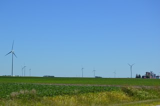
Princeville Township is located in Peoria County, Illinois. As of the 2010 census, its population was 1,628 and it contained 674 housing units. The township shares a border with Stark County to the North. It also borders Millbrook Township to the West, Akron Township to the East, and the Jubilee Township to the South.

Rosefield Township is located in Peoria County, Illinois. At the 2010 census, its population was 1,217 and it contained 489 housing units.

Salem Township is one of twenty-one townships in Knox County, Illinois, USA. As of the 2010 census, its population was 1,003 and it contained 449 housing units.

Eldorado Township is located in McDonough County, Illinois. As of the 2010 census, its population was 134 and it contained 85 housing units.

Walnut Grove Township is located in McDonough County, Illinois. As of the 2010 census, its population was 469 and it contained 215 housing units.

Buena Vista Township is located in Schuyler County, Illinois. As of the 2010 census, its population was 1,849 and it contained 667 housing units.

Rushville Township is located in Schuyler County, Illinois. As of the 2010 census, its population was 2,722 and it contained 1,301 housing units.

Rozetta Township is one of eleven townships in Henderson County, Illinois, USA. As of the 2010 census, its population was 271 and it contained 121 housing units.

Woodland Township is one of twenty-six townships in Fulton County, Illinois, USA. As of the 2010 census, its population was 415 and it contained 195 housing units.


