Unity, Wisconsin

Last updated

Unity, Wisconsin
Unity Wisconsin Downtown Looking West.jpg
Looking west at downtown Unity
Clark County Wisconsin Incorporated and Unincorporated areas Unity Highlighted.svg
Location of Unity in Clark County
and Marathon County, Wisconsin.
USA Wisconsin location map.svg
Red pog.svg
Unity, Wisconsin
Location within the state of Wisconsin
Coordinates: 44°50′53″N90°18′54″W / 44.84806°N 90.31500°W / 44.84806; -90.31500
Country Flag of the United States.svg  United States
State Flag of Wisconsin.svg  Wisconsin
County Clark, Marathon
Area
[1]
  Total0.99 sq mi (2.57 km2)
  Land0.99 sq mi (2.57 km2)
  Water0.00 sq mi (0.00 km2)
Population
 (2010) [2]
  Total343
  Estimate 
(2019) [3]
330
  Density333.00/sq mi (128.56/km2)
Time zone UTC-6 (Central (CST))
  Summer (DST) UTC-5 (CDT)
ZIP codes
54488
Area code(s) 715 & 534
FIPS code 55-81850
Website villageofunity.com

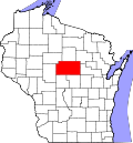
Unity is a village in Clark and Marathon counties in the U.S. state of Wisconsin. It is part of the Wausau, Wisconsin Metropolitan Statistical Area. The population was 343 at the 2010 census. [4] Of this, 204 were in Marathon County, and 139 were in Clark County. The village is located in northeastern town of Unity in Clark County and northwestern town of Brighton in Marathon County.

Contents

Geography

Road sign for Unity Unity Wisconsin Sign WIS13.jpg
Road sign for Unity

Unity is located at 44°50′53″N90°18′53″W / 44.84806°N 90.31472°W / 44.84806; -90.31472 (44.848191, -90.31497). [5]

According to the United States Census Bureau, the village has a total area of 0.99 square miles (2.56 km2), all of it land. [6]

Demographics

Historical population
CensusPop.Note
1910 363
1920 40511.6%
1930 319−21.2%
1940 286−10.3%
1950 35524.1%
1960 3868.7%
1970 363−6.0%
1980 41815.2%
1990 4528.1%
2000 368−18.6%
2010 343−6.8%
2019 (est.)330 [3] −3.8%
U.S. Decennial Census [7]

2010 census

As of the census [2] of 2010, there were 343 people, 145 households, and 101 families living in the village. The population density was 346.5 inhabitants per square mile (133.8/km2). There were 161 housing units at an average density of 162.6 per square mile (62.8/km2). The racial makeup of the village was 98.3% White, 1.5% from other races, and 0.3% from two or more races. Hispanic or Latino of any race were 1.5% of the population.

There were 145 households, of which 30.3% had children under the age of 18 living with them, 55.2% were married couples living together, 7.6% had a female householder with no husband present, 6.9% had a male householder with no wife present, and 30.3% were non-families. 27.6% of all households were made up of individuals, and 8.9% had someone living alone who was 65 years of age or older. The average household size was 2.37 and the average family size was 2.84.

The median age in the village was 41.3 years. 22.7% of residents were under the age of 18; 7.7% were between the ages of 18 and 24; 23.9% were from 25 to 44; 34.4% were from 45 to 64; and 11.4% were 65 years of age or older. The gender makeup of the village was 51.6% male and 48.4% female.

2000 census

As of the census [8] of 2000, there were 368 people, 150 households, and 97 families living in the village. The population density was 372.1 people per square mile (143.5/km2). There were 157 housing units at an average density of 158.8 per square mile (61.2/km2). The racial makeup of the village was 99.46% White, 0.54% from other races. 0.54% of the population were Hispanic or Latino of any race.

There were 150 households, out of which 35.3% had children under the age of 18 living with them, 52.7% were married couples living together, 8.7% had a female householder with no husband present, and 34.7% were non-families. 24.0% of all households were made up of individuals, and 10.0% had someone living alone who was 65 years of age or older. The average household size was 2.45 and the average family size was 3.02.

In the village, the population was spread out, with 26.9% under the age of 18, 7.6% from 18 to 24, 28.8% from 25 to 44, 22.8% from 45 to 64, and 13.9% who were 65 years of age or older. The median age was 38 years. For every 100 females, there were 103.3 males. For every 100 females age 18 and over, there were 99.3 males.

The median income for a household in the village was $31,458, and the median income for a family was $47,813. Males had a median income of $29,000 versus $21,250 for females. The per capita income for the village was $17,819. About 6.3% of families and 12.7% of the population were below the poverty line, including 17.3% of those under age 18 and 22.4% of those age 65 or over.

Notable people

Related Research Articles

Beddington is a town in Washington County, Maine, United States. The population was 60 at the 2020 census. It is the third-smallest organized town in Maine after Frye Island and Frenchboro.

<span class="mw-page-title-main">Clifford, Michigan</span> Village in Michigan, United States

Clifford is a village in Lapeer County of the U.S. state of Michigan. The population was 324 at the 2010 census. The village is within Burlington Township.

<span class="mw-page-title-main">Potter, Nebraska</span> Village in Nebraska, United States

Potter is a village in Cheyenne County, Nebraska, United States. As of the 2010 census, the village population was 337.

<span class="mw-page-title-main">Lankin, North Dakota</span> City in North Dakota, United States

Lankin is a city in Walsh County, North Dakota, United States. The population was 102 at the 2020 census. Lankin was founded in 1905.

<span class="mw-page-title-main">Granton, Wisconsin</span> Village in Wisconsin, United States

Granton is a village in Clark County in the U.S. state of Wisconsin. The population was 355 at the 2010 census.

<span class="mw-page-title-main">Brownsville, Wisconsin</span> Village in Wisconsin, United States

Brownsville is a village in Dodge County, Wisconsin, United States. The population was 581 at the 2010 census.

<span class="mw-page-title-main">Oliver, Wisconsin</span> Village in Wisconsin, United States

Oliver is a village in Douglas County, Wisconsin, United States. The population was 423 at the 2020 census.

<span class="mw-page-title-main">Stratford, Wisconsin</span> Village in Wisconsin, United States

Stratford is a village in Marathon County, Wisconsin, United States. It is part of the Wausau, Wisconsin Metropolitan Statistical Area. The population was 1,578 at the 2010 census.

<span class="mw-page-title-main">Warrens, Wisconsin</span> Village in Wisconsin, United States

Warrens is a village in Monroe County, Wisconsin, United States off I-94. The population was 363 at the 2010 census.

<span class="mw-page-title-main">Centuria, Wisconsin</span> Village in Wisconsin, United States

Centuria is a village in Polk County, Wisconsin, United States. The population was 948 at the 2010 census.

<span class="mw-page-title-main">Tigerton, Wisconsin</span> Village in Wisconsin, United States

Tigerton is a village in Shawano County, Wisconsin, United States. The population was 741 at the 2010 census.

<span class="mw-page-title-main">Wild Rose, Wisconsin</span> Village in Wisconsin, United States

Wild Rose is a village in Waushara County, Wisconsin, United States. The population was 725 at the 2010 census.

<span class="mw-page-title-main">Biron, Wisconsin</span> Village in Wisconsin, United States

Biron is a village in Wood County, Wisconsin, United States. The population was 839 at the 2010 census. It is the site of ND Paper's Biron Mill.

<span class="mw-page-title-main">Hewitt, Wood County, Wisconsin</span> Village in Wisconsin, United States

Hewitt is a village in Wood County, Wisconsin, United States. The population was 828 at the 2010 census.

<span class="mw-page-title-main">Turnerville, Wyoming</span> Census-designated place in Wyoming, United States

Turnerville is a census-designated place (CDP) in Lincoln County, Wyoming, United States. The population was 192 at the 2010 census.

<span class="mw-page-title-main">Livingston, Wisconsin</span> Village in Wisconsin, United States

Livingston is a village in Grant and Iowa Counties in the U.S. state of Wisconsin. The population was 664 at the 2010 census. Of this, 657 were in Grant County, and only 7 were in Iowa County.

<span class="mw-page-title-main">Pulaski, Wisconsin</span> Village in Wisconsin, United States

Pulaski is a village in Brown, Oconto, and Shawano counties in the U.S. state of Wisconsin. The population was 3,539 at the 2010 census. Of this, 3,321 were in Brown County, 218 in Shawano County, and none in Oconto County.

<span class="mw-page-title-main">Balsam Lake, Wisconsin</span> Village in Wisconsin, United States

Balsam Lake is a village in, and the county seat of Polk County, Wisconsin, United States. The population was 1,009 at the 2010 census. The village is located within the Town of Balsam Lake.

<span class="mw-page-title-main">Iola, Wisconsin</span> Village in Wisconsin, United States

Iola is a village in Waupaca County, Wisconsin, United States. The population was 1,236 at the 2020 census. The village is bordered by the towns of Iola and Scandinavia. The community was named after a Potawatomi girl.

<span class="mw-page-title-main">Rudolph, Wisconsin</span> Village in Wisconsin, United States

Rudolph is a village in Wood County, Wisconsin, United States. The population was 439 at the 2010 census. The village is located within the Town of Rudolph.

References

  1. "2019 U.S. Gazetteer Files". United States Census Bureau. Retrieved August 7, 2020.
  2. 1 2 "U.S. Census website". United States Census Bureau . Retrieved November 18, 2012.
  3. 1 2 "Population and Housing Unit Estimates". United States Census Bureau. May 24, 2020. Retrieved May 27, 2020.
  4. "Profile of General Population and Housing Characteristics: 2010 Demographic Profile Data (DP-1): Unity village, Wisconsin". United States Census Bureau . Retrieved September 10, 2012.
  5. "US Gazetteer files: 2010, 2000, and 1990". United States Census Bureau. February 12, 2011. Retrieved April 23, 2011.
  6. "US Gazetteer files 2010". United States Census Bureau. Archived from the original on January 12, 2012. Retrieved November 18, 2012.
  7. "Census of Population and Housing". Census.gov. Retrieved June 4, 2015.
  8. "U.S. Census website". United States Census Bureau . Retrieved January 31, 2008.
  9. 'Wisconsin Blue Book 1901,' Biographical Sketch of Alfred M. Cook, pg. 754
  10. 'Wisconsin Blue Book 1921,' Biographical Sketch of Lewis H. Cook, pg. 276
  11. 'Wisconsin Blue Book 1923,' Biographical Sketch of J.W. Salter, pg. 668