Upper Broghindrummin

Last updated
Upper Broghindrummin
County
Country Northern Ireland
Sovereign state United Kingdom
Police Northern Ireland
Fire Northern Ireland
Ambulance Northern Ireland
EU Parliament Northern Ireland
List of places
UK
Northern Ireland
Antrim

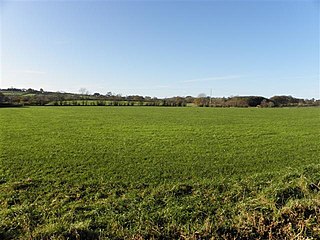
Upper Broghindrummin (also known as Dira) is a townland of 186 acres in County Antrim, Northern Ireland. It is situated in the historic barony of Glenarm Lower and the civil parish of Layd (Grange of Layd). [1]

A townland is a small geographical division of land used in Ireland. The townland system is of Gaelic origin, pre-dating the Norman invasion, and most have names of Irish Gaelic origin. However, some townland names and boundaries come from Norman manors, plantation divisions, or later creations of the Ordnance Survey. The total number of inhabited townlands was 60,679 in 1911. The total number recognised by the Irish Place Names database as of 2014 was 61,098, including uninhabited townlands, mainly small islands.

County Antrim Place in Antrim, Northern Ireland

County Antrim is one of six counties that form Northern Ireland. Adjoined to the north-east shore of Lough Neagh, the county covers an area of 3,046 square kilometres (1,176 sq mi) and has a population of about 618,000. County Antrim has a population density of 203 people per square kilometre or 526 people per square mile. It is also one of the thirty-two traditional counties of Ireland, as well as part of the historic province of Ulster.

Northern Ireland Part of the United Kingdom lying in the north-east of the island of Ireland, created 1921

Northern Ireland is a part of the United Kingdom in the north-east of the island of Ireland, variously described as a country, province or region. Northern Ireland shares a border to the south and west with the Republic of Ireland. In 2011, its population was 1,810,863, constituting about 30% of the island's total population and about 3% of the UK's population. Established by the Northern Ireland Act 1998 as part of the Good Friday Agreement, the Northern Ireland Assembly holds responsibility for a range of devolved policy matters, while other areas are reserved for the British government. Northern Ireland co-operates with the Republic of Ireland in some areas, and the Agreement granted the Republic the ability to "put forward views and proposals" with "determined efforts to resolve disagreements between the two governments".

See also

Related Research Articles

Glenville is the name of several places.

Donegore is the name of a hill, a townland, a small cluster of residences, and a civil parish in the historic barony of Antrim Upper, County Antrim, Northern Ireland. Donegore lies approximately 5 miles (8 km) east of Antrim town. 154 acres of the townland lies in the civil parish of Grange of Nilteen.

Tobergill human settlement in United Kingdom

Tobergill is a townland of 1,044 acres in County Antrim, Northern Ireland. Lying on the western aspect of Donegore hill, it is situated in the civil parish of Donegore and the historic barony of Antrim Upper.

Dunamuggy human settlement in United Kingdom

Dunamuggy is a townland of 172 acres in County Antrim, Northern Ireland. It is situated in the civil parish of Donegore and the historic barony of Antrim Upper.

Cushendall village in Northern Ireland

Cushendall, formerly known as Newtown Glens, is a village and townland in County Antrim, Northern Ireland. It is located in the historic barony of Glenarm Lower and the civil parish of Layd, and is part of Causeway Coast and Glens district.

Lambeg, County Antrim

Lambeg is a small village and civil parish in County Antrim, Northern Ireland. Located between Belfast and Lisburn, it was once a small rural village, but is now within the Greater Belfast conurbation. Lambeg is also an electoral ward of Lisburn Council. In the 2001 Census it had a population of 60 people. The civil parish of Lambeg covers areas of County Down as well as County Antrim.

Knocknacarry is a hamlet and townland about 1 kilometre west of Cushendun in County Antrim, Northern Ireland. It is situated in the historic barony of Glenarm Lower and the civil parish of Layd. In the 2001 Census it had a population of 138 people. It is within the Moyle District Council area.

Waterfoot, County Antrim village in Northern Ireland

Waterfoot is a small village in County Antrim, Northern Ireland. It is situated in the historic barony of Glenarm Lower and the civil parishes of Ardclinis and Layd. The village was situated in the historic townland of Warren. The 2001 Census recorded a population of 504 inhabitants.

Solar, County Antrim

Solar is a townland of 42 acres in County Antrim, Northern Ireland. It is situated in the civil parish of Carncastle and the historic barony of Glenarm Upper.

Glenarm Lower Place in Northern Ireland, United Kingdom

Glenarm Lower is a barony in County Antrim, Northern Ireland. To its east runs the east-Antrim coast, and it is bordered by five other baronies: Cary to the north; Dunluce Lower and Kilconway to the west; Antrim Lower to the south-west; and Glenarm Upper to the south-east.

Aganlane is a townland of 1835 acres in County Antrim, Northern Ireland. It is situated in the historic barony of Glenarm Lower and the civil parish of Layd.

Aghagheigh is a townland of 75 acres in County Antrim, Northern Ireland. It is situated in the historic barony of Glenarm Lower and the civil parish of Layd.

Agolagh is a townland of 138 acres in County Antrim, Northern Ireland. It is situated in the historic barony of Glenarm Lower and the civil parish of Layd.

Altmore Upper is a townland of 153 acres in County Antrim, Northern Ireland. It is situated in the historic barony of Glenarm Lower and the civil parish of Layd.

Ballyagan is a townland of 96 acres in County Antrim, Northern Ireland. It is situated in the historic barony of Glenarm Lower and the civil parish of Layd.

Ballybrack, County Antrim human settlement in United Kingdom

Ballybrack is a townland of 142 acres in County Antrim, Northern Ireland. It is situated in the historic barony of Glenarm Lower and the civil parish of Layd.

Ballyfad is a townland of 76 acres in County Antrim, Northern Ireland. It is situated in the historic barony of Glenarm Lower and the civil parish of Layd.

Layd is a civil parish and townland in County Antrim, Northern Ireland. It is situated in the historic barony of Glenarm Lower.

References

  1. "Upper Broghindrummin". IreAtlas Townland Database. Retrieved 12 April 2015.