
Canungra is a rural town and locality in the Scenic Rim Region, Queensland, Australia. In the 2021 census, the locality of Canungra had a population of 1,436 people.

The Scenic Rim Region is a local government area in West Moreton region of South East Queensland, Australia. Also, is southern part of the Brisbane. Established in 2008, it was preceded by several previous local government areas with histories extending back to the early 1900s and beyond. The main town of the region is Beaudesert.

Beechmont is a rural town and locality in the Scenic Rim Region, Queensland, Australia. In the 2021 census, the locality of Beechmont had a population of 848 people.

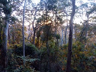
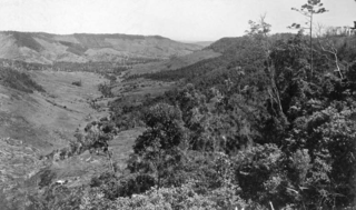
The Gold Coast hinterland is an area of South East Queensland, Australia that comprises the Tweed Range, Nimmel Range, Tamborine Mountain, Numinbah Valley, eastern parts of the McPherson Range and western parts of suburban Gold Coast, such as Mudgeeraba. This undefined unit of area is known for its tourist attractions including resorts, rainforest, lookouts, national parks, its diversity of fauna and flora and as a green backdrop to the coastal strip. It overlaps part of the Scenic Rim and is part of both the City of Gold Coast and Scenic Rim Region and includes Springbrook, Binna Burra and O'Reilly.

Clagiraba is a rural locality in the City of Gold Coast, Queensland, Australia. In the 2021 census, Clagiraba had a population of 651 people.

Nindooinbah is a rural locality in the Scenic Rim Region, Queensland, Australia. In the 2021 census, Nindooinbah had a population of 95 people.

Wonglepong is a rural locality in the Scenic Rim Region, Queensland, Australia. In the 2021 census, Wonglepong had a population of 364 people.

Boyland is a rural locality in the Scenic Rim Region, Queensland, Australia. In the 2021 census, Boyland had a population of 855 people.

Illinbah is a rural locality in the Scenic Rim Region, Queensland, Australia. In the 2021 census, Illinbah had a population of 128 people.
Lower Beechmont is a locality in the City of Gold Coast, Queensland, Australia. It is situated in the Gold Coast hinterland. In the 2021 census, Lower Beechmont had a population of 1,067 people.

Mount Nathan is a rural locality in the City of Gold Coast, Queensland, Australia. In the 2021 census, Mount Nathan had a population of 1,375 people.

Tamborine is a rural town in the Scenic Rim Region and a locality split between the Scenic Rim Region and the City of Logan in Queensland, Australia. In the 2021 census, the locality of Tamborine had a population of 4,388 people.
Binna Burra is a rural locality in the Scenic Rim Region, Queensland, Australia. It borders New South Wales. In the 2021 census, Binna Burra had "no people or a very low population".

O'Reilly is a rural locality in the Scenic Rim Region, Queensland, Australia. It borders New South Wales. In the 2021 census, O'Reilly had a population of 114 people.
Flying Fox is a rural locality in the Scenic Rim Region, Queensland, Australia. In the 2021 census, Flying Fox had a population of 61 people.
Beaudesert–Nerang Road is a major inter-regional arterial road that connects the township of Beaudesert with the Gold Coast via Canungra. The road commences in Nerang on the western edge of the Gold Coast and travels west through the Gold Coast hinterland and terminates in central Beaudesert at the intersection of Mount Lindesay Highway.
Benobble is a rural locality in the Scenic Rim Region, Queensland, Australia. In the 2021 census, Benobble had a population of 29 people.

Cainbable is a rural locality in the Scenic Rim Region, Queensland, Australia. In the 2021 census, Cainbable had a population of 85 people.
Ferny Glen is a rural locality in the Scenic Rim Region, Queensland, Australia. In the 2021 census, Ferny Glen had a population of 91 people.
Sarabah is a locality in the Scenic Rim Region, Queensland, Australia. In the 2021 census, Sarabah had a population of 68 people.

