
Creggan is a townland in County Tyrone, Northern Ireland. It is situated in the historic barony of Omagh East and the civil parish of Termonmaguirk and covers an area of 4022 acres.

Ballymagorry or Ballymagory is a small village and townland in County Tyrone, Northern Ireland. It is west of Artigarvan and 5 kilometres (3.1 mi) north of Strabane. In the 2001 Census it had a population of 565. It lies within the Strabane District Council area and lies on the River Glenmornan.
Barmeen is a townland in County Antrim, Northern Ireland. It is located at the foot of Glendun, one of the nine Glens of Antrim, west of Cushendun and north of Knocknacarry. It is situated in the historic barony of Cary and the civil parish of Culfeightrin and covers 59 acres.
Groggan is a hamlet and townland near Randalstown in County Antrim, Northern Ireland. It is situated in the historic barony of Toome Upper and the civil parish of Drummaul and covers an area of 620 acres. It is within the Borough of Antrim. It had a population of 135 people in the 2011 Census.

Dooish (Irish: Dubhais is a village and townland near Drumquin in County Tyrone, Northern Ireland. The townland is situated in the historic barony of Omagh West and the civil parish of Longfield West and covers an area of 845 acres. In the 2001 Census it had a population of 93 people. It lies within the Omagh District Council area.

Clady is a small village and townland in County Tyrone, Northern Ireland. It lies about 4 miles from Strabane on the River Finn and borders with the Republic of Ireland. In the 2001 Census it had a population of 423 people. It is within Urney civil parish and the former barony of Strabane Lower. In local government it is part of the Derry City and Strabane District Council. The townland covers an area of 173 acres.
Ballymully Glebe is a townland in County Tyrone, Northern Ireland. It is situated in the historic barony of Dungannon Upper and the civil parish of Desertcreat and covers an area of 144 acres.
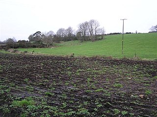
Acravally is a townland in County Antrim, Northern Ireland. It is situated in the historic barony of Cary and the civil parish of Culfeightrin and covers an area of 31 acres.

Aghaboy is a townland in County Antrim, Northern Ireland. It is situated in the historic barony of Toome Upper and the civil parish of Drummaul and covers an area of 286 acres

Aghaloughan is a townland in County Antrim, Northern Ireland. It is situated in the historic barony of Toome Upper and the civil parish of Drummaul and covers an area of 286 acres

Aghancrossy is a townland in County Antrim, Northern Ireland, near Dervock. It is situated in the historic barony of Dunluce Lower and the civil parish of Derrykeighan and covers an area of 55 acres

Aghanliss is a townland in County Antrim, Northern Ireland. It is situated in the historic barony of Massereene Upper and the civil parish of Ballinderry and covers an area of 341 acres
Antynanum is a townland in County Antrim, Northern Ireland. It is situated in the historic barony of Antrim Lower and the civil parish of Racavan and covers an area of 450 acres.

Appletee is a townland in County Antrim, Northern Ireland. It is situated in the historic barony of Antrim Lower and the civil parish of Connor and covers an area of 226 acres.

Araboy is a townland in County Antrim, Northern Ireland. It is situated in the historic barony of Cary and the civil parish of Ballintoy and covers an area of 430 acres.
Artibrannan is a townland in County Antrim, Northern Ireland, near Ballymena. It is situated in the historic barony of Toome Lower and the civil parishes of Ahoghill and Craigs and covers an area of 112 acres.

Aughalish is a townland in County Antrim, Northern Ireland. It is situated in the historic barony of Toome Upper and the civil parish of Drummaul and covers an area of 93 acres.

Ballaghbeddy is a townland of 164 acres in County Antrim, Northern Ireland, near Ballymoney. It is situated in the historic barony of Kilconway and the civil parish of Finvoy, on the eastern bank of the River Bann which forms the western boundary of the parish of Finvoy.

Ballinlea Upper is a townland in County Antrim, Northern Ireland, near to Straid. It is situated in the historic barony of Cary and the civil parish of Ballintoy and covers an area of 280 acres
Drummaul is a townland and civil parish in County Antrim, Northern Ireland. It is situated in the historic barony of Toome Upper and contains the town of Randalstown.

