
Empire Township is located in McLean County, Illinois. As of the 2010 census, its population was 4,093 and it contained 1,719 housing units. Empire Township changed its name from Le Roy Township on May 17, 1858.

Laenna Township is located in Logan County, Illinois. As of the 2010 census, its population was 584 and it contained 282 housing units.

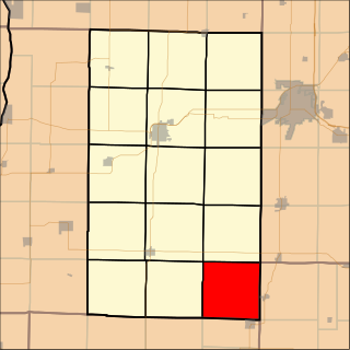
Cedar Township is one of twenty-one townships in Knox County, Illinois, USA. As of the 2010 census, its population was 3,270 and it contained 1,487 housing units. Its name was changed from Cherry Grove Township on June 8, 1853.
Maquon Township is one of twenty-one townships in Knox County, Illinois, USA. As of the 2010 census, its population was 556 and it contained 269 housing units.
Orange Township is one of twenty-one townships in Knox County, Illinois, USA. As of the 2010 census, its population was 556 and it contained 246 housing units.

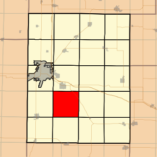
Persifer Township is one of twenty-one townships in Knox County, Illinois, USA. As of the 2010 census, its population was 980 and it contained 835 housing units.

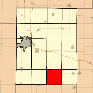
Salem Township is one of twenty-one townships in Knox County, Illinois, USA. As of the 2010 census, its population was 1,003 and it contained 449 housing units.
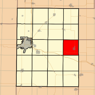
Truro Township is one of twenty-one townships in Knox County, Illinois, USA. As of the 2010 census, its population was 840 and it contained 431 housing units.

Colchester Township is located in McDonough County, Illinois. As of the 2010 census, its population was 1,837 and it contained 896 housing units.

Bushnell Township is located in McDonough County, Illinois. As of the 2010 census, its population was 3,272 and it contained 1,511 housing units.

Eldorado Township is located in McDonough County, Illinois. As of the 2010 census, its population was 134 and it contained 85 housing units.

Hire Township is located in McDonough County, Illinois. As of the 2010 census, its population was 229 and it contained 117 housing units.

New Salem Township is located in McDonough County, Illinois. As of the 2010 census, its population was 369 and it contained 168 housing units. It is Township 5 North, Range 1 West of the Fourth Principal Meridian.

Tennessee Township is located in McDonough County, Illinois. As of the 2010 census, its population was 336 and it contained 180 housing units.
Browning Township is located in Schuyler County, Illinois. As of the 2010 census, its population was 399 and it contained 226 housing units.

Pittsfield Township is located in Pike County, Illinois. As of the 2010 census, its population was 4,477 and it contained 1,982 housing units.
Greenbush Township is located in Warren County, Illinois. As of the 2010 census, its population was 533 and it contained 286 housing units.

Swan Township is located in Warren County, Illinois, United States. As of the 2010 census, its population was 265 and it contained 126 housing units.

Waterford Township is one of twenty-six townships in Fulton County, Illinois, USA. As of the 2010 census, its population was 187 and it contained 92 housing units.

Woodland Township is one of twenty-six townships in Fulton County, Illinois, USA. As of the 2010 census, its population was 415 and it contained 195 housing units.


