
Banff National Park is Canada's oldest national park, established in 1885. Located in Alberta's Rocky Mountains, 110–180 kilometres (68–112 mi) west of Calgary, Banff encompasses 6,641 square kilometres (2,564 sq mi) of mountainous terrain, with many glaciers and ice fields, dense coniferous forest, and alpine landscapes. The Icefields Parkway extends from Lake Louise, connecting to Jasper National Park in the north. Provincial forests and Yoho National Park are neighbours to the west, while Kootenay National Park is located to the south and Kananaskis Country to the southeast. The main commercial centre of the park is the town of Banff, in the Bow River valley.

Kananaskis Country is a multi-use planning area west of Calgary, Alberta, Canada in the foothills and front ranges of the Canadian Rockies. The area is named for the Kananaskis River, which was named by John Palliser in 1858 after a Cree acquaintance. The area covers 4,000 km2 (1,500 sq mi) and was formed by the Alberta Government in 1978 to enable an assortment of land uses including resource extraction, recreation, power generation, residential communities, and protected areas.

The Bow River is a river in Alberta, Canada. It begins within the Canadian Rocky Mountains and winds through the Alberta foothills onto the prairies, where it meets the Oldman River, the two then forming the South Saskatchewan River. These waters ultimately flow through the Nelson River into Hudson Bay. The Bow River runs through the city of Calgary, taking in the Elbow River at the historic site of Fort Calgary near downtown. The Bow River pathway, developed along the river's banks, is considered a part of Calgary's self-image.

Canmore is a town in Alberta, Canada, located approximately 81 kilometres (50 mi) west of Calgary near the southeast boundary of Banff National Park. It is located in the Bow Valley within Alberta's Rocky Mountains. The town shares a border with Kananaskis Country to the west and south and the Municipal District of Bighorn No. 8 to the north and east. With a population of 14,798 in 2020, Canmore is the ninth-largest town in Alberta.

Exshaw is a hamlet in Alberta, Canada within Municipal District (MD) of Bighorn No. 8. Located approximately 90 kilometres (56 mi) west of downtown Calgary and 15 kilometres (9.3 mi) east of Canmore, Exshaw is situated within the Bow River valley north of the Bow River.
Alberta Provincial Highway No. 1, commonly referred to as Highway 1, is a major east–west highway in Southern Alberta that forms the southern mainline of the Trans-Canada Highway. It runs from the British Columbia border near Lake Louise through Calgary to the Saskatchewan border east of Medicine Hat. It continues as Highway 1 into both provinces. It spans approximately 534 km (332 mi) from Alberta's border with British Columbia in the west to its border with Saskatchewan in the east. The route is a divided 4-lane expressway throughout the province with the exception of a section in central Calgary where it is an arterial thoroughfare and Urban Boulevard carrying 4 to 6 lanes. The highway is a freeway between the Sunshine exit near the town of Banff and Home Road in Calgary. Other rural sections have at grade intersections with Interchanges only at busier junctions. Twinning of the final 8.5 km (5.3 mi) of Highway 1 between Lake Louise and the British Columbia border was completed by Parks Canada and opened to traffic on June 12, 2014 making the whole length of Alberta Highway 1 a divided minimum 4-lane route.

Alberta Provincial Highway No. 1A is the designation of two alternate routes off the Alberta portion of Trans-Canada Highway 1. However, it is not the only name used for spurs off Highway 1 - Highway 1X is another such designation. Despite these highways being suffixed routes of Highway 1, they are not part of the Trans-Canada Highway network, and are signed with Alberta's provincial primary highway shields instead of the Trans-Canada shields used for Highway 1.

Bow Valley Provincial Park is a provincial park in Alberta, Canada. Established in 1959 in the arch of the Bow River at its confluence with the Kananaskis River, the park is one park of many within the Kananaskis Country park system.

Alberta has been a tourist destination since the early days of the 20th Century, with attractions including national parks, National Historic Sites of Canada, urban arts and cultural facilities, outdoor locales for skiing, hiking and camping, shopping locales such as West Edmonton Mall, outdoor festivals, professional athletic events, international sporting competitions such as the Commonwealth Games and Olympic Winter Games, as well as more eclectic attractions.

Spray Valley Provincial Park is a provincial park located east of the Rocky Mountains, along the Spray River in western Alberta, Canada.
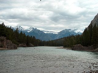
The Spray River is a tributary of the Bow River in western Alberta, Canada.

The Kananaskis River is a mountain river in western Alberta, Canada. It is a tributary of the Bow River, crossing the length of Kananaskis Country.
The Bow Valley Crag and Canyon is a weekly local newspaper based in Banff, Alberta, Canada. On July 3, 2013, following the 2013 Alberta floods, Sun Media combined the Banff Crag & Canyon and the Canmore Leader under one publication. The Bow Valley Crag & Canyon is delivered across Banff and Canmore and covers news from Lake Louise to Kananaskis. Like other local newspapers in the Bow Valley, the Crag & Canyon does not charge customers directly but relies solely upon advertising revenue for income.

Alberta's Rockies comprise the Canadian Rocky Mountains in Alberta, Canada. On the southwestern part of the province along the British Columbia border, the region covers all but the south of Census Division 15.
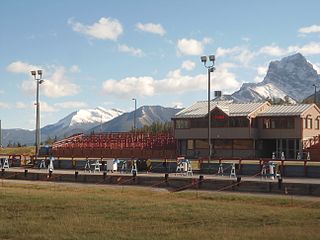
Canmore Nordic Centre Provincial Park is a provincial park in Alberta, Canada, located immediately west of Canmore, 105 km (65 mi) west of Calgary.
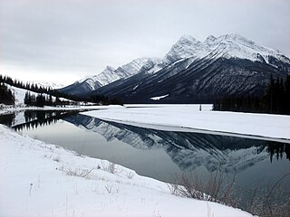
Spray Lakes Reservoir is a reservoir in Alberta, Canada. The Spray Lakes were a string of lakes formed along the Spray River, a tributary of the Bow River. With the damming of the river, the lakes were united in the Spray Lakes Reservoir.
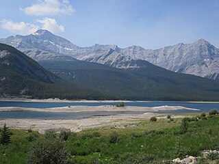
Goat Range is a mountain range of the Canadian Rockies in southwestern Alberta, Canada.
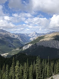
The Ghost River is a river in Alberta, Canada. It begins within the front ranges of the Canadian Rocky Mountains, joining the Bow River at Ghost Lake. These waters flow through Cochrane, Calgary, and ultimately into Hudson Bay. The upper reaches of the Ghost are fully protected by the Ghost River Wilderness Area.
The Rocky Mountain Outlook is a weekly local newspaper based in Canmore, Alberta, Canada. The Rocky Mountain Outlook is delivered across the Bow Valley in Banff, Canmore, Lake Louise, the Municipal District of Bighorn and the Stoney Nakoda First Nation. The paper covers news in and around the Bow Valley region, which spans from Lake Louise in the west to the Stoney Nakoda First Nation and Kananaskis Country in the east. The paper does not charge readers and relies on advertising for income.
Don Getty Wildland Provincial Park is a wildland provincial park in Kananaskis Country, Alberta, Canada. It was created on 24 July 2001 and has an area of 62,775 hectares. The park was named for the 11th premier of Alberta, Don Getty. The park was designated as part of the Special Places 2000: Alberta’s Natural Heritage initiative.


