Buchan, Queensland

Last updated

Buchan
Queensland
Buchan Street, Palm Cove, 2018 02.jpg
Buchan Street, 2018
Australia Queensland location map.svg
Red pog.svg
Buchan
Coordinates 16°44′36″S145°40′06″E / 16.7433°S 145.6683°E / -16.7433; 145.6683 (Buchan (town centre)) Coordinates: 16°44′36″S145°40′06″E / 16.7433°S 145.6683°E / -16.7433; 145.6683 (Buchan (town centre))
Postcode(s) 4816
Elevation5 m (16 ft)
Time zone AEST (UTC+10:00)
Location27 km (17 mi) N of Cairns
LGA(s) Cairns Region
State electorate(s) Cook
Federal Division(s) Leichhardt

Buchan is a coastal town in the locality of Palm Cove in the Cairns Region, Queensland, Australia. [1]

Contents

Geography

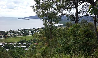
Buchan is a coastal town with sandy beaches north and south of Buchan Point. The Captain Cook Highway passes through the town. [2]

History

View from Buchan past Buchan Point towards Double Island, circa 1890 Cairns area with Double Island in view, circa 1890.jpg
View from Buchan past Buchan Point towards Double Island, circa 1890

The town name is derived from Mount Buchan, named on 20 October 1873 by explorer George Elphinstone Dalrymple, after one of the districts of his native Aberdeenshire in Scotland. [1] [3]

In the 1880s, there was a coconut palm plantation with over 600 trees owned by James Jamieson known as the Mount Buchan Estate. It was predicted to become a popular seaside retreat for the people of Cairns. [4] The palm trees along the beach areas gave it the nickname Palm Beach but, as that caused confusion with other places officially known as Palm Beach, it acquired the name Palm Cove, which is now the official name for the locality (although the town itself remains gazetted as Buchan). [5]

In April 1933, a number of families were living at Buchan Point while the men were working on the road from Cairns to Port Douglas (now the Captain Cook Highway). The families asked the Queensland Government to provide a school. [6] Buchan Point State School opened on 1933 and in December 1933 the students enjoyed a "breaking up" party at Hartley's Creek. [7] Buchan Point State School No 850 opened on 1933he school closed in February 1934. [8] [9]

Related Research Articles

Cairns City in Queensland, Australia

Cairns is a city in Queensland, Australia, on the east coast of Far North Queensland. The city is the 5th-most-populous in Queensland, and 14th in Australia.

Mission Beach, Queensland Town in Queensland, Australia

Mission Beach is a small coastal town and locality in the Cassowary Coast Region, Queensland, Australia. In the 2016 census Mission Beach and surrounding villages had a total population of 3,597 people.

Yarrabah, Queensland Town in Queensland, Australia

Yarrabah, traditionally Yagaljida in the Yidin language spoken by the indigenous Yidinji people, is a coastal town and locality in the Aboriginal Shire of Yarrabah, Queensland, Australia. It is an Aboriginal community about 53 kilometres (33 mi) by road from Cairns CBD on Cape Grafton. It is much closer by direct-line distance but is separated from Cairns CBD by the Murray Prior Range and Trinity Inlet, an inlet of the Coral Sea. At the 2016 census, Yarrabah had a population of 2,559.

Edmonton, Queensland Suburb of Cairns, Queensland, Australia

Edmonton is a town and suburb in the Cairns Region, Queensland, Australia. In the 2016 census, Edmonton had a population of 10,753 people.

Herberton, Queensland Town in Queensland, Australia

Herberton is a rural town and locality in the Tablelands Region, Queensland, Australia. In the 2016 census, Herberton had a population of 855 people.

Millaa Millaa, Queensland Town in Queensland, Australia

Millaa Millaa is a rural town and locality in the Tablelands Region, Queensland, Australia. In the 2016 census, Millaa Millaa had a population of 514 people.

Mount Molloy, Queensland Town in Queensland, Australia

Mount Molloy is a historic mining and timber town and locality lying 55 kilometres (34 mi) north of Cairns in Queensland, Australia. It is within the local government area of Shire of Mareeba.

Rainbow Beach, Queensland Town in Queensland, Australia

Rainbow Beach is a coastal rural town and locality in the Gympie Region, Queensland, Australia. In the 2016 census, Rainbow Beach had a population of 1,249 people.

Shire of Mareeba Local government area in Queensland, Australia

The Shire of Mareeba is a local government area at the base of Cape York Peninsula in Far North Queensland, inland from Cairns. The shire, administered from the town of Mareeba, covered an area of 53,491 square kilometres (20,653.0 sq mi), and existed as a local government entity from 1879 until 2008, when it amalgamated with several councils in the Atherton Tableland area to become the Tablelands Region.

Georgetown, Queensland Town in Queensland, Australia

Georgetown is a town and locality in the Shire of Etheridge, Queensland, Australia. In the 2016 census, Georgetown had a population of 348 people.

Yorkeys Knob, Queensland Suburb of Cairns Region, Queensland, Australia

Yorkeys Knob is a coastal suburb of Cairns, in Cairns Region, Far North Queensland, Australia. It is approximately 13 kilometres (8.1 mi) north of the centre of Cairns, and is the third beach suburb after Machans Beach and Holloways Beach.

Tin Can Bay, Queensland Town in Queensland, Australia

Tin Can Bay is a coastal town and locality in the Wide Bay–Burnett region in Queensland, Australia. The locality is split between the Fraser Coast Region and the Gympie Region, but the town itself is within Gympie Region. In the 2016 census, Tin Can Bay had a population of 2,242 people.

Palm Cove, Queensland Suburb of Cairns, Queensland, Australia

Palm Cove is a coastal suburb of Cairns in the Cairns Region, Queensland, Australia. It is 27 kilometres (17 mi) north of the city of Cairns. It is named after the palm trees that line the beach.

Holloways Beach, Queensland Suburb of Cairns, Queensland, Australia

Holloways Beach is a coastal suburb of Cairns in the Cairns Region, Queensland, Australia. At the 2016 census, the suburb recorded a population of 2,347. The town of Holloway Beach is within the suburb.

Redlynch, Queensland Suburb of Cairns, Queensland, Australia

Redlynch is a town and suburb of Cairns in the Cairns Region, Queensland, Australia. In the 2016 census, Redlynch had a population of 9,728 people.

Daradgee, Queensland Town in Queensland, Australia

Daradgee is a rural town and locality in the Cassowary Coast Region, Queensland, Australia. In the 2016 census, Daradgee had a population of 74 people.

South Mission Beach Town in Queensland, Australia

South Mission Beach is a coastal town and locality in the Cassowary Coast Region, Queensland, Australia. In the 2016 census, South Mission Beach had a population of 932 people.

Macalister Range, Queensland Suburb of Cairns Region, Queensland, Australia

Macalister Range is a coastal locality in the Cairns Region, Queensland, Australia. In the 2016 census, Maclister Range had no population.

References

  1. 1 2 "Buchan - town in Cairns Region (entry 4865)". Queensland Place Names. Queensland Government . Retrieved 28 December 2017.
  2. "Queensland Globe". State of Queensland . Retrieved 13 March 2018.
  3. "Mount Buchan - mountain in the Cairns Region (entry 4869)". Queensland Place Names. Queensland Government . Retrieved 13 March 2018.
  4. "Mr. Groom, M.L.A., on Cairns". Cairns Post . VII (430). Queensland, Australia. 26 June 1889. p. 2. Archived from the original on 28 January 2021. Retrieved 14 March 2018 via National Library of Australia.
  5. "Palm Cove". Queensland Places. Centre for the Government of Queensland, University of Queensland. Archived from the original on 13 March 2018. Retrieved 13 March 2018.
  6. "CAIRNS NOTES". Townsville Daily Bulletin . LV (88). Queensland, Australia. 13 April 1933. p. 8. Archived from the original on 28 January 2021. Retrieved 13 March 2018 via National Library of Australia.
  7. "HARTLEY'S CREEK SCHOOL PICNIC". Cairns Post (9950). Queensland, Australia. 23 December 1933. p. 12. Archived from the original on 28 January 2021. Retrieved 13 March 2018 via National Library of Australia.
  8. "Item ID13990, Buchan Point No.850 State School". Queensland State Archives . Retrieved 13 March 2018.
  9. Queensland Family History Society (2010), Queensland schools past and present (Version 1.01 ed.), Queensland Family History Society, ISBN   978-1-921171-26-0