Chapman State Park (Maryland)

Last updated

Chapman State Park
Mount Aventine - Chapman House Front Approach.jpg
Mount Aventine
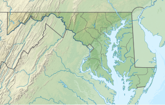
USA Maryland relief location map.svg
Red pog.svg
Chapman State Park
Location in Maryland
Location Charles County, Maryland, United States
Nearest town Indian Head, Maryland
Coordinates 38°37′17″N77°07′09″W / 38.62139°N 77.11917°W / 38.62139; -77.11917 [1]
Area829 acres (335 ha) [2]
Elevation3 ft (0.91 m) [1]
Established1998
Administered by Maryland Department of Natural Resources
Designation Maryland state park
Website Official website OOjs UI icon edit-ltr-progressive.svg

Chapman State Park is a public recreation and historic preservation area bordering the Potomac River in Charles County, Maryland. The state park preserves the mansion and grounds of Mount Aventine, the historic home of the Chapman family, who had significant ties to many of the Founding Fathers. The State of Maryland purchased Mount Aventine and established Chapman State Park in 1998. [3] The park's diverse, heavily wooded biosphere is home to many rare and disjunct plant and animal species. Several of the park's trees have been nominated for state and national big tree champion status. [4] Recreational features include fishing, hunting, and several miles of hiking trails. [3]
Related Research Articles

<span class="mw-page-title-main">Bryans Road, Maryland</span> Census-designated place in Maryland, United States

Bryans Road is a census-designated place (CDP) in Charles County, Maryland, United States. Per the 2020 census, the population was 8,650.

<span class="mw-page-title-main">Deep Creek Lake State Park</span> State park in Garrett County, Maryland

Deep Creek Lake State Park is a public recreation area occupying more than 1,100 acres (450 ha) on the northeast side of Deep Creek Lake in Garrett County, Maryland, in the United States. The park features water activities, camping facilities, and recreational trails and is located about 18 miles (29 km) south of Interstate 68 on U.S. Route 219.

The Potomac Heritage Trail, also known as the Potomac Heritage National Scenic Trail or the PHT, is a designated National Scenic Trail corridor spanning parts of the mid-Atlantic region of the United States that will connect various trails and historic sites in Virginia, Maryland, Pennsylvania, and the District of Columbia. The trail network includes 710 miles (1,140 km) of existing and planned sections, tracing the natural, historical, and cultural features of the Potomac River corridor, the upper Ohio River watershed in Pennsylvania and western Maryland, and a portion of the Rappahannock River watershed in Virginia. The trail is managed by the National Park Service and is one of three National Trails that are official NPS units.

<span class="mw-page-title-main">Fort Frederick State Park</span> State park in Maryland, US

Fort Frederick State Park is a public recreation and historic preservation area on the Potomac River surrounding the restored Fort Frederick, a fortification active in the French and Indian War (1754–1763) and the American Revolutionary War (1775-1783). The state park lies south of the town of Big Pool, Maryland. The Chesapeake and Ohio Canal runs through the park grounds. The site was designated a National Historic Landmark in 1973.

<span class="mw-page-title-main">St. Clement's Island State Park</span> State park in St. Marys County, Maryland

St. Clement's Island State Park is a publicly owned historic preservation and recreational area that encompasses St. Clement's Island, an uninhabited Potomac River island lying one-half mile southeast of Colton's Point, St. Mary's County, Maryland. The state park features a 40-foot stone cross dedicated to the beginnings of freedom of religion in the United States as well as a reconstruction of the historic Blakistone Island Light. It is the central feature of the St. Clement's Island Historic District that was listed on the National Register of Historic Places in 1972.

<span class="mw-page-title-main">Cook Forest State Park</span> State park in Pennsylvania, United States

Cook Forest State Park is a 8,500-acre (3,440 ha) Pennsylvania state park in Farmington Township, Clarion County, Barnett Township, Forest County and Barnett Township, Jefferson County, Pennsylvania in the United States. Located just south of the Allegheny National Forest, the park is a heavily wooded area of rolling hills and mountains along the Clarion River in northwestern Pennsylvania. Cook Forest State Park is known for some of America's finest virgin white pine and hemlock timber stands and was once called the "Black Forest" due to the preponderance of evergreen tree coverage.

<span class="mw-page-title-main">Seneca Creek State Park</span> State park in Montgomery County, Maryland, United States

Seneca Creek State Park is a public recreation area encompassing more than 6,300 acres (2,500 ha) along 14 miles of Seneca Creek in its run to the Potomac River in Montgomery County, Maryland. The park features facilities for boating and fishing as well as trails for hiking, cycling, and horseback riding. It is managed by the Maryland Department of Natural Resources.

<span class="mw-page-title-main">Swallow Falls State Park</span> State park in Maryland, United States

Swallow Falls State Park is a public recreation area located on the west bank of the Youghiogheny River nine miles (14 km) northwest of Oakland in Garrett County, Maryland, in the United States. The state park features Maryland's highest free-falling waterfall, the 53-foot (16 m) Muddy Creek Falls, as well as smaller waterfalls on the Youghiogheny River and Tolivar Creek. The park is notable for its stand of old hemlock trees, some more than 300 years old, "the last stand of its kind in Maryland."

<span class="mw-page-title-main">Susquehanna State Park (Maryland)</span> State park in Maryland, United States

Susquehanna State Park is a public recreation area located on the banks of the lower Susquehanna River north of the city of Havre de Grace, Maryland. The state park's main area is on the west bank of the river; the park also manages land on the river islands and east bank. The park offers fishing, boating, camping, and trails for hiking and equestrian use. It is managed as a complex with Rocks State Park and Palmer State Park by the Maryland Department of Natural Resources.

<span class="mw-page-title-main">White Clay Creek Preserve</span> State park in Chester County, Pennsylvania

White Clay Creek Preserve is a 3,050-acre (1,230 ha) Pennsylvania state park along the valley of White Clay Creek in London Britain Township in Chester County, Pennsylvania in the United States. The park was donated by the DuPont Company in 1984 for the purpose of "preserving the diverse and unique plant and animal species, and the rich cultural heritage of the area". Dupont also donated an additional 528 acres (214 ha) for the adjoining White Clay Creek State Park to the state of Delaware. White Clay Creek Preserve is 3 miles (4.8 km) north of Newark, Delaware on Pennsylvania Route 896.

<span class="mw-page-title-main">Big Oak Tree State Park</span> State park in Missouri, United States

Big Oak Tree State Park is a state-owned nature preserve with recreational features encompassing 1,029 acres (416 ha) in East Prairie, Missouri, United States. The state park was established in a large expanse of drained cropland in 1938 to protect some of the largest trees in the state and in the nation. The park was declared a National Natural Landmark in May 1986, recognized as a rare, untouched wet-mesic bottomland hardwood forest in the Mississippi Alluvial Plain portion of the Gulf Coastal Plain.

<span class="mw-page-title-main">Chapman State Park</span> State park in Pennsylvania, United States

Chapman State Park is a 862-acre (349 ha) Pennsylvania state park in Pleasant Township, Warren County, Pennsylvania near Clarendon, in the United States. The man-made Chapman Lake covers 68 acres (28 ha) of the park. Chapman State Park is named in honor of Dr. Leroy E. Chapman. Dr. Chapman was a state senator from 1929 until 1963. He was part of several civic groups that pushed for the creation of a state park in Warren County. Chapman State Park, opened in 1951, is adjacent to Allegheny National Forest and State Game Land 29 just off U.S. Route 6.

<span class="mw-page-title-main">Gathland State Park</span> State park in Maryland, United States

Gathland State Park is a public recreation area and historic preserve located on South Mountain near Burkittsville, Maryland, in the United States. The state park occupies the former estate of war correspondent George Alfred Townsend (1841-1914), who wrote under the pen name "Gath" during the American Civil War. The estate's few remaining original structures include the War Correspondents Memorial Arch, which sits alongside the Appalachian Trail. The park is operated by the Maryland Department of Natural Resources. The arch is a National Historic Monument maintained by the National Park Service.

<span class="mw-page-title-main">Mount Spokane State Park</span> State park in Washington (state), United States

Mount Spokane State Park is a public recreation area in the northwest United States, located in the Selkirk Mountains, 23 miles (37 km) northeast of the city of Spokane, Washington. The state park surrounds 5,883-foot (1,793 m) Mount Spokane and other peaks including Mount Kit Carson, Beauty Mountain, and Quartz Mountain.

<span class="mw-page-title-main">Patapsco Valley State Park</span> State park in Maryland, United States

Patapsco Valley State Park is a Maryland state park extending along 32 miles (51 km) of the Patapsco River south and west of the city of Baltimore, Maryland. The park encompasses multiple developed areas on over 14,000 acres (5,700 ha) acres of land, making it Maryland's largest state park. In 2006, it was officially celebrated as Maryland's first state park, its first formation being in 1906. Patapsco Valley State Park is managed by the Maryland Department of Natural Resources.

<span class="mw-page-title-main">New Germany State Park</span> State park in Maryland, United States

New Germany State Park is a public recreation area covering 508 acres (206 ha) adjacent to the Savage River State Forest in Garrett County, Maryland. The state park is administered by the Maryland Department of Natural Resources.

<span class="mw-page-title-main">Chapel Point State Park</span> State park in Charles County, Maryland

Chapel Point State Park is an undeveloped public recreation area located on the Port Tobacco River, a tributary of the Potomac, in Charles County, Maryland. The state park offers fishing and hunting and is under the management of Charl​es County.

<span class="mw-page-title-main">Greenbrier State Park</span> State park in Maryland, United States

Greenbrier State Park is a public recreation area located on South Mountain, three miles (4.8 km) northeast of Boonsboro in Washington County, Maryland, USA. The state park has camping, hiking trails, and a 42-acre (17 ha) man-made lake. It is managed by the Maryland Department of Natural Resources.

<span class="mw-page-title-main">Mount Aventine</span> Historic district in Maryland, United States

Mount Aventine is a farm complex and national historic district located along the Potomac River in Bryans Road, Charles County, Maryland. The complex includes the main house; a second-quarter 19th century Greek Revival-influenced brick house. It was enlarged about 1860 to its present five-bay, center-passage, 2+12-story appearance. Also on the property are a 19th-century frame smokehouse, the site of another 19th-century house complex, late-19th /early-20th-century agricultural outbuildings, house and dairy barn complex built about 1900, historic roadbeds, a family cemetery, and sites of a 19th-century fishery and an 18th-century house.

<span class="mw-page-title-main">Sang Run State Park</span> State park in Garrett County, Maryland

Sang Run State Park is a public recreation area covering 264 acres (107 ha) in Garrett County, Maryland. Focal points of the state park are a homestead, Friends Delight, that dates from the early 1800s and the historic Friends Store, which as a center of Sang Run's community life sold various staples and served as post office until the 1970s. The park offers picnicking, hiking trail, and a put-in for Class V whitewater rafting on the Youghiogheny River.

References

  1. 1 2 "Chapman Landing". Geographic Names Information System . United States Geological Survey, United States Department of the Interior.
  2. "DNR Lands Acreage Report" (PDF). Maryland Department of Natural Resources. Retrieved October 15, 2024.
  3. 1 2 "Chapman State Park". Maryland Department of Natural Resources. Retrieved November 2, 2017.
  4. Simmons, Roderick H. (October 2009). "A Survey of Rare Natural Heritage Resources Along Three Trails at Chapman State Park, Charles County, Maryland" (PDF). Friends of Chapman State Park. Retrieved December 21, 2013.