Collier Manor-Cresthaven, Florida

Last updated
Collier Manor-Cresthaven, Florida
FLMap-doton-PompanoBeachHighlands.PNG
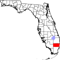
Location of Bolivia, Florida
Coordinates: 26°15′59″N80°6′28″W / 26.26639°N 80.10778°W / 26.26639; -80.10778 Coordinates: 26°15′59″N80°6′28″W / 26.26639°N 80.10778°W / 26.26639; -80.10778
Country Flag of the United States.svg  United States
State Flag of Florida.svg  Florida
County   Broward
Area
  Total1.2 sq mi (3.0 km2)
  Land1.2 sq mi (3.0 km2)
  Water0.0 sq mi (0.0 km2)
Population
 (2000)
  Total7,741
  Density6,682.3/sq mi (2,580.1/km2)
Time zone UTC-5 (Eastern (EST))
  Summer (DST) UTC-4 (EDT)
FIPS code 12-13625 [1]

Collier Manor-Cresthaven was a census-designated place (CDP) that now serves as a neighborhood of Pompano Beach, Florida, United States. The population was 7,741 at the 2000 census. During the recent rapid appreciation of home values in South Florida, many homes the Cresthaven neighborhood have come to be better maintained than they once were.

Contents

The neighborhood was developed by George J. Collier Inc.

Geography

Collier Manor-Cresthaven is located at 26°15′59″N80°6′28″W / 26.26639°N 80.10778°W / 26.26639; -80.10778 (26.266308, -80.107815). [2]

According to the United States Census Bureau, the CDP has a total area of 3.0 km2 (1.2 mi2), all land.

Demographics

As of the census [1] of 2000, there were 7,741 people, 3,056 households, and 1,851 families residing in the CDP. The population density was 2,576.6/km2 (6,682.3/mi2). There were 3,303 housing units at an average density of 1,099.4/km2 (2,851.3/mi2). The racial makeup of the CDP was 77.82% White (67.4% were Non-Hispanic White,) [3] 11.78% African American, 0.47% Native American, 1.10% Asian, 0.03% Pacific Islander, 4.84% from other races, and 3.97% from two or more races. Hispanic or Latino of any race were 16.28% of the population.

There were 3,056 households, out of which 30.5% had children under the age of 18 living with them, 42.2% were married couples living together, 11.7% had a female householder with no husband present, and 39.4% were non-families. 29.2% of all households were made up of individuals, and 12.0% had someone living alone who was 65 years of age or older. The average household size was 2.53 and the average family size was 3.14.

In the CDP, the population was spread out, with 24.2% under the age of 18, 7.1% from 18 to 24, 36.0% from 25 to 44, 21.0% from 45 to 64, and 11.6% who were 65 years of age or older. The median age was 36 years. For every 100 females, there were 104.1 males. For every 100 females age 18 and over, there were 103.6 males.

The median income for a household in the CDP was $35,261, and the median income for a family was $38,750. Males had a median income of $30,385 versus $23,098 for females. The per capita income for the CDP was $15,289. About 8.6% of families and 11.1% of the population were below the poverty line, including 12.4% of those under age 18 and 16.6% of those age 65 or over.

As of 2000, English as a first language accounted for 72.54% of all residents, while Spanish made up 16.92%, French Creole accounted for 6.88%, French was the mother tongue of 1.40%, and both Italian and Portuguese tied at 1.12% of the population. [4]

Related Research Articles

Skwentna, Alaska CDP in Alaska, United States

Skwentna is a census-designated place (CDP) on Iditarod Trail in Matanuska-Susitna Borough, Alaska, United States. It is part of the Anchorage, Alaska Metropolitan Statistical Area. At the 2010 census the population was 37, down from 111 in 2000.

Oroville East, California census-designated place in California, United States

Oroville East or Kelly Ridge is a census-designated place (CDP) in Butte County, California, United States. The population was 8,280 at the 2010 census, down from 8,680 at the 2000 census. Most citizens are dependent on the commerce of Oroville, and the vast majority of high school students in Kelly Ridge attend Las Plumas High School. The community of Kelly Ridge sits at Lake Oroville and offers direct access to boating, camping, fishing and a variety of water sports. Some of Oroville’s most beautiful and modern properties can be found here and this neighborhood is also a popular place to retire and enjoy the outdoors.

Bayview-Montalvin, California former CDP in California, United States

Bayview-Montalvin is a former census-designated place (CDP) in Contra Costa County, California, United States. The population was 5,004 at the 2000 census.

Broward Estates was a census-designated place (CDP) in Broward County, Florida, United States. The population was 3,416 at the 2000 census. It now serves as Lauderhill's neighborhood. Residents of this neighborhood often refer to their neighborhood as "Parkway" as well, as it also contains Parkway Middle School.

Leisureville was a census-designated place (CDP) in Broward County, Florida, United States, and now a neighborhood of the City of Pompano Beach, Florida. The population was 1,147 at the 2000 census.

Rock Island was a census-designated place (CDP) in Broward County, Florida, United States. The population was 3,076 at the 2000 census. It is now a neighborhood of Fort Lauderdale.

Lely, Florida Census-designated place in Florida

Lely is a census-designated place (CDP) in Collier County, Florida, United States. The population was 3,451 at the 2010 census. It is part of the Naples–Marco Island Metropolitan Statistical Area.

Lely Resort, Florida Census-designated place in Florida

Lely Resort is a census-designated place (CDP) in Collier County, Florida, United States. The population was 4,646 at the 2010 census, up from 1,426 in 2000. It is part of the Naples–Marco Island Metropolitan Statistical Area. As of 2017, the population is 4,646.

Naples Manor, Florida Census-designated place in Florida

Naples Manor is a census-designated place (CDP) in Collier County, Florida, United States. The population was 5,562 at the 2010 census. It is part of the Naples–Marco Island Metropolitan Statistical Area.

Pine Ridge, Collier County, Florida Census-designated place in Florida

Pine Ridge is a census-designated place (CDP) in Collier County, Florida, United States. The population was 1,918 at the 2010 census. It is part of the Naples–Marco Island Metropolitan Statistical Area.

Paradise Heights, Florida Census-designated place in Florida, United States

Paradise Heights is a census-designated place and an unincorporated area in Orange County, Florida, United States. The population was 1,215 at the 2010 census. It is part of the Orlando–Kissimmee Metropolitan Statistical Area.

Seminole Manor is a census-designated place (CDP) in Palm Beach County, Florida, United States. The population was 2,546 at the 2000 census. The neighborhood was developed in the late 1950s, with the majority of houses built in 1958 and 1959.

Ferndale, Maryland Census-designated place in Maryland, United States

Ferndale is a census-designated place (CDP) in Anne Arundel County, Maryland, United States. At the 2010 census, the population was 16,746.

Goddard, Maryland Unincorporated community in Maryland

Goddard is an unincorporated community and former census-designated place (CDP) in Prince George's County, Maryland, United States. It was named after the physicist Robert H. Goddard. The population was 5,554 in the 2000 census. The area was no longer a census-designated place as of the 2010 census.

Tilghman Island, Maryland CDP in Maryland, United States

Tilghman Island is an island in the Chesapeake Bay. It is part of Talbot County, Maryland, United States.

Helena Valley Northwest, Montana CDP in Montana, United States

Helena Valley Northwest is a census-designated place (CDP) in Lewis and Clark County, Montana, United States. The population was 3,482 at the 2010 census. It is part of the Helena Micropolitan Statistical Area.

Zephyr Cove–Round Hill Village, Nevada Former CDP in Nevada, United States

Zephyr Cove–Round Hill Village is a former census-designated place (CDP) in Douglas County, Nevada, United States. The population was 1,649 at the 2000 census. For the 2010 census, the area was split into the Zephyr Cove and Round Hill Village CDPs.

Leisure Knoll, New Jersey Census-designated place in New Jersey, United States

Leisure Knoll is an unincorporated community and census-designated place (CDP) located within Manchester Township, in Ocean County, New Jersey, United States. As of the 2010 United States Census, the CDP's population was 2,490.

Seagate, North Carolina CDP in North Carolina, United States

Seagate was a census-designated place (CDP) in New Hanover County, North Carolina, United States. The population was 4,590 at the 2000 census. It is part of the Wilmington Metropolitan Statistical Area.

Maple Heights-Lake Desire, Washington Census-designated place in Washington, United States

Maple Heights-Lake Desire is a census-designated place (CDP) in King County, Washington, United States. At the 2010 census, the population was 3,152.

References

  1. 1 2 "U.S. Census website". United States Census Bureau . Retrieved 2008-01-31.
  2. "US Gazetteer files: 2010, 2000, and 1990". United States Census Bureau. 2011-02-12. Retrieved 2011-04-23.
  3. "Demographics of Collier Manor-Cresthaven, FL". MuniNetGuide.com. Archived from the original on 2008-04-28. Retrieved 2007-11-16.
  4. "MLA Data Center Results for Collier Manor-Cresthaven, FL". Modern Language Association . Retrieved 2007-11-16.