Decatur, Arkansas

Last updated

Decatur, Arkansas
Downtown Decatur, AR.jpg
Downtown Decatur
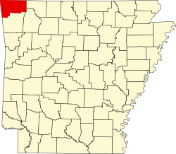
Benton County Arkansas Incorporated and Unincorporated areas Decatur Highlighted 0517740.svg
Location of Decatur in Benton County, Arkansas.
Coordinates: 36°20′25″N94°27′28″W / 36.34028°N 94.45778°W / 36.34028; -94.45778
Country United States
State Arkansas
County Benton
Area
[1]
  Total4.53 sq mi (11.72 km2)
  Land4.47 sq mi (11.58 km2)
  Water0.06 sq mi (0.14 km2)
Elevation
[2]
1,204 ft (367 m)
Population
 (2020)
  Total1,773
  Density396.56/sq mi (153.11/km2)
Time zone UTC-6 (Central (CST))
  Summer (DST) UTC-5 (CDT)
ZIP code
72722
Area code 479
FIPS code 05-17740
GNIS feature ID2404207 [2]
Website decaturarkansas.com

Decatur is a city, in Benton County, Arkansas, United States. The population was 1,773 at the 2020 census. [3] It is part of the Northwest Arkansas region. This town is named after Commodore Stephen Decatur, Jr.

Contents

Geography

Decatur is located in western Benton County at 36°20′15″N94°27′24″W / 36.33750°N 94.45667°W / 36.33750; -94.45667 (36.337541, -94.456721). [4] Arkansas Highway 59 passes through the city, leading north 6 miles (10 km) to Gravette and 13 miles (21 km) to the Missouri border, and south 13 miles (21 km) to Siloam Springs. Arkansas Highway 102 leads east 16 miles (26 km) to Bentonville and west 10 miles (16 km) to the Oklahoma border.

According to the United States Census Bureau, Decatur has a total area of 4.5 square miles (11.7 km2), of which 4.4 square miles (11.5 km2) is land and 0.039 square miles (0.1 km2), or 1.21%, is water. [3]

Demographics

Historical population
CensusPop.Note
1910 246
1920 42472.4%
1930 413−2.6%
1940 358−13.3%
1950 350−2.2%
1960 41518.6%
1970 847104.1%
1980 1,01319.6%
1990 918−9.4%
2000 1,31443.1%
2010 1,69929.3%
2020 1,7734.4%
U.S. Decennial Census [5]
2015 Estimate [6]
The historic Kansas City-Southern Depot was built in 1920 and added to the National Register of Historic Places (NRHP) in 1992. Decatur Train Station in Decatur, Arkansas.jpg
The historic Kansas City-Southern Depot was built in 1920 and added to the National Register of Historic Places (NRHP) in 1992.

2020 census

Decatur racial composition [8]
RaceNumberPercentage
White (non-Hispanic)88249.75%
Black or African American (non-Hispanic)110.62%
Native American 613.44%
Asian 191.07%
Pacific Islander 392.2%
Other/Mixed 1709.59%
Hispanic or Latino 59133.33%

As of the 2020 United States census, there were 1,773 people, 591 households, and 419 families residing in the city.

2010 census

As of the 2010 census Decatur had a population of 1,699. The racial and ethnic makeup of the population was 62.4% non-Hispanic white, 0.5% non-Hispanic black, 4.3% Native American, 0.9% Asian, 5.2% from two or more races and 28.4% Hispanic or Latino. [9]

2000 census

As of the census [10] of 2000, there were 1,314 people, 465 households, and 346 families residing in the city. The population density was 573.0 inhabitants per square mile (221.2/km2). There were 535 housing units at an average density of 233.3 per square mile (90.1/km2). The racial makeup of the city was 80.97% White, 5.48% Native American, 0.46% Asian, 10.12% from other races, and 2.97% from two or more races. 16.51% of the population were Hispanic or Latino of any race.

There were 465 households, out of which 44.7% had children under the age of 18 living with them, 52.3% were married couples living together, 15.7% had a female householder with no husband present, and 25.4% were non-families. 21.9% of all households were made up of individuals, and 9.5% had someone living alone who was 65 years of age or older. The average household size was 2.83 and the average family size was 3.23.

In the city, the population was spread out, with 32.0% under the age of 18, 9.8% from 18 to 24, 33.3% from 25 to 44, 16.1% from 45 to 64, and 8.8% who were 65 years of age or older. The median age was 29 years. For every 100 females, there were 111.6 males. For every 100 females age 18 and over, there were 103.0 males.

The median income for a household in the city was $29,844, and the median income for a family was $33,333. Males had a median income of $22,115 versus $19,125 for females. The per capita income for the city was $11,618. About 16.3% of families and 18.3% of the population were below the poverty line, including 23.2% of those under age 18 and 22.1% of those age 65 or over.

Education

Public education for elementary and secondary school students is provided by the Decatur School District, [11] leading to graduation from Decatur High School.

Related Research Articles

<span class="mw-page-title-main">Morgan County, Alabama</span> County in Alabama, United States

Morgan County is a county in the north-central part of the U.S. state of Alabama. As of the 2020 census, its population was 123,421. The county seat is Decatur. On June 14, 1821, it was renamed in honor of American Revolutionary War General Daniel Morgan of Virginia. It is a prohibition or dry county, although alcohol sales are allowed in the cities of Decatur, Hartselle, and Priceville. Morgan County is included in the Decatur, AL Metropolitan Statistical Area, which is also included in the Huntsville-Decatur-Albertville, AL Combined Statistical Area. It is a part of the North, Northwest, and North-Central regions of Alabama.

<span class="mw-page-title-main">Ringgold County, Iowa</span> County in Iowa, United States

Ringgold County is a county located in the U.S. state of Iowa. As of the 2020 census, the population was 4,663, making it the Iowa county with the second-smallest population. The county seat is Mount Ayr. The county is named after Maj. Samuel Ringgold, a hero of the Battle of Palo Alto fought in May 1846, during the Mexican–American War. It is one of the 26 Iowa counties with a name that is unique across the nation.

<span class="mw-page-title-main">Benton County, Arkansas</span> County in Arkansas, United States

Benton County is a county within the Northwest Arkansas region with a culture, economy, and history that have transitioned from rural and agricultural to suburban and white collar since the growth of Walmart, which is headquartered in Benton County. Created as Arkansas's 35th county on September 30, 1836, Benton County contains thirteen incorporated municipalities, including Bentonville, the county seat, and Rogers, the most populous city. The county was named after Thomas Hart Benton, a U.S. Senator from Missouri influential in Arkansas statehood.

<span class="mw-page-title-main">Hartselle, Alabama</span> City in Alabama, United States

Hartselle is the second largest city in Morgan County, Alabama, United States, 13 miles (21 km) south of Decatur. It is part of the Decatur Metropolitan Area and the Huntsville-Decatur Combined Statistical Area.

<span class="mw-page-title-main">Avoca, Arkansas</span> Town in Arkansas, United States

Avoca is a town in Benton County, Arkansas, United States. The population was 487 at the 2020 census. It is part of the Northwest Arkansas region.

<span class="mw-page-title-main">Centerton, Arkansas</span> City in Arkansas, United States

Centerton is a city in Benton County, Arkansas, United States. Located west of Bentonville on Highway 102, Centerton has grown from a railroad stop and fruit orchard community in the early 20th century into a suburban bedroom community within the rapidly growing Northwest Arkansas (NWA) region. The city's population has grown from 491 in 1990 to 16,244 in 2019. Centerton is considered to be one of the fastest growing cities in Arkansas and consistently ranks amongst the safest cities in the state.

<span class="mw-page-title-main">Highfill, Arkansas</span> Town in Arkansas, United States

Highfill is a town in Benton County, Arkansas, United States. The population was 1,587 as of the 2020 census. It is home to the Northwest Arkansas National Airport, which serves all of the Northwest Arkansas region. In September 2023, officials of the airport voted to detach itself from the city over taxing and public service disputes.

<span class="mw-page-title-main">Lowell, Arkansas</span> City in Arkansas, United States

Lowell is a city in Benton County, Arkansas, United States. Located within the Ozarks, the first settlement was along Old Wire Road in the 1840s, and although destroyed during the Civil War, the community was reestablished by J. R. McClure and thrived when the St. Louis–San Francisco Railway came through the area in the 1880s. The city is a growing bedroom community within the rapidly growing Northwest Arkansas region. Lowell is the headquarters of trucking company J.B. Hunt. Lowell's population was 9,839 at the 2020 census, an increase of 34% since 2010.

<span class="mw-page-title-main">Pea Ridge, Arkansas</span> City in Arkansas

Pea Ridge is a city in Benton County, Arkansas, United States. The name Pea Ridge is derived from a combination of the physical location of the original settlement of the town, across the crest of a ridge of the Ozark Mountains, and for the hog peanuts or turkey peas that had been originally cultivated by Native American tribes centuries before European settlement, which later helped to provide basic subsistence once those pioneer settlers arrived.

<span class="mw-page-title-main">Prairie Creek, Arkansas</span> CDP in Arkansas, United States

Prairie Creek is a census-designated place (CDP) in Benton County, Arkansas, United States. Per the 2020 census, the population was 2,217. It is a lakefront community adjacent to Beaver Lake and Rogers within the Northwest Arkansas region.

<span class="mw-page-title-main">Cedarville, Arkansas</span> City in Arkansas, United States

Cedarville is a city in Crawford County, Arkansas, United States. It is part of the Fort Smith, Arkansas-Oklahoma Metropolitan Statistical Area. The population was 1,410 at the 2020 census.

<span class="mw-page-title-main">Turrell, Arkansas</span> City in Arkansas, United States

Turrell is a city in Crittenden County, Arkansas, United States. Per the 2020 census, the population was 517.

<span class="mw-page-title-main">Bradley, Arkansas</span> City in Arkansas, United States

Bradley is a city in Lafayette County, Arkansas, United States. The population was 628 at the 2010 census.

<span class="mw-page-title-main">Hindsville, Arkansas</span> Town in Arkansas, United States

Hindsville is a town in Madison County, Arkansas, United States. The population was 90 at the 2020 census. It is part of the Northwest Arkansas region.

<span class="mw-page-title-main">Benton, Arkansas</span> City in Arkansas, United States

Benton is a city in and the county seat of Saline County, Arkansas, United States and a suburb of Little Rock. It was established in 1837. At the 2020 census, the city had a population of 35,014, making it the 12th most populous city in Arkansas. It is part of the Little Rock–North Little Rock–Conway Metropolitan Statistical Area. The city of Benton, first settled in 1833 and named after Missouri Senator Thomas Hart Benton, was formally chartered in 1836 when Arkansas became a state.

<span class="mw-page-title-main">Salem, Saline County, Arkansas</span> CDP in Arkansas, United States

Salem is a census-designated place (CDP) in Saline County, Arkansas, United States. Per the 2020 census, the population was 2,544. It is part of the Little Rock–North Little Rock–Conway Metropolitan Statistical Area.

<span class="mw-page-title-main">Mansfield, Arkansas</span> City in Arkansas, United States

Mansfield is a city in Scott and Sebastian counties Arkansas, United States. The Sebastian County portion of the city is part of the Fort Smith, Arkansas-Oklahoma Metropolitan Statistical Area. As of the 2010 Census, the population was 1,139. The population was 1,097 at the 2000 census.

<span class="mw-page-title-main">Hackett, Arkansas</span> City in Arkansas, United States

Hackett is a city in Sebastian County, Arkansas, United States. It is part of the Fort Smith, Arkansas-Oklahoma Metropolitan Statistical Area. The population was 812 at the 2010 census.

<span class="mw-page-title-main">Pierson, Florida</span> Town in the state of Florida, United States

Pierson is a town in Volusia County, Florida, United States. The town is part of the Deltona–Daytona Beach–Ormond Beach, Florida Metropolitan Statistical Area. The population was 1,542 as of the 2020 census.

<span class="mw-page-title-main">Roosevelt Park, Michigan</span> City in Michigan, United States

Roosevelt Park is a city in Muskegon County in the U.S. state of Michigan. The population was 4,172 at the 2020 census, up from 3,831 in 2010.

References

  1. "2020 U.S. Gazetteer Files". United States Census Bureau. Retrieved October 29, 2021.
  2. 1 2 U.S. Geological Survey Geographic Names Information System: Decatur, Arkansas
  3. 1 2 "Geographic Identifiers: 2010 Demographic Profile Data (G001): Decatur city, Arkansas". U.S. Census Bureau, American Factfinder. Archived from the original on February 12, 2020. Retrieved September 23, 2013.
  4. "US Gazetteer files: 2010, 2000, and 1990". United States Census Bureau. February 12, 2011. Retrieved April 23, 2011.
  5. "Census of Population and Housing". Census.gov. Retrieved June 4, 2015.
  6. "Annual Estimates of the Resident Population for Incorporated Places: April 1, 2010 to July 1, 2015". Archived from the original on October 19, 2016. Retrieved June 26, 2016.
  7. "National Register Information System". National Register of Historic Places . National Park Service. July 9, 2010.
  8. "Explore Census Data". data.census.gov. Retrieved January 1, 2022.
  9. 2010 general profile of population and housing characteristics of Decatur from the US census
  10. "U.S. Census website". United States Census Bureau . Retrieved January 31, 2008.
  11. "2020 CENSUS - SCHOOL DISTRICT REFERENCE MAP: Benton County, AR" (PDF). U.S. Census Bureau . Retrieved May 25, 2022.