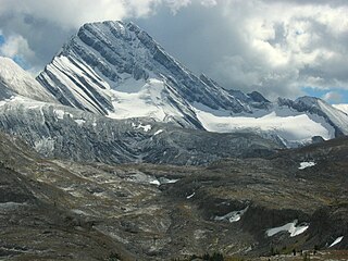
Mount Assiniboine, also known as Assiniboine Mountain, is a pyramidal peak mountain on the Great Divide, on the British Columbia/Alberta border in Canada.
Height of the Rockies Provincial Park is a provincial park in the Canadian Rockies of south eastern British Columbia, Canada. It is located west of the Continental Divide, adjacent to Elk Lakes Provincial Park.
Birkenhead Peak, commonly known as Mount Birkenhead and sometimes Birkenhead Mountain or Mount Birken is a mountain in the Gates Valley region of the Lillooet Country of the South-Central Interior of British Columbia, Canada. Located approximately midway between the towns of Lillooet (NE) and Pemberton-Mount Currie, the mountain's very high prominence separates it from the adjoining Cadwallader Range by the pass between Blackwater Creek and Birkenhead Lake.
Intersection Mountain is a 2,452-metre (8,045 ft) mountain on the Continental Divide. The mountain is so named because it lies at the intersection of the 120th meridian where the British Columbia and Alberta border diverges from its line along the Divide northwards along the meridian. The mountain is in Kakwa Provincial Park in British Columbia and Willmore Wilderness Park in Alberta and is near Casket Pass.
Whiteshield Mountain is located at the northern boundary of Mount Robson Provincial Park on the Alberta-British Columbia border. It was named in 1924 because of the ice and snow on the eastern side of the mountain.
Upright Mountain is located east of the head of the Moose River at the NE side of Mount Robson Provincial Park on the Continental Divide marking the Alberta-British Columbia border. Arthur O. Wheeler named the mountain in 1911 as the strata of the mountain have been upheaved to an almost vertical position.

Mount Phillips is a mountain located on the border of Jasper National Park (Alberta) and Mount Robson Provincial Park. It is Alberta's 61st highest peak, and British Columbia's 84th highest peak. It was named in 1923 by J. Norman Collie after Donald "Curly" Phillips, a Jasper area outfitter and guide who made the disputed first ascent of Mount Robson in 1909.
Salient Mountain is located just north of Miette Pass, at the NE end of Mount Robson Provincial Park on the Continental Divide marking the Alberta-British Columbia border. It is Alberta's 80th most prominent mountain. It was named in 1922 by Arthur O. Wheeler. It was noted to be the "sharpest" peak in the area.

Bastion Peak is a 2,994-metre (9,823 ft) mountain summit located on the shared border of Jasper National Park in Alberta, and Mount Robson Provincial Park in British Columbia, Canada. It is situated in the Tonquin Valley in the Canadian Rockies. It was named in 1916 by Édouard-Gaston Deville because it has an appearance similar to that of a bastion on a castle. Its nearest higher peak is Turret Mountain, 1.6 km (0.99 mi) to the west, and its greater parent is Mount Geikie 3 km (1.9 mi) to the west.
Dungeon Peak is a 3,129-metre (10,266 ft) mountain summit located on the shared border of Jasper National Park in Alberta, and Mount Robson Provincial Park in British Columbia, Canada. Dungeon Peak is part of The Ramparts in the Tonquin Valley. The descriptive name was applied in 1916 by Morrison P. Bridgland (1878-1948), a Dominion Land Surveyor who named many peaks in Jasper Park and the Canadian Rockies. The mountain's name was made official in 1935 by the Geographical Names Board of Canada.

Parapet Peak is located at southern end of Mount Robson Provincial Park on the border of Alberta and British Columbia. It was named in 1921 by Cyril G. Wates.

Simon Peak is located on the border of Alberta and British Columbia, at the Southern end of Mount Robson Provincial Park. It is the highest peak of Mount Fraser. It was named in 1920 by the Alberta-British Columbia Boundary Commission.
Scarp Mountain is located on the border of Alberta and British Columbia, at the southern end of Mount Robson Provincial Park. It was named in 1922 by Arthur O. Wheeler.
Whitecrow Mountain is located at the head of the Fraser River in Mount Robson Provincial Park on the Continental Divide marking the Alberta-British Columbia border. It was named in 1922 by Arthur O. Wheeler for the number of white crows that were seen on the peak.
Mount Scott is located on the border of Alberta and British Columbia, North of the Hooker Icefield in Hamber Provincial Park. It is Alberta's 44th highest peak, and Alberta's 46th most prominence mountain. It is also British Columbia's 57th highest peak. It was named in 1913 after Captain Robert Falcon Scott.
Chaba Peak is located in the Chaba Icefield south of Fortress Lake in Hamber Provincial Park on the Continental Divide marking the Alberta-British Columbia border. It was named in 1920 after the Chaba River by the Interprovincial Boundary Survey. Chaba is the Stoney Indian word for beaver.
Eden Peak is located on the border of Alberta and British Columbia, east of Cummins Lakes Provincial Park and between the Chaba and Apex Glaciers. It was named in 1901 by Jean Habel.

The Towers is a 2,842-metre (9,324-foot) mountain located on the border of Alberta and British Columbia on the Continental Divide. It also straddles the shared boundary of Banff National Park with Mount Assiniboine Provincial Park. It was named in 1917 by Arthur O. Wheeler. Its nearest higher peak is Mount Magog, 2.5 km (1.6 mi) to the west.

Mount Sir Douglas is located on the border of Alberta and British Columbia on the Continental Divide, at the northern end of Height of the Rockies Provincial Park and east of Invermere. It is Alberta's 18th highest peak, and 28th prominence mountain as well as British Columbia's 28th highest peak. It was named in 1916 by interprovincial boundary surveyors after Field Marshal Sir Douglas Haig.
A mountain formerly known as Mount Pétain, but with no current official name, is located on the border of the Canadian provinces of Alberta and British Columbia (BC) on the Continental Divide.


