Related Research Articles

The Australian Greens Victoria, commonly known as the Victorian Greens or just as The Greens, is the Victorian state member party of the Australian Greens, a green political party in Australia.

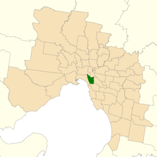
The Division of Melbourne Ports was an Australian federal electoral division in the inner south-eastern suburbs of Melbourne, Victoria, Australia. It was located to the south of Melbourne's central business district and covered an area of approximately 40 km2 around the north and north-eastern shores of Port Phillip Bay.

Prahran is an electoral district of the Legislative Assembly in the Australian state of Victoria. It was created by the Electoral Act Amendment Act 1888, taking effect at the 1889 elections. It is the state's smallest electorate of 12 km² in the inner south-east of Melbourne, taking in the suburbs of South Yarra, Prahran and Windsor, as well as parts of Balaclava, St Kilda, St Kilda East and Toorak. The electorate had a population of 54,141 at the 2001 census.

The electoral district of Melbourne is an electorate of the Victorian Legislative Assembly. It currently includes the localities of Carlton, North Carlton, Melbourne, East Melbourne, West Melbourne, North Melbourne, Parkville, Newmarket, Kensington and Flemington, and includes Melbourne University. The district has been in existence since 1856.

The electoral district of Gippsland South is a Lower House electoral district of the Victorian Parliament. It is located within the Eastern Victoria Region of the Legislative Council.

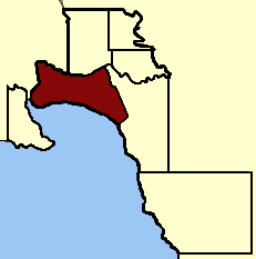
Sandridge was an electoral district of the Victorian Legislative Assembly. It existed from 1859 until 1889, when it was abolished and replaced with Port Melbourne, reflecting the name change of the suburb at its centre. Frederick Derham, the last member for the seat, continued as member for Port Melbourne.

Electoral district of South Melbourne was an electoral district of the Legislative Assembly in the British colony of Victoria (Australia).

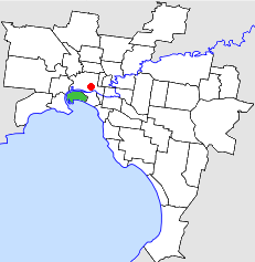
The City of Port Melbourne was a local government area about 4 kilometres (2 mi) southwest of Melbourne, the state capital of Victoria, Australia, on the south bank of the Yarra River. The city covered an area of 10.62 square kilometres (4.10 sq mi), and existed from 1860 until 1994.
Melbourne West Province was an electorate of the Victorian Legislative Council from 1904 until 2006.

The Electoral district of Maryborough was an electorate of the Victorian Legislative Assembly based on an area around Maryborough, Victoria. It was created in the expansion of the Assembly by the Victorian Electoral Act, 1858, which took effect at the election in 1859.

Emerald Hill was an electoral district of the Victorian Legislative Assembly, Australia. It covered part of the inner-city suburb South Melbourne and consisted part of the previous Electoral district of South Melbourne which was abolished in 1859..
Gippsland Province was an electorate of the Victorian Legislative Council from November 1882 until 2006. It was based in the Gippsland region of Victoria, Australia.
South Yarra Province was an electorate of the Victorian Legislative Council from November 1882 until May 1904.
Melbourne South Province was an electorate of the Victorian Legislative Council. It was created in June 1904 when Melbourne Province was reduced in size and North Yarra Province and South Yarra Province were abolished. The new Melbourne South, Melbourne North, Melbourne East and Melbourne West Provinces were then created.

Central Province was an electorate of the Victorian Legislative Council.

Collingwood was an electoral district of the Legislative Assembly in the Australian state of Victoria from 1856 to 1958. It centred on the Melbourne suburb of Collingwood, Victoria.

East Bourke Boroughs was an electoral district of the Legislative Assembly in the Australian state of Victoria from 1859 to 1904.
Jolimont and West Richmond was an electoral district of the Legislative Assembly in the Australian state of Victoria from 1889 to 1904. It was located in the inner eastern suburbs of Melbourne and included parts of Richmond and Jolimont.
Melbourne South was an electoral district of the Legislative Assembly in the Australian state of Victoria from 1889 to 1904.
This is a list of members of the Victorian Legislative Assembly, from the elections of 28 March 1889 to the elections of 20 April 1892. There were 95 seats in the Assembly from 1889, up from 86 in the previous Parliament.
References
- ↑ "The General Elections", The Argus, 15 March 1889, retrieved 26 December 2012
- ↑ "The Electoral Act Amendment Act 1888" (PDF). Retrieved 15 June 2013.
- ↑ U'Ren, Nancy; Turnbull, Noel (1983). A History of Port Melbourne. Oxford University Press.
- ↑ "Re-Member (Former Members)". State Government of Victoria. Retrieved 16 December 2012.
- ↑ Strangio, Paul (2012). Neither Power Nor Glory: 100 Years of Political Labor in Victoria, 1856-1956. Melbourne University Press. pp. 30–31.
Coordinates: 37°49′50″S144°55′30″E / 37.83056°S 144.92500°E