Related Research Articles
The Electoral district of Clayton is a former electoral district of the Victorian Legislative Assembly. It was named for the Melbourne suburb of Clayton, and also includes Clarinda, Notting Hill as well as parts of surrounding suburbs.

The electoral district of Gippsland South is a Lower House electoral district of the Victorian Parliament. It is located within the Eastern Victoria Region of the Legislative Council.
Electoral district of Pakenham was an electoral district of the Legislative Assembly in the Australian state of Victoria. It was recreated in the redistribution of electoral boundaries in 2021, and will be re-contested at the 2022 Victorian state election.
The Electoral district of Kara Kara and Borung was an electoral district of the Victorian Legislative Assembly.
The Electoral district of Stawell and Ararat was an electoral district of the Victorian Legislative Assembly. It was created from the Electoral district of Stawell and Electoral district of Ararat which were abolished in 1904.

The Electoral district of Colac was an electoral district of the Victorian Legislative Assembly, one of the inaugural districts of the first Assembly in 1856.
The Electoral district of Rainbow was an electoral district of the Victorian Legislative Assembly.

The Electoral district of Maldon was an electoral district of the Victorian Legislative Assembly.
The Electoral district of Midlands was an electoral district of the Victorian Legislative Assembly.

The electoral district of Bellarine is one of the electoral districts of Victoria, Australia, for the Victorian Legislative Assembly. It covers an area of 367 square kilometres (142 sq mi) stretching from the Bellarine Peninsula to the outer eastern suburbs of Geelong. It includes the towns of Barwon Heads, Clifton Springs, Drysdale, Indented Head, Ocean Grove, Point Lonsdale, Portarlington and Queenscliff and the Geelong suburbs of Leopold and Moolap. It lies within the Western Victoria Region of the upper house, the Legislative Council.
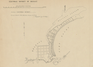
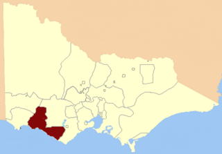
The electoral district of Belfast was an electorate of the Victorian Legislative Assembly in the British colony of Victoria. It was one of the original lower house seats in the first Parliament of Victoria in 1856. Belfast was renamed in 1889 to Port Fairy after the town of Belfast was also renamed.
The electoral district of Horsham was an electoral district of the Legislative Assembly in the Australian state of Victoria, centered on the town of Horsham, Victoria. It was created in 1889 and abolished in 1904.
Villiers and Heytesbury was an electoral district of the Legislative Assembly in the Australian state of Victoria from 1856 to 1904. It was based in western Victoria, and included the area from Lake Corangamite along the coast westward past Port Fairy.

Port Fairy was an electoral district of the Legislative Assembly in the Australian state of Victoria from 1889 to 1927. It was created when the Electoral district of Belfast was renamed. Bryan O'Loghlen was the last member for Belfast, serving 1888–1889.

West Bourke was an electoral district of the Legislative Assembly in the Australian state of Victoria from 1856 to 1904.

Ovens was an electoral district of the Legislative Assembly in the Australian state of Victoria from 1856 to 1927. It was based in northern Victoria, bordered by the Ovens River in the south-west and included the town of Beechworth, Victoria.
The Electoral district of Belfast and Warrnambool was one of the original sixteen electoral districts of the unicameral Legislative Council of the British colony of Victoria in 1851 to 1856.

The Electoral district of North Bourke was one of the original sixteen electoral districts of the old unicameral Victorian Legislative Council of 1851 to 1856. Victoria being a colony in Australia at the time.

The Electoral district of Wimmera was one of the original sixteen electoral districts of the old unicameral Victorian Legislative Council of 1851 to 1856. Victoria was a colony in Australia at the time.

The Electoral district of Villiers and Heytesbury was one of the original sixteen electoral districts of the old unicameral Victorian Legislative Council of 1851 to 1856. Victoria being a colony in Australia at the time.
References
- ↑ "Re-Member (Former Members)". State Government of Victoria. Retrieved 27 May 2014.
Coordinates: 35°04′S142°19′E / 35.067°S 142.317°E
| | This Victoria (Australia) government-related article is a stub. You can help Wikipedia by expanding it. |