Related Research Articles

The electoral district of Malvern is an electorate of the Victorian Legislative Assembly. It is named for the suburb of Malvern and also includes Malvern East, Armadale, Kooyong and parts of Glen Iris and Toorak.
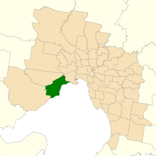
The electoral district of Altona is one of the electoral districts of Victoria, Australia, for the Victorian Legislative Assembly. It covers an area of 79 square kilometres (31 sq mi) in western Melbourne, and includes the suburbs of Altona, Altona Meadows, Laverton, Point Cook, Seabrook and Seaholme. It also includes the RAAF Williams airbase and the Point Cook Coastal Park. It lies within the Western Metropolitan Region of the upper house, the Legislative Council.

The electoral district of Bayswater is one of the electoral districts of Victoria, Australia, for the Victorian Legislative Assembly. It covers an area of 40 square kilometres (15 sq mi) in outer eastern Melbourne, and includes the suburbs of Bayswater, Heathmont, Kilsyth South and The Basin, and parts of Bayswater North, Boronia, Ringwood and Wantirna. It lies within the Eastern Metropolitan Region of the upper house, the Legislative Council.

The electoral district of Brunswick is an electorate of the Victorian Legislative Assembly. It covers an area of 16 square kilometres (6.2 sq mi) in inner northern Melbourne, and includes the suburbs of Brunswick, Brunswick East, and Brunswick West, and parts of Coburg, Fitzroy North, Parkville and Pascoe Vale South. It lies within the Northern Metropolitan Region of the upper house, the Legislative Council.
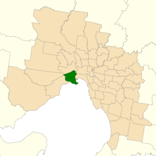
Williamstown is an electoral district of the Legislative Assembly in the Australian state of Victoria. It is a 33 km2 urban electorate in the inner south-western suburbs of Melbourne, encompassing the suburbs of Brooklyn, Newport, Spotswood, Williamstown and Yarraville. The electorate had a population of 54,426 as of the 2006 census.

The electoral district of Broadmeadows is an electorate of the Victorian Legislative Assembly. It covers an area of 49 square kilometres (19 sq mi) in outer northern Melbourne, and includes the suburbs of Broadmeadows, Campbellfield, Coolaroo, Dallas, Fawkner, Jacana and Meadow Heights. It also includes parts of Glenroy, Roxburgh Park, Somerton and Westmeadows. It lies within the Northern Metropolitan Region of the upper house, the Legislative Council.
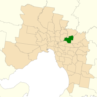
The electoral district of Bulleen is an electoral district of the Victorian Legislative Assembly. It covers an area of 36 square kilometres (14 sq mi) in eastern Melbourne, including the suburbs of Bulleen, Doncaster, Templestowe Lower, and part of Templestowe. It lies within the Eastern Metropolitan Region of the upper house, the Legislative Council.

Bundoora is an electoral district of the Victorian Legislative Assembly. It covers an area of 31 square kilometres (12
Electoral district of Korong and Eaglehawk was an electoral district of the Legislative Assembly in the Australian state of Victoria.
For the lower house seats in the Victorian Legislative Assembly, see South Bourke 1856–1889, or Evelyn and Mornington 1856–1859.

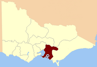
The Electoral district of South Bourke was an electoral district of the Legislative Assembly in then Australian colony of Victoria. It was one of the original 36 electoral districts of the Assembly. It covered an area east of Melbourne, bounded by Dandenong Creek in the south and east, Moorabbin, Prahran and Hawthorn in the west and Templestowe in the north. It was abolished in 1889.
Loddon was an electoral district of the Legislative Assembly in the Australian state of Victoria from 1856 to 1859. It was based in northern Victoria around the Loddon River.

The Electoral district of Murray was one of the sixteen electoral districts of the original unicameral Victorian Legislative Council of 1851 to 1856.

Ovens was an electoral district of the Legislative Assembly in the Australian state of Victoria from 1856 to 1927. It was based in northern Victoria, bordered by the Ovens River in the south-west and included the town of Beechworth, Victoria.

The Electoral district of Grant was one of the sixteen electoral districts of the original unicameral Victorian Legislative Council (Australia) of 1851 to 1856.

Geelong East was an electoral district of the Legislative Assembly in the Australian state of Victoria from 1859 to 1985. It was located south of the city of Geelong, defined in the Victorian Electoral Act, 1858 as:
Commencing at the north-western angle of the town reserve of Geelong; thence by a line south to the River Barwon; thence westward and northwestward by the River Barwon to the western boundary of the reserve at the junction of the Moorabool and Barwon; thence east by the northern boundary of section 25, parish of Barrabool; thence south by the eastern boundaries of sections 25 and 11, and by part of the eastern boundary of section 7, all in the same parish; thence south-easterly by a curved line crossing the Waurn Chain of Ponds to the southern boundary of section 3, parish of Conewarre; thence east by the southern boundaries of sections 3 and 4 in the same parish; thence north-easterly by a curved line crossing the River Barwon to the south-eastern angle of section 11 in the parish of Moolap; thence by the eastern boundary of that section and a line north to the shores of Corio Bay; and thence by the shores of Corio Bay to the north-western angle of the town reserve, the commencing point aforesaid, including the remaining portion of the reserve at Point Henry.

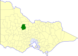
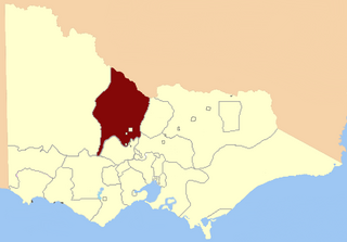
Kyneton was an electoral district of the Legislative Assembly in the Australian state of Victoria centred on Kyneton from 1889 to 1904.

This is a list of members of the Victorian Legislative Council, as appointed to the Council of 1853 or elected at the 1853 election. Members added in 1855 are noted in a separate section below.

This is a list of members of the Victorian Legislative Council from the elections on 5 August 1856 to the elections of 31 August to 2 October 1858.
This is a list of members of the Victorian Legislative Council from the elections of 16 September – 2 November 1868 to the elections of 24 August to 10 December 1870.
References
- ↑ "Former Members". re-member: a database of all Victorian MPs since 1851. Parliament of Victoria. Retrieved 25 August 2022.
- ↑ "Keith Dodgshun". re-member: a database of all Victorian MPs since 1851. Parliament of Victoria. Retrieved 25 August 2022.