Related Research Articles
Electoral district of Moonee Ponds was an electoral district of the Legislative Assembly in the Australian state of Victoria.
Electoral district of South Melbourne was an electoral district of the Legislative Assembly in the British colony of Victoria (Australia).
The Electoral district of Wantirna was an electoral district of the Victorian Legislative Assembly. It was first created after the Electoral district of Scoresby was abolished in 1976. Geoff Hayes was the last member for Scoresby in its first incarnation, and the first for Wantirna. After the 2002 redistribution, the electorate was replaced, once again returning as the Electoral district of Scoresby. The last member of Wantirna, Kim Wells was also the first member for Scoresby, in its second incarnation.
The Electoral district of Stawell and Ararat was an electoral district of the Victorian Legislative Assembly. It was created from the Electoral district of Stawell and Electoral district of Ararat which were abolished in 1904.
The Electoral district of Castlemaine and Maldon was an electoral district of the Victorian Legislative Assembly (Australia).
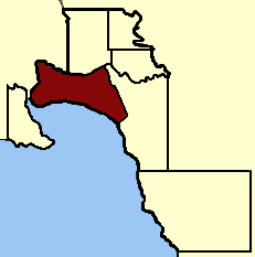
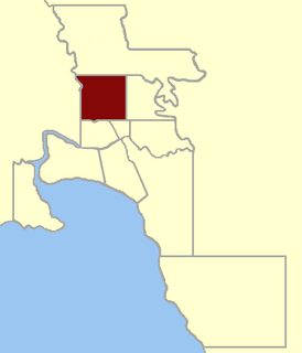
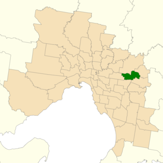
The Electoral district of Mernda was an electoral district of the Victorian Legislative Assembly. Mernda was created in the 1945 redistribution, created from the abolished Electoral district of Bulla and Dalhousie.
The electoral district of Allandale was an electoral district of the Legislative Assembly in the Australian state of Victoria, located north-west of Ballarat.
The electoral district of Nunawading was an electoral district of the Legislative Assembly in the Australian state of Victoria, located in the eastern Melbourne suburb of Nunawading. A notable former member was future Prime Minister, Robert Menzies.
The electoral district of Mooroolbark was an electoral district of the Legislative Assembly in the Australian state of Victoria.
The electoral district of Warrenheip and Grenville was an electorate of the Victorian Legislative Assembly in the Australian state of Victoria. Created in 1927 by the Electoral Districts Act 1926 after the abolition of the electoral district of Warrenheip, the electorate was abolished in 1945.

The Electoral district of South Bourke was an electoral district of the Legislative Assembly in then Australian colony of Victoria. It was one of the original 36 electoral districts of the Assembly. It covered an area east of Melbourne, bounded by Dandenong Creek in the south and east, Moorabbin, Prahran and Hawthorn in the west and Templestowe in the north. It was abolished in 1889.

Castlemaine was an electoral district of the Legislative Assembly in the Australian state of Victoria from 1859 to 1904. It included the towns of Castlemaine, Muckleford and Harcourt.
The Electoral district of Castlemaine and Kyneton was an electoral district of the Victorian Legislative Assembly (Australia).

Dalhousie was an electoral district of the Legislative Assembly in the Australian state of Victoria from 1859 to 1927. It was based in north-western Victoria. The district had been named Electoral district of Anglesey. The district of Dalhousie was defined in the 1858 Electoral Act as :
THE ELECTORAL DISTRICT OF DALHOUSIE.
ANGLESEY. Bounded on the west by part of the eastern boundary of the County of Dalhousie, namely, by the River Goulburn from the confluence of Hughes's Creek to the confluence of Dabyminga Creek; thence by Dabyminga Creek to its source in the Great Dividing Range; on the south by the Great Dividing Range to the main source of the River Goulburn; on the east by the range dividing the waters of the main source of the Goulburn and Big Rivers from those of the Rubicon and Snod-por-dock Creek northward to Mount Torbrick; thence by Jerusalem Creek to its confluence with the River Goulburn; thence by the River Goulburn to the confluence of the River Delatite; thence by the River Delatite and its north-west arm to the Dividing Range between the last named arm and Septimus Creek; and on the north by that range to the source of Hughes's Creek; and thence by Hughes's Creek to its confluence with the River Goulburn, excepting the country included in the Boroughs of Seymour and Avenel ... DALHOUSIE. Commencing at the junction of the Rivers Campaspe and Coliban; thence by a line south-easterly to the source of the Mclvor or Patterson's Creek; thence by a line north-east to the confluence of Hughes's Creek with the River Goulburn; on the east by the River Goulburn until it joins the Dabyminga Creek, by that creek to its source in the Dividing Range; on
the south by the Dividing Range to the source of the River Coliban; and on the west by the last mentioned river to its junction with the River Campaspe, being the commencing point, excepting the country included in the electoral districts of the Kyneton Boroughs, Murray Boroughs, and Kilmore.

Gippsland North was an electoral district of the Legislative Assembly in the Australian state of Victoria located in northern Gippsland from 1859 to 1955.

Grenville was an electoral district of the Legislative Assembly in the Australian state of Victoria from 1859 to 1927. It was located in western Victoria, south of Ballarat.
North Melbourne was an electoral district of the Legislative Assembly in the Australian state of Victoria from 1859 to 1927.

Ripon and Hampden was an electoral district of the Legislative Assembly in the Australian state of Victoria from 1859 to 1904. It was based in western Victoria.
The electoral district of Ringwood is an electoral district of the Victorian Legislative Assembly. It was first proclaimed in 1958 and was abolished in 1992. The electorate was located to the east of Melbourne and centred on the suburb of Ringwood, after which it is named.
The Electoral district of Ripponlea was an electoral district of the Victorian Legislative Assembly located in the Melbourne south-east suburb of Ripponlea, Victoria. It was created in 1955 and abolished in 1967.
References
- 1 2 3 "Re-Member (Former Members)". State Government of Victoria. Retrieved 27 May 2014.