Related Research Articles

Electoral districts of Victoria are the electoral districts, commonly referred to as "seats" or "electorates", into which the Australian State of Victoria is divided for the purpose of electing members of the Victorian Legislative Assembly, one of the two houses of the Parliament of the State. The State is divided into 88 single-member districts. The Legislative Assembly has had 88 electorates since the 1985 election, increased from 81 previously.

The Electoral district of Rodney was a Victorian Legislative Assembly electorate in Northern Victoria.
The electoral district of Kew is an electoral district of the Victorian Legislative Assembly. Located in eastern Melbourne, a few kilometres from the city centre, it is centred on the suburbs of Kew and Kew East. It also contains Balwyn, Balwyn North, Deepdene, and parts of Canterbury, Mont Albert, and Surrey Hills.
The lower houses of the parliaments of the states and territories of Australia are divided into electoral districts. Most electoral districts send a single member to a state or territory's parliament using the preferential method of voting. The area of a state electoral district is dependent upon the Electoral Acts in the various states and vary in area between them. At present, there are 409 state electoral districts in Australia.

The electoral district of Gippsland South is a Lower House electoral district of the Victorian Parliament. It is located within the Eastern Victoria Region of the Legislative Council.

The electoral district of Anglesey was an electoral district of the Legislative Assembly in the Australian state of Victoria.

The electoral district of Wimmera was an electoral district of the Legislative Assembly in the Australian state of Victoria.

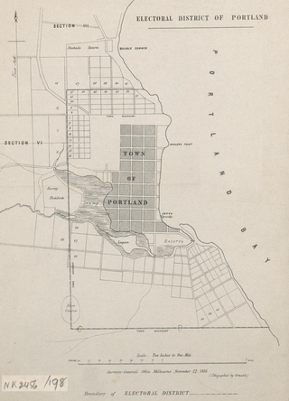
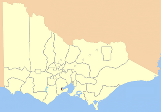
The electoral district of Portland was an electoral district of the Legislative Assembly in the Australian state of Victoria.

Ararat was an electoral district of the Legislative Assembly in the Australian state of Victoria. The electorate was abolished in 1904 and replaced by the electoral district of Stawell and Ararat.

Dundas was an electoral district of the Legislative Assembly in the Australian state of Victoria from 1856 to 1976. It covered a region of western Victoria and consisted of the counties of Dundas and Follett.

Castlemaine Boroughs was an electoral district of the Legislative Assembly in the Australian state of Victoria from 1856 to 1859. It included the towns Castlemaine, Muckleford, Harcourt and Elphinstone, all roughly 110 to 130 km north-west of Melbourne. The boundaries included non-continuous urban areas.

Collingwood was an electoral district of the Legislative Assembly in the Australian state of Victoria from 1856 to 1958. It centred on the Melbourne suburb of Collingwood, Victoria.

West Melbourne was an electoral district of the Legislative Assembly in the Australian state of Victoria from 1859 to 1904.

Murray Boroughs was an electoral district of the Legislative Assembly in the Australian state of Victoria from 1856 to 1877. It was based in northern Victoria, and included the towns of Benalla Avenel Euroa Seymour, Wodonga and Wangaratta. The district of Murray Boroughs was one of the initial districts of the first Victorian Legislative Assembly, 1856.

Geelong West was an electoral district of the Legislative Assembly in the Australian state of Victoria from 1859 to 1985. It was located west of the city of Geelong, defined in the Victorian Electoral Act, 1858 as:
Bounded on the north and north-west by a line drawn at a distance of 2 miles from the north-western angle of the town reserve of Geelong, as a centre from the western shore of Corio Bay, near Cowie's Creek, to a road leading to the River Barwon; on the west by that road; on the south-west and south by the River Barwon; and on the east by the western boundary of the town reserve of Geelong and the shores of Corio Bay, including the reserve at the junction of the Barwon and Moorabool
Glenelg was an electoral district of the Legislative Assembly in the Australian state of Victoria based in far south-western Victoria from 1904 to 1927.

Grenville was an electoral district of the Legislative Assembly in the Australian state of Victoria from 1859 to 1927. It was located in western Victoria, south of Ballarat.
Kara Kara was an electoral district of the Legislative Assembly in the Australian state of Victoria from 1877 to 1927 and 1955 to 1976. It was based in north-western Victoria and included the subdivisions of Donald, Charlton, Minyip, Murtoa, St. Arnaud, Wedderburn, Inglewood, Dunnolly, Landsborough, Avoca, Maryborough and Carisbrook. It was abolished in 1976 and replaced by the electoral district of Ripon.

North Melbourne was an electoral district of the Legislative Assembly in the Australian state of Victoria from 1859 to 1927.
Upper Goulburn was an electoral district of the Legislative Assembly in the Australian state of Victoria, from 1904 to 1945. It was based in northern Victoria. Upper Goulburn was created in 1904 after the abolition of the Electoral district of Delatite and the Electoral district of Anglesey. Thomas Hunt was the last member for Anglesey and first for Upper Goulburn.
References
- ↑ "Re-Member (Former Members)". State Government of Victoria. Retrieved 26 May 2014.