Related Research Articles

The Melbourne Sports and Entertainment Precinct is a series of sports stadiums and venues, located in Melbourne, Victoria, in Australia. The precinct is situated around 3 km east of the Melbourne central business district, located in suburbs of Melbourne and Jolimont, near East Melbourne and Richmond.

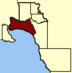
The electoral district of Melbourne is an electorate of the Victorian Legislative Assembly. It currently includes the localities of Docklands, Carlton, Melbourne, East Melbourne, West Melbourne, North Melbourne, Parkville, Newmarket, Kensington and Flemington, and includes Melbourne University. The district has been in existence since 1856.
Port Melbourne was an electoral district of the Victorian Legislative Assembly. It was created in 1889, replacing the previous electorate of Sandridge, which was the former name for Port Melbourne.
Electoral district of South Melbourne was an electoral district of the Legislative Assembly in the British colony of Victoria (Australia).
The Electoral district of Donald and Swan Hill was an electoral district of the Victorian Legislative Assembly. It was created by the Electoral Act Amendment Act 1888, taking effect at the 1889 elections. It was abolished by the Victorian Electoral Districts Boundaries Act 1903.
Electoral district of Abbotsford was an electoral district of the Legislative Assembly in the Australian state of Victoria.
Melbourne West Province was an electorate of the Victorian Legislative Council from 1904 until 2006.

The Electoral district of Maldon was an electoral district of the Victorian Legislative Assembly.

Jolimont Yard was an array of railway lines and carriage sidings on the edge of the central business district of Melbourne, Australia. Located between Flinders Street station, Richmond Junction, the Yarra River and Flinders Street they were often criticised for cutting off the city from the river, being the site of many redevelopment proposals. The Princes Gate Towers were built over part of the yard in the 1960s, which themselves were replaced by Federation Square in the 2000s. The rail sidings themselves were progressively removed from the 1980s to the 1990s with only running lines today, but the area continues to be referred to as the 'Jolimont railyards' by Melburnians.
South Yarra Province was an electorate of the Victorian Legislative Council from November 1882 until May 1904.
Melbourne South Province was an electorate of the Victorian Legislative Council. It was created in June 1904 when Melbourne Province was reduced in size and North Yarra Province and South Yarra Province were abolished. The new Melbourne South, Melbourne North, Melbourne East and Melbourne West Provinces were then created.

Collingwood was an electoral district of the Legislative Assembly in the Australian state of Victoria from 1856 to 1958. It centred on the Melbourne suburb of Collingwood, Victoria.

West Bourke was an electoral district of the Legislative Assembly in the Australian state of Victoria from 1856 to 1904.

East Bourke Boroughs was an electoral district of the Legislative Assembly in the Australian state of Victoria from 1859 to 1904.

East Melbourne was an electoral district of the Legislative Assembly in the Australian state of Victoria from 1859 to 1927.

Dalhousie was an electoral district of the Legislative Assembly in the Australian state of Victoria from 1859 to 1927. It was based in north-western Victoria. The district had been named Electoral district of Anglesey. The district of Dalhousie was defined in the 1858 Electoral Act as :
THE ELECTORAL DISTRICT OF DALHOUSIE.
ANGLESEY. Bounded on the west by part of the eastern boundary of the County of Dalhousie, namely, by the River Goulburn from the confluence of Hughes's Creek to the confluence of Dabyminga Creek; thence by Dabyminga Creek to its source in the Great Dividing Range; on the south by the Great Dividing Range to the main source of the River Goulburn; on the east by the range dividing the waters of the main source of the Goulburn and Big Rivers from those of the Rubicon and Snod-por-dock Creek northward to Mount Torbrick; thence by Jerusalem Creek to its confluence with the River Goulburn; thence by the River Goulburn to the confluence of the River Delatite; thence by the River Delatite and its north-west arm to the Dividing Range between the last named arm and Septimus Creek; and on the north by that range to the source of Hughes's Creek; and thence by Hughes's Creek to its confluence with the River Goulburn, excepting the country included in the Boroughs of Seymour and Avenel ... DALHOUSIE. Commencing at the junction of the Rivers Campaspe and Coliban; thence by a line south-easterly to the source of the Mclvor or Patterson's Creek; thence by a line north-east to the confluence of Hughes's Creek with the River Goulburn; on the east by the River Goulburn until it joins the Dabyminga Creek, by that creek to its source in the Dividing Range; on
the south by the Dividing Range to the source of the River Coliban; and on the west by the last mentioned river to its junction with the River Campaspe, being the commencing point, excepting the country included in the electoral districts of the Kyneton Boroughs, Murray Boroughs, and Kilmore.
Melbourne South was an electoral district of the Legislative Assembly in the Australian state of Victoria from 1889 to 1904.

North Melbourne was an electoral district of the Legislative Assembly in the Australian state of Victoria from 1859 to 1927.
This is a list of members of the Victorian Legislative Assembly, from the elections of 28 March 1889 to the elections of 20 April 1892. There were 95 seats in the Assembly from 1889, up from 86 in the previous Parliament.
This is a list of members of the Victorian Legislative Assembly, from the 1902 state election held on 1 October 1902 to the 1904 state election held on 1 June 1904. From 1889 there were 95 seats in the Assembly.
References
- 1 2 "Re-Member (Former Members)". Parliament of Victoria. Archived from the original on 7 March 2007. Retrieved 14 November 2024.
- ↑ "The Electoral Act Amendment Act 1888" (PDF). Australasian Legal Information Institute. Retrieved 3 June 2014.
- ↑ "Electoral Districts Boundaries Act 1903" . Retrieved 21 January 2014.