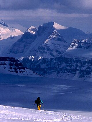
Mount Assiniboine, also known as Assiniboine Mountain, is a pyramidal peak mountain on the Great Divide, on the British Columbia/Alberta border in Canada.

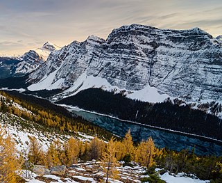
Mount Columbia is a mountain located in the Winston Churchill Range of the Rocky Mountains. It is the highest point in Alberta, Canada, and is second only to Mount Robson for height and topographical prominence in the Canadian Rockies. It is located on the border between Alberta and British Columbia on the northern edge of the Columbia Icefield. Its highest point, however, lies within Jasper National Park in Alberta.

Mount Bryce is a mountain at the southwestern corner of the Columbia Icefield, in British Columbia, Canada, near the border with Alberta. It can be seen from the Icefields Parkway.

Athabasca Pass is a high mountain pass in the Canadian Rockies on the border between Alberta and British Columbia. In fur trade days it connected Jasper House on the Athabasca River with Boat Encampment on the Columbia River.

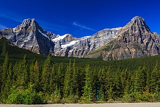
Howse Peak is the highest mountain in the Waputik Mountains, a subrange of the Canadian Rockies. It is located 5 km (3 mi) west of the Icefields Parkway, above Chephren Lake, on the continental divide between Alberta and British Columbia. At 3,295 m (10,810 ft), it is the 46th highest peak in Alberta, and the 59th highest in British Columbia.

The Hart Ranges are a major subrange of the Canadian Rockies located in northeastern British Columbia and western Alberta. The mountains constitute the southernmost portion of the Northern Rocky Mountains.

Mount Balfour is a mountain located on the Continental Divide, part of the border between British Columbia and Alberta, in the Waputik Range in the Park Ranges of the Canadian Rockies. It is the 71st highest peak in Alberta and the 113th highest in British Columbia; it is also the 52nd most prominent in Alberta.
Intersection Mountain is a 2,452-metre (8,045 ft) mountain on the Continental Divide. The mountain is so named because it lies at the intersection of the 120th meridian where the British Columbia and Alberta border diverges from its line along the Divide northwards along the meridian. The mountain is in Kakwa Provincial Park in British Columbia and Willmore Wilderness Park in Alberta and is near Casket Pass.
Razorback Mountain is located on the border of Alberta and British Columbia. It was named in 1915 for the narrow ridge on the mountain.

Leather Peak is located on the border of Alberta and British Columbia and is the highest of the four peaks on Yellowhead Mountain. The peak was named in 1918 by Arthur O. Wheeler.

Yellowhead Mountain is located west of Yellowhead Pass in Mount Robson Provincial Park and straddles the Continental Divide marking the Alberta-British Columbia border. It was named for Pierre Bostonais aka Tête Jaune. The mountain has four officially named summits: Bingley Peak, Leather Peak, Lucerne Peak, and Tête Roche.

Farbus Mountain is located on the provincial border of Alberta and British Columbia in Banff National Park. It was named in 1918 after Farbus, a village on the eastern slopes of Vimy Ridge in France.In the Battle of Vimy Ridge, Canadian troops retook Farbus from German control on April 9, 1917 as part of securing the Brown Line objective.
Gilgit Mountain is located on the border of Alberta and British Columbia at the head of Waitabit Creek and NE of Golden. It was named in 1898 by J. Norman Collie for Gilgit, Pakistan. Collie had accompanied Albert F. Mummery in an expedition to Nanga Parbat in 1895 where Mummery and two Gurkhas were killed in an avalanche on the mountain. Gilgit was the last civilization seen by the expedition.

Nanga Parbat Mountain is located on the border of Alberta and British Columbia at the head of the Mummery Glacier, North of Golden. It was named in 1898 by J. Norman Collie after the ninth highest mountain in the world Nanga Parbat, located in the Himalayas. Collie had climbed on Nanga Parbat in 1895.

Mount Bosworth is located in the Canadian Rockies on the border of Alberta and British Columbia. The mountain is situated immediately northwest of Kicking Horse Pass and straddles the shared border of Banff National Park with Yoho National Park. It was named in 1903 after George Morris Bosworth, an executive and long-time employee of the Canadian Pacific Railway.

Boom Mountain is located north of Vermilion Pass on the border of Alberta and British Columbia on the Continental Divide. It was named in 1908 after Boom Lake which is located right under the mountain. When viewed by an Alpine Club of Canada expedition, a buildup of logs on the lake resembled a log boom.
A mountain formerly known as Mount Pétain, but with no current official name, is located on the border of the Canadian provinces of Alberta and British Columbia (BC) on the Continental Divide.

Mount Haig is located on the border of Alberta and British Columbia on the Continental Divide. It was named in 1862 after Haig, Captain R.W. Mount Haig is the highest peak of Gravenstafel Ridge; its lower north and east faces feature as back country cat skiing for Castle Mountain Resort on neighbouring Gravenstafel Mountain.
Three Lakes Ridge is located on the border of Alberta and British Columbia on the Continental Divide. It was named by the Interprovincial Boundary Survey.


