Jim Mountain

Last updated
Jim Mountain
Jim Mountain.jpg
South aspect
Highest point
Elevation 10,430 ft (3,179 m) [1]
Prominence 670 ft (204 m) [1]
Parent peak Peak 12132 [2]
Isolation 5.28 mi (8.50 km) [2]
Coordinates 44°31′45″N109°28′28″W / 44.5292286°N 109.4745119°W / 44.5292286; -109.4745119 [3]
Naming
Etymology Jim Baker
Geography
USA Wyoming relief location map.svg
Red triangle with thick white border.svg
Jim Mountain
Location in Wyoming
Usa edcp relief location map.png
Red triangle with thick white border.svg
Jim Mountain
Jim Mountain (the United States)
CountryUnited States
State Wyoming
County Park
Protected area North Absaroka Wilderness
Parent range Absaroka Range
Rocky Mountains
Topo map USGS Jim Mountain
Geology
Rock type volcanic breccia
Climbing
Easiest route class 2

Jim Mountain is a 10,430-foot-elevation (3,179-meter) summit in Park County, Wyoming, United States.

Contents

Description

The mountain is situated 20 miles (32.2 km) west of the town of Cody and can be seen from Highway 20 approximately midway between Cody and Yellowstone National Park. It is set in the Absaroka Range along the boundary of North Absaroka Wilderness on land managed by Shoshone National Forest. [2] Precipitation runoff from the mountain drains into tributaries of the Shoshone River. Topographic relief is significant as the south aspect rises 4,830 feet (1,470 meters) above North Fork Shoshone River in four miles (6.4 km) and the east aspect rises 2,000 feet (610 meters) above Jim Creek in one mile (1.6 km).

Etymology

Jim Mountain is named after Jim Baker (1818–1898), frontiersman, trapper, army scout, interpreter, and rancher. [4] The mountain's toponym has been officially adopted by the United States Board on Geographic Names. [3]

Climate

According to the Köppen climate classification system, Jim Mountain is located in a semi-arid climate zone with cold, snowy winters, and cool to warm summers. [5] Winter temperatures can drop below −10 °F with wind chill factors below −30 °F. Due to its altitude, it receives precipitation all year, as snow in winter and as thunderstorms in summer, with a dry period in late spring.

Climate data for Jim Mountain 44.5345 N, 109.4766 W, Elevation: 10,036 ft (3,059 m) (1991–2020 normals)
MonthJanFebMarAprMayJunJulAugSepOctNovDecYear
Mean daily maximum °F (°C)24.3
(−4.3)
24.5
(−4.2)
30.5
(−0.8)
35.7
(2.1)
44.9
(7.2)
55.4
(13.0)
66.3
(19.1)
65.4
(18.6)
55.5
(13.1)
41.8
(5.4)
29.8
(−1.2)
23.5
(−4.7)
41.5
(5.3)
Daily mean °F (°C)16.0
(−8.9)
15.3
(−9.3)
20.5
(−6.4)
25.3
(−3.7)
34.3
(1.3)
43.8
(6.6)
53.6
(12.0)
52.8
(11.6)
43.9
(6.6)
31.8
(−0.1)
21.5
(−5.8)
15.3
(−9.3)
31.2
(−0.4)
Mean daily minimum °F (°C)7.7
(−13.5)
6.2
(−14.3)
10.5
(−11.9)
15.0
(−9.4)
23.8
(−4.6)
32.3
(0.2)
40.9
(4.9)
40.3
(4.6)
32.3
(0.2)
21.7
(−5.7)
13.1
(−10.5)
7.1
(−13.8)
20.9
(−6.1)
Average precipitation inches (mm)1.96
(50)
2.04
(52)
2.46
(62)
3.89
(99)
3.96
(101)
2.68
(68)
1.46
(37)
1.53
(39)
2.06
(52)
2.38
(60)
2.67
(68)
1.80
(46)
28.89
(734)
Source: PRISM Climate Group [6]

Trout Peak is a high mountain peak about 5 miles north of Jim Mountain.

Climate data for Trout Peak 44.6012 N, 109.5263 W, Elevation: 11,824 ft (3,604 m) (1991–2020 normals)
MonthJanFebMarAprMayJunJulAugSepOctNovDecYear
Mean daily maximum °F (°C)18.8
(−7.3)
18.0
(−7.8)
22.9
(−5.1)
29.0
(−1.7)
38.1
(3.4)
48.3
(9.1)
58.7
(14.8)
57.9
(14.4)
48.9
(9.4)
36.1
(2.3)
24.0
(−4.4)
18.0
(−7.8)
34.9
(1.6)
Daily mean °F (°C)9.7
(−12.4)
8.0
(−13.3)
12.3
(−10.9)
17.4
(−8.1)
26.2
(−3.2)
35.5
(1.9)
44.8
(7.1)
44.2
(6.8)
35.9
(2.2)
24.5
(−4.2)
15.0
(−9.4)
9.2
(−12.7)
23.6
(−4.7)
Mean daily minimum °F (°C)0.6
(−17.4)
−1.9
(−18.8)
1.7
(−16.8)
5.8
(−14.6)
14.3
(−9.8)
22.8
(−5.1)
30.9
(−0.6)
30.4
(−0.9)
22.9
(−5.1)
12.9
(−10.6)
5.9
(−14.5)
0.4
(−17.6)
12.2
(−11.0)
Average precipitation inches (mm)4.30
(109)
4.86
(123)
5.03
(128)
5.12
(130)
5.60
(142)
3.76
(96)
1.80
(46)
1.77
(45)
2.67
(68)
4.03
(102)
5.13
(130)
4.01
(102)
48.08
(1,221)
Source: PRISM Climate Group [7]

See also

Related Research Articles

Continental Glacier is in Bridger-Teton and Shoshone National Forests, in the U.S. state of Wyoming and straddles the Continental Divide in the northern Wind River Range. Continental Glacier is in both the Bridger and Fitzpatrick Wildernesses, and is part of the largest grouping of glaciers in the American Rocky Mountains. Continental Glacier is situated at an elevation range of 13,100 to 11,200 feet and forms a nearly unbroken icefield over 3 miles (4.8 km) in length along a high altitude plateau to the north of Downs Mountain. Immediately east of Continental Glacier lies East Torrey Glacier.

<span class="mw-page-title-main">Cloud Peak</span> Mountain in Wyoming, United States

Cloud Peak is the highest peak within the Bighorn Mountains in the U.S. state of Wyoming.

The Washakie Wilderness is located in Shoshone National Forest in the U.S. state of Wyoming.
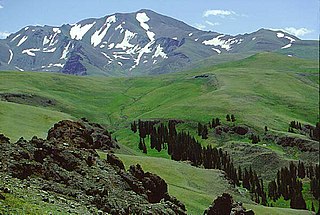
<span class="mw-page-title-main">Francs Peak</span> Mountain in Wyoming, United States

Francs Peak, elevation 13,158 feet (4,011 m), is the highest point in the Absaroka Range which extends from north-central Wyoming into south-central Montana, in the United States. It is in the Washakie Wilderness of Shoshone National Forest, and the peak is also the highest point in Park County, Wyoming, which includes much of Yellowstone National Park. It was named after Otto Franc, a cattle baron and homesteader in the Big Horn Basin in the latter half of the 19th century.
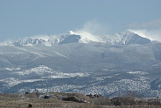
<span class="mw-page-title-main">Truchas Peak</span> Mountain in New Mexico, United States

Truchas Peak is the second highest peak in the U.S. State of New Mexico behind Wheeler Peak. It is in the Sangre de Cristo Mountains 26 miles (42 km) northeast of Santa Fe. It lies within the Pecos Wilderness, part of the Santa Fe National Forest. The name of the peak is Spanish for "trout" (plural). It is the highest point in both Rio Arriba and Mora counties. It is also the most southerly peak and land area in the continental United States to rise above 13,000 feet (3,962 m).

<span class="mw-page-title-main">Boott Spur</span> Mountain in New Hampshire, United States

Boott Spur is a minor peak located in Coos County, New Hampshire, United States. The mountain is named after Francis Boott (1792–1863), and is part of the Presidential Range of the White Mountains. Boott Spur stands on the shoulder of Mount Washington, above the south side of the headwall of Tuckerman Ravine.

Mount Isolation is a mountain located in Coos County, New Hampshire. The mountain is part of the Presidential Range of the White Mountains. Mount Isolation is the highest peak on the Montalban Ridge which extends south from Boott Spur.
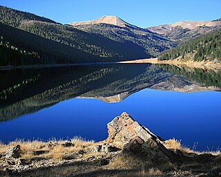
<span class="mw-page-title-main">Wyoming Peak</span> Mountain in Wyoming, United States

Wyoming Peak is the tallest mountain in the Wyoming Range in the U.S. state of Wyoming. Situated in Bridger-Teton National Forest, a now collapsed fire lookout is located on the summit. Wyoming Peak is .75 miles (1.21 km) south-southeast of Coffin Peak, the second highest peak in the Wyoming Range.

Fortress Mountain is located in the Absaroka Range in the U.S. state of Wyoming. Fortress Mountain is 1 mi (1.6 km) south of Sheep Mesa, a subpeak along the mesa that is 500 ft (150 m) lower in altitude. The headwaters of Cabin Creek are on the east slopes of Fortress Mountain, while those for Sheep Creek are on the northwest.

Dry Creek Glacier is located in Shoshone National Forest, in the U.S. state of Wyoming on Dry Creek Ridge, a high altitude plateau to the east of the main summits of the Wind River Range. The toe of the glacier has an unnamed proglacial lake, and the glacier has a moderate slope which descends from 12,320 to 11,800 ft.

<span class="mw-page-title-main">Bighorn Peak</span> Mountain in the American state of Wyoming

Bighorn Peak is located in the Bighorn Mountains in the U.S. state of Wyoming. The peak is the seventh highest in the range and it is in the Cloud Peak Wilderness of Bighorn National Forest. Bighorn Peak is 1.5 miles (2.4 km) south of Darton Peak.

Mather Peaks is located in the Bighorn Mountains in the U.S. state of Wyoming. The peak is the sixth highest in the range and it is in the Cloud Peak Wilderness of Bighorn National Forest. Mather Peaks is 4.5 miles (7.2 km) northwest of Darton Peak and 3.2 mi (5.1 km) south of Bomber Mountain.

<span class="mw-page-title-main">Sundance Mountain</span> Mountain in Montana, United States

Sundance Mountain is in the Beartooth Mountains in the U.S. state of Montana. The peak is one of the tallest in the Beartooth Mountains and is in the Absaroka-Beartooth Wildernessin Custer National Forest.

<span class="mw-page-title-main">Carter Mountain</span> Mountain in Wyoming, United States

Carter Mountain is in Shoshone National Forest in the U.S. state of Wyoming. Carter Mountain slopes gently up from the Bighorn Basin to the east but has steep cliffs on its western face. The region is well known for large herds of bighorn sheep, pronghorn and elk.

Tumble Mountain is in the Absaroka Range in the U.S. state of Montana. The peak is located in Custer National Forest. The tiny glacieret Tumble Glacier lies to the northeast.

<span class="mw-page-title-main">Ostler Peak</span> Mountain in the American state of Utah

Ostler Peak is a 12,718-foot elevation (3,876 m) mountain summit located in Summit County, Utah, United States.

<span class="mw-page-title-main">Mount Lovenia</span> Mountain in the American state of Utah

Mount Lovenia is a 13,219-foot elevation (4,029 m) mountain summit located on the common border that Duchesne County shares with Summit County in the U.S. state of Utah.

<span class="mw-page-title-main">Mount Beulah</span> Mountain in the American state of Utah

Mount Beulah is a 12,557-foot elevation (3,827 m) mountain summit located in Summit County, Utah, United States.

<span class="mw-page-title-main">Darwin Peak</span> Mountain in Wyoming, United States

Darwin Peak is an 11,647-foot-elevation (3,550-meter) mountain summit in Teton County, Wyoming, United States.

<span class="mw-page-title-main">Hobbs Peak (Wyoming)</span> Mountain in Wyoming, United States of America

Hobbs Peak is an 11,663-foot-elevation (3,555-meter) mountain summit in Fremont County, Wyoming, United States.

References

  1. 1 2 "Jim Mountain, Wyoming". Peakbagger.com. Retrieved 2023-09-23.
  2. 1 2 3 "Jim Mountain - 10,430' WY". listsofjohn.com. Retrieved 2023-09-23.
  3. 1 2 "Jim Mountain". Geographic Names Information System . United States Geological Survey, United States Department of the Interior . Retrieved 2023-09-23.
  4. Barry Swackhamer, The American Mountain Man: A Tribute, hmdb.org, Retrieved 2023-09-23.
  5. Peel, M. C.; Finlayson, B. L.; McMahon, T. A. (2007). "Updated world map of the Köppen-Geiger climate classification" (PDF). Hydrology and Earth System Sciences. 11 (5): 1633–1644. doi: 10.5194/hess-11-1633-2007 .
  6. "PRISM Climate Group, Oregon State University". PRISM Climate Group, Oregon State University. Retrieved October 12, 2023. To find the table data on the PRISM website, start by clicking Coordinates (under Location); copy Latitude and Longitude figures from top of table; click Zoom to location; click Precipitation, Minimum temp, Mean temp, Maximum temp; click 30-year normals, 1991-2020; click 800m; click Retrieve Time Series button.
  7. "PRISM Climate Group, Oregon State University". PRISM Climate Group, Oregon State University. Retrieved October 12, 2023. To find the table data on the PRISM website, start by clicking Coordinates (under Location); copy Latitude and Longitude figures from top of table; click Zoom to location; click Precipitation, Minimum temp, Mean temp, Maximum temp; click 30-year normals, 1991-2020; click 800m; click Retrieve Time Series button.