Deopuri, also spelled Devpuri, is a village in Bachhrawan block of Rae Bareli district, Uttar Pradesh, India. As of 2011, its population is 1,188, in 244 households. Located 2 km from Bachhrawan, Deopuri was historically the last village held by the zamindars descended from Qazi Sultan, the first zamindar of the pargana of Thulendi in the 1400s.

Karanpur is a village in Bachhrawan block of Rae Bareli district, Uttar Pradesh, India. Located 23 km from the city of Raebareli, Karanpur was historically one of the main villages in the Bachhrawan pargana. As of 2011, Karanpur's population is 4,171, in 791 households.

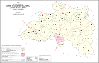
Atrehta is a village in Maharajganj block of Rae Bareli district, Uttar Pradesh, India. Located 1 km from Maharajganj, the block headquarters, it is the village whose lands the Maharajganj bazar was originally founded on. As of 2011, Atrehta has a population of 5,628, in 1,056 households. It has two primary schools and no healthcare facilities.

Kumhrawan is a village in Shivgarh block of Rae Bareli district, Uttar Pradesh, India. Formerly a pargana headquarters, it consists of a main village and several scattered hamlets. As of 2011, Kumhrawan has a population of 2,441, in 426 households.

Hardoi is a village in Maharajganj block of Rae Bareli district, Uttar Pradesh, India. Located on the road from Maharajganj to Bachhrawan, Hardoi historically served as the seat of a pargana and has a now-ruined fort built in the early 1400s under the Jaunpur Sultanate. As of 2011, its population is 2,308, in 415 households.

Panhauna is a village in Singhpur block of Rae Bareli district, Uttar Pradesh, India. As of 2011, its population is 7,075, in 1,307 households. It has one primary school and no healthcare facilities.

Datauli is a village in Harchandpur block of Rae Bareli district, Uttar Pradesh, India. As of 2011, its population is 1,980, in 357 households. It has one primary school and no healthcare facilities.

Pasi Tusi is a village in Harchandpur block of Rae Bareli district, Uttar Pradesh, India. As of 2011, its population is 645, in 125 households. It has no schools and no healthcare facilities.

Kathwara is a village in Harchandpur block of Rae Bareli district, Uttar Pradesh, India. It is located 13 km from Raebareli, the district headquarters, on the road to Lucknow, and on the left bank of the Baita river not far from its confluence with the Sai. The railway passes by Kathwara, and the closest station is at Harchandpur. As of 2011, the population of Kathwara is 5,115, in 921 households. It has two primary schools and no healthcare facilities.

Kilauli is a village in Sataon block of Rae Bareli district, Uttar Pradesh, India. It is located 8 km from Raebareli, the district headquarters. As of 2011, its population is 5,188, in 1,045 households. It has 6 primary schools and no healthcare facilities.

Didaur, also spelled Dedaur, is a village in Sataon block of Rae Bareli district, Uttar Pradesh, India. It is located 8 km from Raebareli on the road to Unnao, just east of the intersection with the road to Lalganj. It is near the right bank of the Sai river. As of 2011, Didaur has a population of 4,781 people, in 900 households. The village hosts two annual festivals: one is the Badhwapur-ka-Mela, which is dedicated to the worship of Nag Devta and is held on Bhadra Sudi 5, and the other is the Jhurhapur-ka-Mela, which is dedicated to worship of Rama and falls on Phalguna Sudi 8.

Rahi is a village and corresponding community development block in Rae Bareli district, Uttar Pradesh, India. It is located 7 km from Rae Bareli, the district headquarters, which according to one folk etymology is named after the village. Rahi was formerly the seat of a pargana before Rae Bareli replaced it in that capacity. As of 2011, Rahi has a population of 7,536 people, in 1,373 households. It has one primary school and one medical clinic.

Bela Bhela, also called Uttarpara, is a village in Rahi block of Rae Bareli district, Uttar Pradesh, India. It is located 9 km from Rae Bareli, the district headquarters, east of the road to Dalmau. It lies in a belt of stiff clay soil which is highly productive agriculturally and is interspersed with wetlands and patches of barren usar soil. Bela Bhela is a large village consisting of many hamlets. As of 2011, Bela Bhela has a total population of 16,623 people, in 3,004 households. It has one primary school and one medical clinic.

Lodhwari is a village in Rahi block of Rae Bareli district, Uttar Pradesh, India. It is located 12 km from Rae Bareli, the district headquarters, on the left bank of the Sai river. The road to Parshadepur runs through the northeastern part of the village lands. As of 2011, Lodhwari has a population of 10,592 people, in 2,019 households.

Hullapur is a village in Sareni block of Rae Bareli district, Uttar Pradesh, India. It is located 20 km from Lalganj, the tehsil headquarters. As of 2011, it has a population of 1,864 people, in 355 households. It has one primary school and no healthcare facilities.

Tonk is a village in Dalmau block of Rae Bareli district, Uttar Pradesh, India. It is located 10 km from Dalmau, the block headquarters. As of 2011, it has a population of 642 people, in 120 households. It has no schools and no healthcare facilities.

Itaura Buzurg is a village in Rohaniya block of Rae Bareli district, Uttar Pradesh, India. One of the largest villages in the historical pargana of Salon, it is located 28 km from Raebareli, the district headquarters, near the point where the road to Allahabad intersects the one leading from Fursatganj to the Gukana ghat. As of 2011, Itaura Buzurg has a population of 13,851 people, in 2,469 households. It has 6 primary schools and no healthcare facilities.

Bani is a village in Rahi block of Rae Bareli district, Uttar Pradesh, India. It is located 7 km from Rae Bareli, the district headquarters. As of 2011, it has a population of 672 people, in 136 households. It has no schools and no healthcare facilities.

Purai is a village in Sataon block of Rae Bareli district, Uttar Pradesh, India. It is located 15 km west of Raebareli, the district headquarters, near the point where the Basaha stream joins the Sai river.

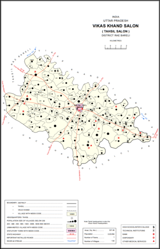
Bara Dih, also spelled Baradih, is a village in Salon block of Rae Bareli district, Uttar Pradesh, India. It is located 3 km northwest of Salon, the block headquarters, close to the point where the Chob stream joins the Sai river. As of 2011, Bara Dih has a population of 2,248 people, in 386 households.


