Kundauli is a village in Bachhrawan block of Rae Bareli district, Uttar Pradesh, India. It is located 5 km from Bachhrawan, the block headquarters, and the main staple foods are wheat and rice. As of 2011, its population is 3,183, in 683 households.

Kasrawan is a village in Bachhrawan block of Rae Bareli district, Uttar Pradesh, India. It is located 3 km from Bachhrawan, the block headquarters, and the main staple foods are wheat and rice. As of 2011, its population is 3,690, in 725 households.

Churwa is a village in Bachhrawan block of Rae Bareli district, Uttar Pradesh, India. It is located 6 km from Bachhrawan, the block headquarters, and the main staple foods are wheat and rice. As of 2011, its population is 1,661, in 323 households.

Pipri is a village in Shivgarh block of Rae Bareli district, Uttar Pradesh, India. As of 2011, its population is 1,263, in 222 households. It has one primary school and no healthcare facilities.

Masapur is a village in Shivgarh block of Rae Bareli district, Uttar Pradesh, India. As of 2011, its population is 418, in 76 households. It has one primary school and no healthcare facilities.

Kasna is a village in Shivgarh block of Rae Bareli district, Uttar Pradesh, India. As of 2011, its population is 1,191, in 222 households. It has one primary school and no healthcare facilities.

Achhai is a village in Shivgarh block of Rae Bareli district, Uttar Pradesh, India. As of 2011, its population is 2,652 people, in 537 households.

Riwan is a village in Shivgarh block of Rae Bareli district, Uttar Pradesh, India. As of 2011, its population is 3,220, in 556 households. It has two primary schools and no healthcare facilities.

Sarai Madho is a village in Singhpur block of Rae Bareli district, Uttar Pradesh, India. As of 2011, its population is 1,212, in 219 households. It has no schools and no healthcare facilities.

Sarai Umar is a village in Harchandpur block of Rae Bareli district, Uttar Pradesh, India. As of 2011, its population is 2,434, in 490 households. It has two primary schools and no healthcare facilities.

Sarai Dugosha is a village in the Sataon block of the Rae Bareli district, Uttar Pradesh, India. It is located 14 km from Raebareli, the district headquarters. As of 2011, its population was 1,473, living in 251 households. It has one primary school and no healthcare facilities.

Sarai Mahmud is a village in Khiron block of Rae Bareli district, Uttar Pradesh, India. It is located 17 km from Lalganj, the tehsil headquarters. As of 2011, it has a population of 460 people, in 72 households. It has no schools and no healthcare facilities.

Sarai Muhammad Sharif is a village in Rahi block of Rae Bareli district, Uttar Pradesh, India. It is located 9 km from Rae Bareli, the district headquarters. As of 2011, it has a population of 1,400 people, in 271 households. It has one primary school and no healthcare facilities.

Sarai is a village in Lalganj block of Rae Bareli district, Uttar Pradesh, India. It is located 19 km from Lalganj, the block and tehsil headquarters. As of 2011, it has a population of 902 people, in 173 households. It has one primary school and no healthcare facilities.

Sarai Lakhmi is a village in Dalmau block of Rae Bareli district, Uttar Pradesh, India. It is located 4 km from Dalmau, the block headquarters. As of 2011, it has a population of 871 people, in 166 households. It has one pre-primary school and no healthcare facilities.

Sarai Sri Bakhsh is a village in Jagatpur block of Rae Bareli district, Uttar Pradesh, India. As of 2011, it has a population of 1,671 people, in 260 households. It has one primary school and no healthcare facilities.

Sarai Hardo is a village in Unchahar block of Raebareli district, Uttar Pradesh, India. It is located 30 km from Raebareli, the district headquarters. As of 2011, it has a population of 1,398 people, in 347 households.

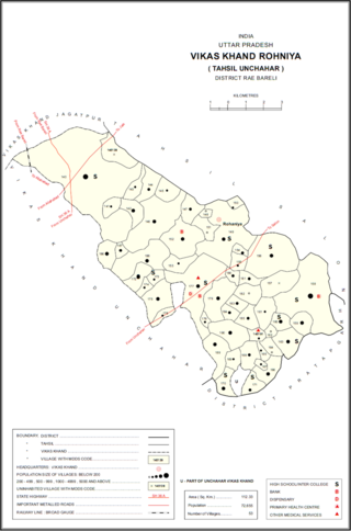
Sarai Akhtiar is a village in Rohaniya block of Rae Bareli district, Uttar Pradesh, India. It is located 40 km from Raebareli, the district headquarters. As of 2011, it has a population of 1,731 people, in 305 households. It has two primary schools and no healthcare facilities, and it hosts both a permanent market and a weekly haat.

Sarai Manik is a village in Dih block of Rae Bareli district, Uttar Pradesh, India. It is located 23 km from Raebareli, the district headquarters. As of 2011, it has a population of 4,433 people, in 878 households. It has two primary schools and no healthcare facilities, and it does not host a permanent market or weekly haat. It belongs to the nyaya panchayat of Dih.

Sarai Kurmi is a village in Lalganj block of Rae Bareli district, Uttar Pradesh, India. It is located 4 km from Lalganj, the block and tehsil headquarters. As of 2011, it has a population of 843 people, in 197 households. It has no healthcare facilities and does not host a permanent market or a weekly haat. It belongs to the nyaya panchayat of Behta Kalan.


