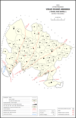
Bhagipur is a village in Unchahar block of Raebareli district, Uttar Pradesh, India. It is located 34 km from Raebareli, the district headquarters. As of 2011, it has a population of 446 people, in 89 households.

Tanda is a village in Harchandpur block of Rae Bareli district, Uttar Pradesh, India. It is located 5 km from Raebareli, the district headquarters. As of 2011, its population is 1,559, in 312 households. It has one primary school and no healthcare facilities.

Ghunsari is a village in Harchandpur block of Rae Bareli district, Uttar Pradesh, India. It is located 22 km from Raebareli, the district headquarters. As of 2011, its population is 321, in 74 households. It has one primary school and no healthcare facilities.

Faridpur is a village in Harchandpur block of Rae Bareli district, Uttar Pradesh, India. It is located 22 km from Raebareli, the district headquarters. As of 2011, its population is 993, in 151 households. It has one primary school and no healthcare facilities.

Rampur is a village in Amawan block of Rae Bareli district, Uttar Pradesh, India. It is located 7 km from Raebareli, the district headquarters. As of 2011, its population is 22, in 5 households. It has no schools and no healthcare facilities.

Jamalpur Karaundi is a village in Amawan block of Rae Bareli district, Uttar Pradesh, India. It is located 11 km from Raebareli, the district headquarters. As of 2011, its population is 630, in 125 households.

Kondras Khurd is a village in Amawan block of Rae Bareli district, Uttar Pradesh, India. It is located 5 km from Raebareli, the district headquarters. As of 2011, its population is 296, in 61 households.

Rasehta is a village in Amawan block of Rae Bareli district, Uttar Pradesh, India. It is located 14 km from Raebareli, the district headquarters. As of 2011, its population is 2,756, in 491 households. It has one primary school and no healthcare facilities.

Haibatmau is a village in Amawan block of Rae Bareli district, Uttar Pradesh, India. It is located 10 km from Raebareli, the district headquarters. As of 2011, its population is 854, in 142 households. It has one primary school and no healthcare facilities.

Khaira is a village in Amawan block of Rae Bareli district, Uttar Pradesh, India. It is located 18 km from Raebareli, the district headquarters. As of 2011, its population is 851, in 157 households. It has one primary school and no healthcare facilities.

Garhi Dularai is a village located in Sataon block of Rae Bareli district, Uttar Pradesh, India. It is located 24 km from Raebareli, the district headquarters. As of 2011, its population is 1,300, in 232 households. It has one primary school and no healthcare facilities.

Ataura Buzurg is a village in Sataon block of Rae Bareli district, Uttar Pradesh, India. It is located 14 km from Raebareli, the district headquarters. As of 2011, its population is 8,466, in 1,573 households. It has 4 primary schools and no healthcare facilities.

Narauka is a village in the Sataon block of Rae Bareli district, Uttar Pradesh, India. It is located 15 km from Raebareli, the district headquarters. As of 2011, its population is 900, living in 163 households. It has one primary school and no healthcare facilities.

Tikaria is a village in Deenshah Gaura block of Rae Bareli district, Uttar Pradesh, India. It is located 30 km from Raebareli, the district headquarters. As of 2011, it has a population of 812 people, in 140 households. It has no schools and no healthcare facilities.

Newada is a village in Unchahar block of Raebareli district, Uttar Pradesh, India. It is located 29 km from Raebareli, the district headquarters. As of 2011, it has a population of 814 people, in 137 households.

Chandrai is a village in Unchahar block of Raebareli district, Uttar Pradesh, India. It is located 30 km from Raebareli, the district headquarters. As of 2011, it has a population of 1,455 people, in 300 households. It has one primary school and no healthcare facilities.

Khaliqpur Kalan is a village in Unchahar block of Raebareli district, Uttar Pradesh, India. It is located 30 km from Raebareli, the district headquarters. As of 2011, it has a population of 1,841 people, in 339 households.

Sarai Hardo is a village in Unchahar block of Raebareli district, Uttar Pradesh, India. It is located 30 km from Raebareli, the district headquarters. As of 2011, it has a population of 1,398 people, in 347 households.

Hatwa is a village in Unchahar block of Raebareli district, Uttar Pradesh, India. It is located 36 km from Raebareli, the district headquarters. As of 2011, it has a population of 1,062 people, in 196 households.

Dandanpur is a village in Khiron block of Rae Bareli district, Uttar Pradesh, India. It is located 20 km from Lalganj, the tehsil headquarters. As of 2011, it has a population of 537 people, in 109 households. It has 1 primary school and no healthcare facilities and it does not host a weekly haat or permanent market. It belongs to the nyaya panchayat of Atarhar.


