Brahmani, Raebareli

Last updated

Brahmani
Village
Bahadurpur block map (Rae Bareli).png
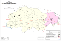
Map showing Brahmani (#154) in Bahadurpur CD block
India Uttar Pradesh location map.svg
Red pog.svg
Brahmani
Location in Uttar Pradesh, India
Coordinates: 26°15′18″N81°24′00″E / 26.254893°N 81.400106°E / 26.254893; 81.400106 [1]
Country IndiaFlag of India.svg  India
State Uttar Pradesh
District Raebareli
Area
[2]
  Total5.72 km2 (2.21 sq mi)
Population
 (2011) [2]
  Total6,163
  Density1,100/km2 (2,800/sq mi)
Languages
  Official Hindi
Time zone UTC+5:30 (IST)
PIN
229308 [2]
Vehicle registration UP-35

Brahmani is a village in Bahadurpur block of Rae Bareli district, Uttar Pradesh, India. [2] It includes the important bazar and railway station of Fursatganj. [3] Fursatganj holds markets twice per week, on Thursdays and Sundays, where grain, vegetables, and cloth are the main items of trade. [4] The place also hosts a large Dussehra festival annually on Asvina Sudi 15. [4]

Contents

As of 2011, the total population of Brahmani is 6,163, in 1,087 households. [2] It has 6 primary schools and 1 medical clinic. [2] The main staple foods are wheat and juwar. [5]

History

Brahmani was historically part of the taluqdari estate belonging to the Rajas of Tiloi. [3] Its commercial importance grew with the opening of the railway station at Fursatganj. [3] At the turn of the 20th century, it also had a small school and a post office. [3] The population in 1901 was 1,690, including a large number of Ahirs and Banias. [3]

An aerodrome was constructed at Fursatganj in 1941–42. [4]

The 1961 census recorded Brahmani (here spelled "Barhmani") as comprising 8 hamlets, with a total population of 1,928 people (980 male and 948 female), in 425 households and 423 physical houses. [4] The area of the village was given as 1,381 acres. [4] Average attendance of the Fursatganj biweekly market was about 3,000 people, and average of the annual Dussehra festival was about 9,000. [4]

The 1981 census recorded Brahmani (again as "Barhmani") as having a population of 3,238 people, in 506 households, and having an area of 560.09 hectares. [5]

See also

Related Research Articles

<span class="mw-page-title-main">Mainahar Katra</span> Village in Uttar Pradesh, India

Mainahar Katra is a village in Bachhrawan block of Rae Bareli district, Uttar Pradesh, India. As of 2011, its population is 2,197, in 382 households. It historically formed a taluqdar estate.

<span class="mw-page-title-main">Saidpur Behta</span> Village in Uttar Pradesh, India

Saidpur Behta is a village in Bachhrawan block of Rae Bareli district, Uttar Pradesh, India. As of 2011, its population is 612, in 118 households. It historically belonged to the taluqdars of Tirbediganj.

<span class="mw-page-title-main">Karanpur, Raebareli</span> Village in Uttar Pradesh, India

Karanpur is a village in Bachhrawan block of Rae Bareli district, Uttar Pradesh, India. Located 23 km from the city of Raebareli, Karanpur was historically one of the main villages in the Bachhrawan pargana. As of 2011, Karanpur's population is 4,171, in 791 households.

<span class="mw-page-title-main">Bahadurnagar</span> Village in Uttar Pradesh, India

Bahadurnagar is a village in Bachhrawan block of Rae Bareli district, Uttar Pradesh, India. Located 8 km from Bachhrawan, the block headquarters, Bahadurnagar hosts a market on Mondays and Thursdays. It was historically one of the main villages in the Bachhrawan pargana. As of 2011, Bahadurnagar's population is 4,508, in 964 households.

<span class="mw-page-title-main">Sheikhpur Samodha</span> Village in Uttar Pradesh, India

Sheikhpur Samodha is a village in Bachhrawan block of Rae Bareli district, Uttar Pradesh, India. Historically one of the main villages in the pargana of Bachhrawan, Sheikhpur Samodha hosts no market and is connected to minor district roads. It is located 4 km from Bachhrawan, the block headquarters. As of 2011, Sheikhpur Samodha's population is 6,931, in 1,376 households.

<span class="mw-page-title-main">Atrehta</span> Village in Uttar Pradesh, India

Atrehta is a village in Maharajganj block of Rae Bareli district, Uttar Pradesh, India. Located 1 km from Maharajganj, the block headquarters, it is the village whose lands the Maharajganj bazar was originally founded on. As of 2011, Atrehta has a population of 5,628, in 1,056 households. It has two primary schools and no healthcare facilities.

<span class="mw-page-title-main">Kumhrawan</span> Village in Uttar Pradesh, India

Kumhrawan is a village in Shivgarh block of Rae Bareli district, Uttar Pradesh, India. Formerly a pargana headquarters, it consists of a main village and several scattered hamlets. As of 2011, Kumhrawan has a population of 2,441, in 426 households.

<span class="mw-page-title-main">Konchi, Raebareli</span> Village in Uttar Pradesh, India

Konchi is a village in Singhpur block of Rae Bareli district, Uttar Pradesh, India. As of 2011, its population is 1,914, in 318 households.

<span class="mw-page-title-main">Panhauna</span> Village in Uttar Pradesh, India

Panhauna is a village in Singhpur block of Rae Bareli district, Uttar Pradesh, India. As of 2011, its population is 7,075, in 1,307 households. It has one primary school and no healthcare facilities.

<span class="mw-page-title-main">Kathwara, Raebareli</span> Village in Uttar Pradesh, India

Kathwara is a village in Harchandpur block of Rae Bareli district, Uttar Pradesh, India. It is located 13 km from Raebareli, the district headquarters, on the road to Lucknow, and on the left bank of the Baita river not far from its confluence with the Sai. The railway passes by Kathwara, and the closest station is at Harchandpur. As of 2011, the population of Kathwara is 5,115, in 921 households. It has two primary schools and no healthcare facilities.

<span class="mw-page-title-main">Kilauli</span> Village in Uttar Pradesh, India

Kilauli is a village in Sataon block of Rae Bareli district, Uttar Pradesh, India. It is located 8 km from Raebareli, the district headquarters. As of 2011, its population is 5,188, in 1,045 households. It has 6 primary schools and no healthcare facilities.

<span class="mw-page-title-main">Didaur</span> Village in Uttar Pradesh, India

Didaur, also spelled Dedaur, is a village in Sataon block of Rae Bareli district, Uttar Pradesh, India. It is located 8 km from Raebareli on the road to Unnao, just east of the intersection with the road to Lalganj. It is near the right bank of the Sai river. As of 2011, Didaur has a population of 4,781 people, in 900 households. The village hosts two annual festivals: one is the Badhwapur-ka-Mela, which is dedicated to the worship of Nag Devta and is held on Bhadra Sudi 5, and the other is the Jhurhapur-ka-Mela, which is dedicated to worship of Rama and falls on Phalguna Sudi 8.

<span class="mw-page-title-main">Rahi, Raebareli</span> Village in Uttar Pradesh, India

Rahi is a village and corresponding community development block in Rae Bareli district, Uttar Pradesh, India. It is located 7 km from Rae Bareli, the district headquarters, which according to one folk etymology is named after the village. Rahi was formerly the seat of a pargana before Rae Bareli replaced it in that capacity. As of 2011, Rahi has a population of 7,536 people, in 1,373 households. It has one primary school and one medical clinic.

<span class="mw-page-title-main">Tonk, Raebareli</span> Village in Uttar Pradesh, India

Tonk is a village in Dalmau block of Rae Bareli district, Uttar Pradesh, India. It is located 10 km from Dalmau, the block headquarters. As of 2011, it has a population of 642 people, in 120 households. It has no schools and no healthcare facilities.

<span class="mw-page-title-main">Gaura Hardo</span> Village in Uttar Pradesh, India

Gaura Hardo, or just Gaura, is a village in Rae Bareli district, Uttar Pradesh, India. It serves as the headquarters of Deenshah Gaura block, in the tehsil of Dalmau. It is located 33 km from Raebareli, the district headquarters, on the road from Dalmau to Salon. As of 2011, Gaura Hardo has a population of 8,001 people, in 1,446 households. It has five primary schools and one maternity and child welfare centre.

<span class="mw-page-title-main">Itaura Buzurg</span> Village in Uttar Pradesh, India

Itaura Buzurg is a village in Rohaniya block of Rae Bareli district, Uttar Pradesh, India. One of the largest villages in the historical pargana of Salon, it is located 28 km from Raebareli, the district headquarters, near the point where the road to Allahabad intersects the one leading from Fursatganj to the Gukana ghat. As of 2011, Itaura Buzurg has a population of 13,851 people, in 2,469 households. It has 6 primary schools and no healthcare facilities.

<span class="mw-page-title-main">Dih, Raebareli</span> Village in Uttar Pradesh, India

Dih, also spelled Deeh, is a dessert and corresponding community development block in Salon tehsil of Rae Bareli district, Uttar Pradesh, India. It is located 22 km from Raebareli, the district headquarters, near the point where the road to Parshadepur intersects the road leading from Jais to the Gukana ghat. The Sai river flows a short distance to the south. As of 2011, Dih has a population of 12,110 people, in 2,186 households. It has three primary schools and no healthcare facilities, as well as a post office, a library, and an Anganwadi centre. It is the headquarters of a nyaya panchayat, which also includes 8 other villages.

<span class="mw-page-title-main">Purai</span> Village in Uttar Pradesh, India

Purai is a village in Sataon block of Rae Bareli district, Uttar Pradesh, India. It is located 15 km west of Raebareli, the district headquarters, near the point where the Basaha stream joins the Sai river.

<span class="mw-page-title-main">Suchi, Raebareli</span> Village in Uttar Pradesh, India

Suchi is a village in Salon block of Rae Bareli district, Uttar Pradesh, India. It is located 10 km from Salon, the block headquarters. As of 2011, Suchi has a population of 5,707 people, in 1,070 households. It has one primary school and no healthcare facilities. The village hosts a Dussehra fair on Asvina Sudi 15; vendors bring everyday items to sell at the festival.

<span class="mw-page-title-main">Mau, Dih, Raebareli</span> Village in Uttar Pradesh, India

Mau is a large village in Dih block of Rae Bareli district, Uttar Pradesh, India. It is located on the road from Fursatganj to the Gukana ghat on the Ganges, 4 miles west of Nasirabad and 8 miles from Jais. A road branches off at Mau and connects to Nasirabad. To the northwest of the village is a large lake called the Bara Tal.

References

  1. Search for "Brahmani" here https://geonames.nga.mil/namesgaz/.{{cite web}}: Missing or empty |title= (help)
  2. 1 2 3 4 5 6 "Census of India 2011: Uttar Pradesh District Census Handbook - Rae Bareli, Part A (Village and Town Directory)" (PDF). Census 2011 India. pp. 159–67. Retrieved 31 July 2021.
  3. 1 2 3 4 5 Nevill, H.R. (1905). Rai Bareli: A Gazetteer, Being Volume XXXIX Of The District Gazetteers Of The United Provinces Of Agra And Oudh. Allahabad: Government Press. pp. 173–4. Retrieved 31 July 2021.
  4. 1 2 3 4 5 6 Census 1961: District Census Handbook, Uttar Pradesh (39 - Raebareli District) (PDF). Lucknow. 1965. pp. 156, 170–1, 176, xcviii-xcix of section "Salon Tahsil". Retrieved 31 July 2021.
  5. 1 2 Census 1981 Uttar Pradesh: District Census Handbook Part XIII-A: Village & Town Directory, District Rae Bareli (PDF). 1982. pp. 196–7. Retrieved 31 July 2021.