Hardaspur, Raebareli

Last updated

Hardaspur
Hardāspur
Village
Amawan block map.png
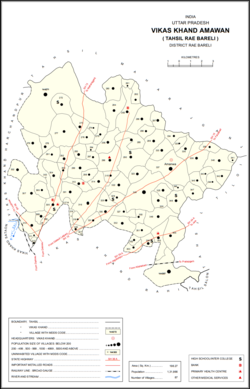
Map showing Hardaspur (#305) in Amawan CD block
India Uttar Pradesh location map.svg
Red pog.svg
Hardaspur
Location in Uttar Pradesh, India
Coordinates: 26°16′43″N81°15′00″E / 26.278634°N 81.2499°E / 26.278634; 81.2499 [1]
Country IndiaFlag of India.svg  India
State Uttar Pradesh
District Raebareli
Area
[2]
  Total2.394 km2 (0.924 sq mi)
Population
 (2011) [2]
  Total2,974
  Density1,200/km2 (3,200/sq mi)
Languages
  Official Hindi
Time zone UTC+5:30 (IST)
Vehicle registration UP-35

Hardaspur is a village in Amawan block of Rae Bareli district, Uttar Pradesh, India. [2] As of 2011, its population is 2,974, in 570 households. [2] It has 3 primary schools and one small clinic. [2]

Hardaspur was historically the seat of a taluqdari estate held by a Kayasth family who had a close association with the Bais rajas of Daundia Khera. [3] They claimed descent from one Ram Lal, who was supposedly the Diwan to the first Bais ruler, Abhai Chand, and several of his descendants held the same office for later Bais rajas. [3] One of them, Nabh Chand, is said to have been adopted by the Bais raja Tilok Chand, and so his descendants were styled Thakur. [3] One of them, Har Das, founded the village of Hardaspur around the time of Akbar; his brother Rath Rai was made qanunqo of the pargana of Rae Bareli. [3]

The Kayasth taluqdars of Hardaspur never gained a large territory because they were surrounded by Rajput taluqdars and often in conflict with their Muslim neighbours. [3] In the 1800s, the taluqdar Baij Nath obtained the sanad for the Hardaspur estate, which comprised 15 villages and it was succeeded by his son Gauri Shanker and Gauri Shanker had one son whose name was Umed Rai who was married to Thakurain Jugraj Kunwar. [3] At the turn of the 20th century, the Hardaspur estate was held by Thakurain Jugraj Kunwar, who was the widow of Baij Nath's grandson Umed Rai; by then it only consisted of 9 villages in the pargana of Rae Bareli. Thakurain Jugraj Kunwar and Umed Rai had only one Daughter whose name was Thakurain Parag Kunwar who was married to Babu Ganga Prasad and they had one daughter whose name was Thakurain Teerath Kunwar and after the Death of Thakurain Jugraj Kunwar the estate Hardaspur was held by Babu Ganga Prasad who was the son in law of Thakurain Jugraj Kunwar and then during the reign Babu Ganga Prasad established one new place that is Gangaganj Then after a few years of rule, Thakurain Parag Kunwar died, Few years after Thakurain Parag Kunwar's Death, Then Babu Ganga Prasad was married to Thakurain Kamlapati Kunwar, Who was the Daughter of Zamindar in Jagdishpur Raebareli, Thakurain Kamlapati Kunwar had no child of her own, so she Adopted her real nephew as her own child who lived with her and his name was Babu Bindra Prasad Srivastava, who was the sole successor of Babu Ganga Prasad. [3]

The present Representative name of Hardaspur Taluqdari family is Dr.Badrinath Srivastava, Shri Girish Chandra Srivastava, Shri Brijesh Kumar Srivastava, at Gangaganj Kothi Raebareli.


The 1961 census recorded Hardaspur as comprising 3 hamlets, with a total population of 1,141 people (579 male and 562 female), in 250 households and 231 physical houses. [4] The area of the village was given as 582 acres. [4]

The 1981 census recorded Hardaspur as having a population of 1,692 people, in 304 households, and having an area of 239.58 hectares. [5] The main staple foods were given as wheat and rice. [5]

Related Research Articles

<span class="mw-page-title-main">Raebareli</span> City in Uttar Pradesh, India

Raebareli is a city in Indian state of Uttar Pradesh. It is the administrative headquarters of Raebareli district and a part of Lucknow Division. The city is situated on the banks of the Sai river, 82 km (51 mi) southeast of Lucknow. It possesses many architectural features and sites, chief of which is a strong and spacious fort. As of 2011, Raebareli has a population of 191,316 people, in 35,197 households.

<span class="mw-page-title-main">Harchandpur</span> Village in Uttar Pradesh, India

Harchandpur is a village and corresponding community development block in Raebareli district, Uttar Pradesh, India. It is located on the Baiti river, which is a tributary of the Sai, and it is northeast from the district headquarters on the road to Lucknow. Particularly since the coming of the railway in the 1800s, Harchandpur serves as one of the main commercial centres for the surrounding region; it is also a major exporter of local goods. As of 2011, its population is 4,348 people, in 833 households.

<span class="mw-page-title-main">Rajamau, Bachhrawan</span> Village in Uttar Pradesh, India

Rajamau is a village in Bachhrawan block of Rae Bareli district, Uttar Pradesh, India. As of 2011, its population is 5,044, in 927 households, and it has 5 primary schools and no healthcare facilities. It is located 10 km southwest of Bachhrawan, the block headquarters, and the main staple foods are wheat and rice. Rajamau hosts a Kalreshwar Mahadeo mela on Magha Sudi 5 dedicated to the worship of Shiva; vendors bring sweets, toys, and everyday items to sell at the fair.

<span class="mw-page-title-main">Shahmau</span> Village in Uttar Pradesh, India

Shahmau is a village panchayat in Tiloi block of district Amethi, Uttar Pradesh, India. It is located 22 km (14 mi) from Gauriganj the district headquarters Amethi, on the road from Mohanganj to Jais. Historically, Shahmau was the taluqdari held by a branch of the Kanhpuria Kshatriya (Rajput), the Ruler taluqdars bore the hereditary title of Raja. As of 2011, its population is 1,647, in 286 households.

<span class="mw-page-title-main">Panhauna</span> Village in Uttar Pradesh, India

Panhauna is a village in Singhpur block of Rae Bareli district, Uttar Pradesh, India. As of 2011, its population is 7,075, in 1,307 households. It has one primary school and no healthcare facilities.

<span class="mw-page-title-main">Amawan</span> Village in Uttar Pradesh, India

Amawan is a village and corresponding community development block in Rae Bareli district, Uttar Pradesh, India. It historically was the seat of a taluqdari estate held by a Pathan family and eventually split into two shares. As of 2011, its population is 5,245, in 973 households. It has 5 primary schools and no healthcare facilities.

<span class="mw-page-title-main">Pahremau</span> Village in Uttar Pradesh, India

Pahremau is a village in Amawan block of Rae Bareli district, Uttar Pradesh, India. Located 5 km from Maharajganj on the road to Nigohan, it is an old Muslim centre that historically served as the headquarters of a taluqdari estate. As of 2011, its population is 3,165, in 577 households. It has 3 primary schools and no healthcare facilities.

<span class="mw-page-title-main">Simrauta</span> Village in Uttar Pradesh, India

Semrauta is a village in Tiloi block of Rae Bareli district, Uttar Pradesh, India. It is located at the intersection of the Maharajganj-Inhauna and Mohanganj-Haidargarh roads, about 20 km from Maharajganj, the tehsil headquarters. Although now eclipsed by Maharajganj, Semrauta was historically a relatively important village that served as the headquarters of a pargana and the capital of a branch of the Kanhpuria Rajputs, who later became known as the Rajas of Chandapur. As of 2011, the population of Simrauta is 6,423, in 1,031 households.

<span class="mw-page-title-main">Sataon</span> Village in Uttar Pradesh, India

Sataon is a village and corresponding community development block in Rae Bareli district, Uttar Pradesh, India. It is located a bit to the west of the river Sai on the main Raebareli-Unnao road. It is 22 km from Raebareli, the district headquarters. As of 2011, its population is 9,151, in 1,756 households. It has 4 primary schools and 1 medical clinic.

<span class="mw-page-title-main">Korihar</span> Village in Uttar Pradesh, India

Korihar is a village located in Sataon block of Rae Bareli district, Uttar Pradesh, India. Located 20 km from Raebareli, the district headquarters, Korihar was historically the seat of a taluqdari estate held by a branch of the Bais Rajputs. On the northwest is Sataon, and to the south is the village of Hajipur, which has the ruins of an old Bais fort. As of 2011, the population of Korihar is 12,351, in 2,240 households. It has one primary school and no healthcare facilities. The village hosts markets twice per week, on Mondays and Fridays.

<span class="mw-page-title-main">Khiron</span> Village in Uttar Pradesh, India

Khiron is a village and corresponding community development block in Rae Bareli district, Uttar Pradesh, India. Located on the main Raebareli-Unnao road, Khiron is an old Muslim town that historically served as the seat of a pargana. As of 2011, the village has a population of 9,955, in 1,714 households. It has six primary schools and one medical clinic. It serves as the headquarters of a nyaya panchayat that also includes 11 other villages.

<span class="mw-page-title-main">Murarmau</span> Village in Uttar Pradesh, India

Murarmau is a village in Sareni block of Rae Bareli district, Uttar Pradesh, India. It is located 21 km from Lalganj, the tehsil headquarters. Murarmau historically served as the seat of the largest taluqdar estate in the district, held by the most senior branch of the Tilokchandi Bais. As of 2011, it has a population of 2,999 people, in 523 households. It has one primary school and no healthcare facilities. Murarmau serves as the headquarters of a nyaya panchayat which also includes 9 other villages.

<span class="mw-page-title-main">Simarpaha</span> Village in Uttar Pradesh, India

Simarpaha is a village in Lalganj block of Rae Bareli district, Uttar Pradesh, India. It is located 3 km southwest of Lalganj on the road to Ralpur on the Ganges. In addition to the main site, the village also includes several dispersed hamlets. Simarpaha was historically the seat of a taluqdari estate held by a branch of the Bais Rajputs. As of 2011, it has a population of 8,391 people, in 1,501 households. It has two primary schools and no healthcare facilities.

<span class="mw-page-title-main">Gaura Hardo</span> Village in Uttar Pradesh, India

Gaura Hardo, or just Gaura, is a village in Rae Bareli district, Uttar Pradesh, India. It serves as the headquarters of Deenshah Gaura block, in the tehsil of Dalmau. It is located 33 km from Raebareli, the district headquarters, on the road from Dalmau to Salon. As of 2011, Gaura Hardo has a population of 8,001 people, in 1,446 households. It has five primary schools and one maternity and child welfare centre.

<span class="mw-page-title-main">Jagatpur, Raebareli</span> Village in Uttar Pradesh, India

Jagatpur is a village and corresponding community development block in Unchahar tehsil of Rae Bareli district, Uttar Pradesh, India. It is located 18 km from Raebareli, the district headquarters, on the road to Allahabad at the point where it intersects the road from Dalmau to Salon. There is a large Buddhist-era ruin site at Tanghan to the south. As of 2011, Jagatpur has a population of 7,267 people, in 1,336 households. It has 4 primary schools and 1 healthcare centre.

<span class="mw-page-title-main">Nain, Raebareli</span> Village in Uttar Pradesh, India

Nain is a village in Salon block of Rae Bareli district, Uttar Pradesh, India. It is located on the south bank of the Sai river, north of the main road from Salon to Raebareli. As of 2011, the village has a population of 2,028 people, in 372 households. It has one primary school and no healthcare facilities.

<span class="mw-page-title-main">Nuruddinpur</span> Village in Uttar Pradesh, India

Nuruddinpur is a village in Salon block of Rae Bareli district, Uttar Pradesh, India. It is located 43 km from Raebareli, the district headquarters. As of 2011, Nuruddinpur has a population of 3,882 people, in 667 households. It has 2 primary schools and no healthcare facilities. It is connected to national highways and hosts a periodic haat but not a permanent market.

<span class="mw-page-title-main">Mau, Dih, Raebareli</span> Village in Uttar Pradesh, India

Mau is a large village in Dih block of Rae Bareli district, Uttar Pradesh, India. It is located on the road from Fursatganj to the Gukana ghat on the Ganges, 4 miles west of Nasirabad and 8 miles from Jais. A road branches off at Mau and connects to Nasirabad. To the northwest of the village is a large lake called the Bara Tal.

<span class="mw-page-title-main">Paho</span> Village in Uttar Pradesh, India

Paho, also spelled Pahu, is a village in Khiron block of Rae Bareli district, Uttar Pradesh, India. It is located near the road from Raebareli to Mauranwan and Unnao, close to the border with Unnao district. It is 18 km away from Lalganj, the tehsil headquarters. As of 2011, Paho has a population of 5,620 people, in 1,088 households. It has two primary schools and no healthcare facilities, and it hosts a weekly haat but not a permanent market. It is the seat of a nyaya panchayat which also includes 7 other villages.

<span class="mw-page-title-main">Khajurgaon</span> Village in Uttar Pradesh, India

Khajurgaon is a village in Lalganj block of Rae Bareli district, Uttar Pradesh, India. It is located on the bank of the Ganges, 12 km from Lalganj, the block and tehsil headquarters. As of 2011, it has a population of 5,916 people, in 1,067 households. It has 5 primary schools and 1 community health centre. It serves as the headquarters of a nyaya panchayat which also includes 12 other villages.

References

  1. "Geonames Search". Do a radial search using these coordinates here.
  2. 1 2 3 4 5 "Census of India 2011: Uttar Pradesh District Census Handbook - Rae Bareli, Part A (Village and Town Directory)" (PDF). Census 2011 India. pp. 185–201. Retrieved 5 August 2021.
  3. 1 2 3 4 5 6 7 Nevill, H.R. (1905). Rai Bareli: A Gazetteer, Being Volume XXXIX Of The District Gazetteers Of The United Provinces Of Agra And Oudh. Allahabad: Government Press. pp. 94–5. Retrieved 3 December 2021.
  4. 1 2 Census 1961: District Census Handbook, Uttar Pradesh (39 - Raebareli District) (PDF). Lucknow. 1965. pp. xxxvi-xxxvii of section "Rae Bareli Tahsil". Retrieved 5 August 2021.
  5. 1 2 Census 1981 Uttar Pradesh: District Census Handbook Part XIII-A: Village & Town Directory, District Rae Bareli (PDF). 1982. pp. 80–1. Retrieved 5 August 2021.