Jalalpur is a village in Bachhrawan block of Rae Bareli district, Uttar Pradesh, India. As of 2011, its population is 1,742, in 354 households. It is located 2 km from Bachhrawan, the block headquarters, and the main staple foods are wheat and rice.
Gujarpur is a village in Bachhrawan block of Rae Bareli district, Uttar Pradesh, India. As of 2011, its population is 608, in 127 households. It is located 4 km from Bachhrawan, the block headquarters, and the main staple foods are wheat and rice. It has one primary school and no healthcare facilities.
Kalui Khera is a village in Bachhrawan block of Rae Bareli district, Uttar Pradesh, India. As of 2011, its population is 1,734, in 342 households. It is located 10 km from Bachhrawan, the block headquarters, and the main staple foods are wheat and rice. It has one primary school and no healthcare facilities.
Dundgarh is a village in Bachhrawan block of Rae Bareli district, Uttar Pradesh, India. As of 2011, its population is 1,397, in 270 households. It has one primary school and no healthcare facilities.
Ashan Jagatpur is a village in Bachhrawan block of Rae Bareli district, Uttar Pradesh, India. As of 2011, its population is 4,413, in 905 households. It is located 12 km from Bachhrawan, the block headquarters, and the main staple foods are wheat and rice. It has two primary schools and no healthcare facilities.

Ahuri is a village in Tiloi block of Rae Bareli district, Uttar Pradesh, India. As of 2011, its population is 1,647, in 286 households. It has one primary school and no healthcare facilities.
Rajamau is a village in Tiloi block of Rae Bareli district, Uttar Pradesh, India. As of 2011, its population is 2,171, in 329 households. It has one primary school and no healthcare facilities.
Asni is a village in Tiloi block of Rae Bareli district, Uttar Pradesh, India. As of 2011, its population is 2,244, in 401 households. It has one primary school and no healthcare facilities.

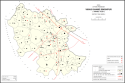
Konchi is a village in Singhpur block of Rae Bareli district, Uttar Pradesh, India. As of 2011, its population is 1,914, in 318 households.
Hasanpur is a village in Singhpur block of Rae Bareli district, Uttar Pradesh, India. As of 2011, its population was 1,162, in 203 households. It has one primary school and no healthcare facilities.
Mirzagarh is a village in Singhpur block of Rae Bareli district, Uttar Pradesh, India. As of 2011, its population is 2,596, in 454 households. It has one primary school and no healthcare facilities.
Rajapur is a village in Singhpur block of Rae Bareli district, Uttar Pradesh, India. As of 2011, its population is 3,954, in 659 households. It has one primary school and no healthcare facilities.
Chingahi is a village in Tiloi block of Rae Bareli district, Uttar Pradesh, India. As of 2011, its population is 1,768, in 303 households. It has one primary school and no healthcare facilities.
Bhadsana is a village in Tiloi block of Rae Bareli district, Uttar Pradesh, India. As of 2011, its population is 1,862, in 343 households.
Pakargaon is a village in Tiloi block of Rae Bareli district, Uttar Pradesh, India. As of 2011, its population is 6,266, in 1,156 households. It has two primary schools and no healthcare facilities.
Belwa Hasanpur is a village in Tiloi block of Rae Bareli district, Uttar Pradesh, India. It is located 32 km from Raebareli, the district headquarters. As of 2011, its population is 2,224, in 400 households. It has two primary schools and no healthcare facilities.

Chak Dahiramau is a village in Bahadurpur block of Rae Bareli district, Uttar Pradesh, India. As of 2011, its population is 532, in 106 households. It has one primary school and no healthcare facilities.

Bhawanshahpur is a village in Gauriganj block of Amethi district, Uttar Pradesh, India. As of 2011, it has a population of 821 people, in 154 households. It has no schools and no healthcare facilities and does not host a permanent market or weekly haat. It belongs to the nyaya panchayat of Semuai.
Raghipur is a village in Gauriganj block of Amethi district, Uttar Pradesh, India. As of 2011, it has a population of 1,207 people, in 231 households. It has one primary school and no healthcare facilities and hosts a permanent market but not a weekly haat. It belongs to the nyaya panchayat of Bahanpur.
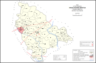
Bhetua is a village in Amethi tehsil of Amethi district, Uttar Pradesh, India. As of 2011, it has a population of 1,680 people, in 260 households. It has one primary school and no healthcare facilities and does not host a weekly haat or permanent market. Bhetua serves as the headquarters of a community development block, which includes 71 rural villages as well as the census town of Korwa. It also serves as the headquarters of a nyaya panchayat that also includes 14 other villages.