Parsadepur, also spelled Parshadepur, is a town and a nagar panchayat in Rae Bareli district in the Indian state of Uttar Pradesh. It is located on the north bank of the Sai river, at the crossroads between the road from Salon to Jais and the smaller road from Raebareli to Ateha. Historically noted for its large weaving industry, Parsadepur served as the headquarters of a pargana since the late 18th century. As of 2011, its population is 11,853 people, in 1,738 households.

Kandrawan is a village in Unchahar block of Raebareli district, Uttar Pradesh, India. It is located on the road from Salon to Khaga, near the banks of the Ganges. Nearby there is a ferry crossing the Ganges over to Naubasta in Fatehpur district. As of 2011, Kandrawan has a population of 10,283 people, in 1,901 households. It is 3 km from Unchahar.
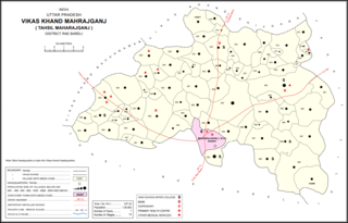
Chandapur is a village in Maharajganj block of Rae Bareli district, Uttar Pradesh, India. Located 4 miles (6.4 km) east of Maharajganj, the block headquarters, it historically was the seat of the Kanhpuria rajas of Chandapur. In 2011, Chandapur had a population of 2,342, in 425 households. It has two primary schools and no healthcare facilities. It has a bazar known as Sheodarshanganj, which holds markets twice per week. The village also hosts the Anna Purna Devi fair on Phalguna Badi 13, which is associated with Maha Shivaratri. Vendors bring sweets, toys and everyday items to sell at the fair.
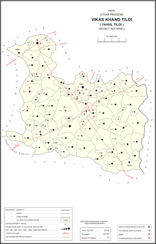
Tiloi is a Town and tehsil headquarters in Amethi district of Uttar Pradesh, India. Located near Mohanganj on the Jais-Inhauna road, Tiloi is notable as the historical seat of a major taluqdari estate held by the Kanhpurias. As of 2011, its population is 6,956, in 1,257 households.

Shahmau is a village panchayat in Tiloi block of district Amethi, Uttar Pradesh, India. It is located 22 km (14 mi) from Gauriganj the district headquarters Amethi, on the road from Mohanganj to Jais. Historically, Shahmau was the taluqdari held by a branch of the Kanhpuria Kshatriya (Rajput), the Ruler taluqdars bore the hereditary title of Raja. As of 2011, its population is 1,647, in 286 households.
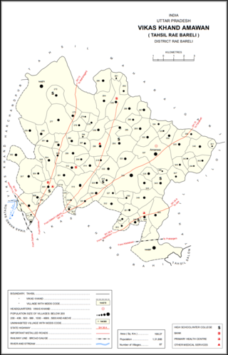
Amawan is a village and corresponding community development block in Rae Bareli district, Uttar Pradesh, India. It historically was the seat of a taluqdari estate held by a Pathan family and eventually split into two shares. As of 2011, its population is 5,245, in 973 households. It has 5 primary schools and no healthcare facilities.

Semrauta is a village in Tiloi block of Rae Bareli district, Uttar Pradesh, India. It is located at the intersection of the Maharajganj-Inhauna and Mohanganj-Haidargarh roads, about 20 km from Maharajganj, the tehsil headquarters. Although now eclipsed by Maharajganj, Semrauta was historically a relatively important village that served as the headquarters of a pargana and the capital of a branch of the Kanhpuria Rajputs, who later became known as the Rajas of Chandapur. As of 2011, the population of Simrauta is 6,423, in 1,031 households.

Sataon is a village and corresponding community development block in Rae Bareli district, Uttar Pradesh, India. It is located a bit to the west of the river Sai on the main Raebareli-Unnao road. It is 22 km from Raebareli, the district headquarters. As of 2011, its population is 9,151, in 1,756 households. It has 4 primary schools and 1 medical clinic.

Korihar is a village located in Sataon block of Rae Bareli district, Uttar Pradesh, India. Located 20 km from Raebareli, the district headquarters, Korihar was historically the seat of a taluqdari estate held by a branch of the Bais Rajputs. On the northwest is Sataon, and to the south is the village of Hajipur, which has the ruins of an old Bais fort. As of 2011, the population of Korihar is 12,351, in 2,240 households. It has one primary school and no healthcare facilities. The village hosts markets twice per week, on Mondays and Fridays.

Didaur, also spelled Dedaur, is a village in Sataon block of Rae Bareli district, Uttar Pradesh, India. It is located 8 km from Raebareli on the road to Unnao, just east of the intersection with the road to Lalganj. It is near the right bank of the Sai river. As of 2011, Didaur has a population of 4,781 people, in 900 households. The village hosts two annual festivals: one is the Badhwapur-ka-Mela, which is dedicated to the worship of Nag Devta and is held on Bhadra Sudi 5, and the other is the Jhurhapur-ka-Mela, which is dedicated to worship of Rama and falls on Phalguna Sudi 8.

Lodhwari is a village in Rahi block of Rae Bareli district, Uttar Pradesh, India. It is located 12 km from Rae Bareli, the district headquarters, on the left bank of the Sai river. The road to Parshadepur runs through the northeastern part of the village lands. As of 2011, Lodhwari has a population of 10,592 people, in 2,019 households.

Murarmau is a village in Sareni block of Rae Bareli district, Uttar Pradesh, India. It is located 21 km from Lalganj, the tehsil headquarters. Murarmau historically served as the seat of the largest taluqdar estate in the district, held by the most senior branch of the Tilokchandi Bais. As of 2011, it has a population of 2,999 people, in 523 households. It has one primary school and no healthcare facilities. Murarmau serves as the headquarters of a nyaya panchayat which also includes 9 other villages.

Jagatpur is a village and corresponding community development block in Unchahar tehsil of Rae Bareli district, Uttar Pradesh, India. It is located 18 km from Raebareli, the district headquarters, on the road to Allahabad at the point where it intersects the road from Dalmau to Salon. There is a large Buddhist-era ruin site at Tanghan to the south. As of 2011, Jagatpur has a population of 7,267 people, in 1,336 households. It has 4 primary schools and 1 healthcare centre.
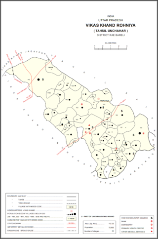
Rasulpur is a village in Rohaniya block of Rae Bareli district, Uttar Pradesh, India. One of the largest villages in the historical pargana of Salon, it is located 48 km from Raebareli, the district headquarters. As of 2011, it has a population of 7,671 people, in 1,379 households. It has one primary school and no healthcare facilities.

Itaura Buzurg is a village in Rohaniya block of Rae Bareli district, Uttar Pradesh, India. One of the largest villages in the historical pargana of Salon, it is located 28 km from Raebareli, the district headquarters, near the point where the road to Allahabad intersects the one leading from Fursatganj to the Gukana ghat. As of 2011, Itaura Buzurg has a population of 13,851 people, in 2,469 households. It has 6 primary schools and no healthcare facilities.

Dih, also spelled Deeh, is a dessert and corresponding community development block in Salon tehsil of Rae Bareli district, Uttar Pradesh, India. It is located 22 km from Raebareli, the district headquarters, near the point where the road to Parshadepur intersects the road leading from Jais to the Gukana ghat. The Sai river flows a short distance to the south. As of 2011, Dih has a population of 12,110 people, in 2,186 households. It has three primary schools and no healthcare facilities, as well as a post office, a library, and an Anganwadi centre. It is the headquarters of a nyaya panchayat, which also includes 8 other villages.
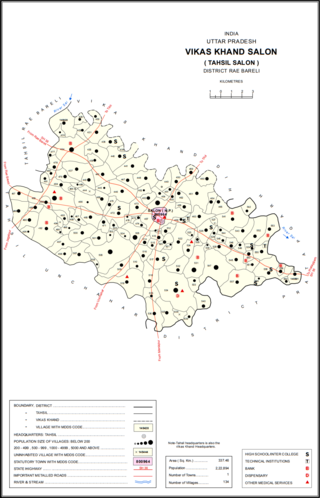
Bara Dih, also spelled Baradih, is a village in Salon block of Rae Bareli district, Uttar Pradesh, India. It is located 3 km northwest of Salon, the block headquarters, close to the point where the Chob stream joins the Sai river. As of 2011, Bara Dih has a population of 2,248 people, in 386 households.

Nuruddinpur is a village in Salon block of Rae Bareli district, Uttar Pradesh, India. It is located 43 km from Raebareli, the district headquarters. As of 2011, Nuruddinpur has a population of 3,882 people, in 667 households. It has 2 primary schools and no healthcare facilities. It is connected to national highways and hosts a periodic haat but not a permanent market.

Rokha is a large village in Dih block of Rae Bareli district, Uttar Pradesh, India. Historically the namesake of a pargana, Rokha is a predominantly agricultural village consisting of many hamlets. It is located 28 km from Raebareli, the district headquarters. The large village of Mau also borders Rokha to the north. Rokha is connected by road with Nasirabad and Jais to the northeast and Suchi to the southwest.

Paho, also spelled Pahu, is a village in Khiron block of Rae Bareli district, Uttar Pradesh, India. It is located near the road from Raebareli to Mauranwan and Unnao, close to the border with Unnao district. It is 18 km away from Lalganj, the tehsil headquarters. As of 2011, Paho has a population of 5,620 people, in 1,088 households. It has two primary schools and no healthcare facilities, and it hosts a weekly haat but not a permanent market. It is the seat of a nyaya panchayat which also includes 7 other villages.


