Sarai Chhatardhari is a village in Shivgarh block of Rae Bareli district, Uttar Pradesh, India. As of 2011, its population is 1,932, in 351 households. It has one primary school and no healthcare facilities.

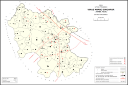
Khara is a village in Singhpur block of Rae Bareli district, Uttar Pradesh, India. As of 2011, its population is 7,320, in 1,339 households.

Tarauna is a village in Bahadurpur block of Rae Bareli district, Uttar Pradesh, India. As of 2011, its population is 1,077, in 194 households. It has one primary school and no healthcare facilities.

Sarai Umar is a village in Harchandpur block of Rae Bareli district, Uttar Pradesh, India. As of 2011, its population is 2,434, in 490 households. It has two primary schools and no healthcare facilities.

Amawan is a village and corresponding community development block in Rae Bareli district, Uttar Pradesh, India. It historically was the seat of a taluqdari estate held by a Pathan family and eventually split into two shares. As of 2011, its population is 5,245, in 973 households. It has 5 primary schools and no healthcare facilities.

Korihar is a village located in Sataon block of Rae Bareli district, Uttar Pradesh, India. Located 20 km from Raebareli, the district headquarters, Korihar was historically the seat of a taluqdari estate held by a branch of the Bais Rajputs. On the northwest is Sataon, and to the south is the village of Hajipur, which has the ruins of an old Bais fort. As of 2011, the population of Korihar is 12,351, in 2,240 households. It has one primary school and no healthcare facilities. The village hosts markets twice per week, on Mondays and Fridays.
Kilauli is a village in Sataon block of Rae Bareli district, Uttar Pradesh, India. It is located 8 km from Raebareli, the district headquarters. As of 2011, its population is 5,188, in 1,045 households. It has 6 primary schools and no healthcare facilities.
Sarai Dugosha is a village in the Sataon block of the Rae Bareli district, Uttar Pradesh, India. It is located 14 km from Raebareli, the district headquarters. As of 2011, its population was 1,473, living in 251 households. It has one primary school and no healthcare facilities.

Sarai Mahmud is a village in Khiron block of Rae Bareli district, Uttar Pradesh, India. It is located 17 km from Lalganj, the tehsil headquarters. As of 2011, it has a population of 460 people, in 72 households. It has no schools and no healthcare facilities.

Bela Bhela, also called Uttarpara, is a village in Rahi block of Rae Bareli district, Uttar Pradesh, India. It is located 9 km from Rae Bareli, the district headquarters, east of the road to Dalmau. It lies in a belt of stiff clay soil which is highly productive agriculturally and is interspersed with wetlands and patches of barren usar soil. Bela Bhela is a large village consisting of many hamlets. As of 2011, Bela Bhela has a total population of 16,623 people, in 3,004 households. It has one primary school and one medical clinic.
Sarai Muhammad Sharif is a village in Rahi block of Rae Bareli district, Uttar Pradesh, India. It is located 9 km from Rae Bareli, the district headquarters. As of 2011, it has a population of 1,400 people, in 271 households. It has one primary school and no healthcare facilities.
Lodhwari is a village in Rahi block of Rae Bareli district, Uttar Pradesh, India. It is located 12 km from Rae Bareli, the district headquarters, on the left bank of the Sai river. The road to Parshadepur runs through the northeastern part of the village lands. As of 2011, Lodhwari has a population of 10,592 people, in 2,019 households.

Sarai is a village in Lalganj block of Rae Bareli district, Uttar Pradesh, India. It is located 19 km from Lalganj, the block and tehsil headquarters. As of 2011, it has a population of 902 people, in 173 households. It has one primary school and no healthcare facilities.

Sarai Lakhmi is a village in Dalmau block of Rae Bareli district, Uttar Pradesh, India. It is located 4 km from Dalmau, the block headquarters. As of 2011, it has a population of 871 people, in 166 households. It has one pre-primary school and no healthcare facilities.

Jagatpur is a village and corresponding community development block in Unchahar tehsil of Rae Bareli district, Uttar Pradesh, India. It is located 18 km from Raebareli, the district headquarters, on the road to Allahabad at the point where it intersects the road from Dalmau to Salon. There is a large Buddhist-era ruin site at Tanghan to the south. As of 2011, Jagatpur has a population of 7,267 people, in 1,336 households. It has 4 primary schools and 1 healthcare centre.
Sarai Sri Bakhsh is a village in Jagatpur block of Rae Bareli district, Uttar Pradesh, India. As of 2011, it has a population of 1,671 people, in 260 households. It has one primary school and no healthcare facilities.

Sarai Hardo is a village in Unchahar block of Raebareli district, Uttar Pradesh, India. It is located 30 km from Raebareli, the district headquarters. As of 2011, it has a population of 1,398 people, in 347 households.

Sarai Akhtiar is a village in Rohaniya block of Rae Bareli district, Uttar Pradesh, India. It is located 40 km from Raebareli, the district headquarters. As of 2011, it has a population of 1,731 people, in 305 households. It has two primary schools and no healthcare facilities, and it hosts both a permanent market and a weekly haat.

Sarai Manik is a village in Dih block of Rae Bareli district, Uttar Pradesh, India. It is located 23 km from Raebareli, the district headquarters. As of 2011, it has a population of 4,433 people, in 878 households. It has two primary schools and no healthcare facilities, and it does not host a permanent market or weekly haat. It belongs to the nyaya panchayat of Dih.
Sarai Kurmi is a village in Lalganj block of Rae Bareli district, Uttar Pradesh, India. It is located 4 km from Lalganj, the block and tehsil headquarters. As of 2011, it has a population of 843 people, in 197 households. It has no healthcare facilities and does not host a permanent market or a weekly haat. It belongs to the nyaya panchayat of Behta Kalan.