Para Kalan is a village in Maharajganj block of Rae Bareli district, Uttar Pradesh, India. As of 2011, its population is 2,217, in 435 households. It has one primary school and no healthcare facilities. It is located 9 km from Maharajganj, the block headquarters. The main staple foods are wheat and rice.

Kachauna Nankari is a village in Amawan block of Rae Bareli district, Uttar Pradesh, India. It is located 10 km from Raebareli, the district headquarters. As of 2011, its population is 1,485, in 271 households. It has one primary school and no healthcare facilities.
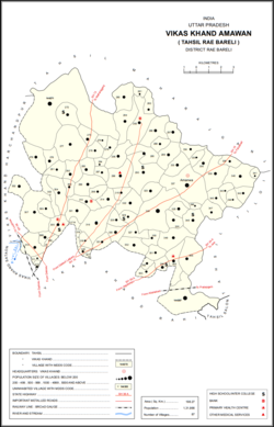
Mardanpur is a village in Amawan block of Rae Bareli district, Uttar Pradesh, India. It is located 15 km from Raebareli, the district headquarters. As of 2011, its population is 1,927, in 333 households. It has one primary school and no healthcare facilities.
Kondras Buzurg is a village in Amawan block of Rae Bareli district, Uttar Pradesh, India. It is located 9 km from Raebareli, the district headquarters. As of 2011, its population is 3,143, in 581 households. It has two primary schools and no healthcare facilities.
Kondras Khurd is a village in Amawan block of Rae Bareli district, Uttar Pradesh, India. It is located 5 km from Raebareli, the district headquarters. As of 2011, its population is 296, in 61 households.
Pindari Khurd is a village in Amawan block of Rae Bareli district, Uttar Pradesh, India. It is located 9 km from Raebareli, the district headquarters. As of 2011, its population is 1,615, in 300 households. It has one primary school and no healthcare facilities.
Rasehta is a village in Amawan block of Rae Bareli district, Uttar Pradesh, India. It is located 14 km from Raebareli, the district headquarters. As of 2011, its population is 2,756, in 491 households. It has one primary school and no healthcare facilities.
Sidhauna is a village in Amawan block of Rae Bareli district, Uttar Pradesh, India. It is located 16 km from Raebareli, the district headquarters. As of 2011, its population is 5,352, in 953 households. It has one primary school and no healthcare facilities.
Rasulpur is a village in Amawan block of Rae Bareli district, Uttar Pradesh, India. It is located 29 km from Raebareli, the district headquarters. As of 2011, its population is 514, in 94 households.
Dusauti is a village in Amawan block of Rae Bareli district, Uttar Pradesh, India. As of 2011, its population is 1,562, in 233 households. It has one primary school and no healthcare facilities.
Rupamau is a village in Amawan block of Rae Bareli district, Uttar Pradesh, India. It is located 12 km from Raebareli, the district headquarters. As of 2011, its population is 6,098, in 1,053 households. It has 4 primary schools and no healthcare facilities.
Hilgi is a village in Amawan block of Rae Bareli district, Uttar Pradesh, India. It is located 18 km from Raebareli, the district headquarters. As of 2011, its population is 1,106, in 199 households. It has one primary school and no healthcare facilities.
Haibatmau is a village in Amawan block of Rae Bareli district, Uttar Pradesh, India. It is located 10 km from Raebareli, the district headquarters. As of 2011, its population is 854, in 142 households. It has one primary school and no healthcare facilities.
Khaira is a village in Amawan block of Rae Bareli district, Uttar Pradesh, India. It is located 18 km from Raebareli, the district headquarters. As of 2011, its population is 851, in 157 households. It has one primary school and no healthcare facilities.

Garhi Dularai is a village located in Sataon block of Rae Bareli district, Uttar Pradesh, India. It is located 24 km from Raebareli, the district headquarters. As of 2011, its population is 1,300, in 232 households. It has one primary school and no healthcare facilities.
Ataura Buzurg is a village in Sataon block of Rae Bareli district, Uttar Pradesh, India. It is located 14 km from Raebareli, the district headquarters. As of 2011, its population is 8,466, in 1,573 households. It has 4 primary schools and no healthcare facilities.

Behta Kalan is a village in Lalganj block of Rae Bareli district, Uttar Pradesh, India. It is located 8 km (5.0 mi) from Lalganj, the block and tehsil headquarters, a bit to the north of the road connecting it and Rae Bareli, the district headquarters.

Khaliqpur Kalan is a village in Unchahar block of Raebareli district, Uttar Pradesh, India. It is located 30 km from Raebareli, the district headquarters. As of 2011, it has a population of 1,841 people, in 339 households.
Pratappur is a village in Lalganj block of Rae Bareli district, Uttar Pradesh, India. As of 2011, it has a population of 417 people, in 74 households. It has no schools and no healthcare facilities, and it does not host a permanent market or a weekly haat. It belongs to the nyaya panchayat of Behta Kalan.

Ramaipur Kalan is a village in Sareni block of Rae Bareli district, Uttar Pradesh, India. It is located 15 km from Lalganj, the tehsil headquarters. As of 2011, it has a population of 1,579 people, in 251 households. It has one primary school and no healthcare facilities, and does not host a weekly haat or a permanent market. It belongs to the nyaya panchayat of Sareni.