Mahraura is a village in Bachhrawan block of Rae Bareli district, Uttar Pradesh, India. As of 2011, its population is 905, in 180 households. It is located 5 km from Bachhrawan, the block headquarters, and the main staple foods are wheat and rice. It has one primary school and no healthcare facilities.

Rajapur is a village in Shivgarh block of Rae Bareli district, Uttar Pradesh, India. As of 2011, its population is 767, in 140 households. It has one primary school and no healthcare facilities. It is located 18 km from Maharajganj, the tehsil headquarters. The main staple foods are wheat and rice.

Chak Dahiramau is a village in Bahadurpur block of Rae Bareli district, Uttar Pradesh, India. As of 2011, its population is 532, in 106 households. It has one primary school and no healthcare facilities.

Johwa Hisar is a village in Harchandpur block of Rae Bareli district, Uttar Pradesh, India. It is located 38 km from Raebareli, the district headquarters. As of 2011, its population is 1,692, in 372 households. It has one primary school and no healthcare facilities.

Chandwal is a village in Sataon block of Rae Bareli district, Uttar Pradesh, India. As of 2011, its population is 1,112, in 225 households. It has one primary school and no healthcare facilities.

Ekauni is a village in Khiron block of Rae Bareli district, Uttar Pradesh, India. It is located 5 km from Lalganj, the tehsil headquarters. As of 2011, it has a population of 1,466 people, in 256 households. It has one primary school and one medical clinic.

Sultanpur Aima is a village in Rahi block of Rae Bareli district, Uttar Pradesh, India. It is located 5 km from Rae Bareli, the district headquarters. As of 2011, it has a population of 448 people, in 78 households. It has one primary school and no healthcare facilities.

Jamalpur Nankari is a village in Rahi block of Rae Bareli district, Uttar Pradesh, India. It is located 4 km from Rae Bareli, the district headquarters. As of 2011, it has a population of 1,203 people, in 242 households. It has one primary school and no healthcare facilities.

Chanda Tikar is a village in Lalganj block of Rae Bareli district, Uttar Pradesh, India. As of 2011, it has a population of 2,156 people, in 377 households. It has one primary school and no healthcare facilities.

Kandharpur is a village in Dalmau block of Rae Bareli district, Uttar Pradesh, India. It is located 8 km from Dalmau, the block headquarters. As of 2011, it has a population of 1,216 people, in 229 households. It has one primary school and no healthcare facilities.

Chandauli is a village in Jagatpur block of Rae Bareli district, Uttar Pradesh, India. As of 2011, it has a population of 516 people, in 98 households. It has no schools and no healthcare facilities.

Chichauli is a village in Jagatpur block of Rae Bareli district, Uttar Pradesh, India. As of 2011, it has a population of 4,189 people, in 711 households. It has 3 primary schools and no healthcare facilities.

Sikandarpur is a village in Jagatpur block of Rae Bareli district, Uttar Pradesh, India. As of 2011, it has a population of 494 people, in 86 households. It has no schools and no healthcare facilities.

Sarai Sri Bakhsh is a village in Jagatpur block of Rae Bareli district, Uttar Pradesh, India. As of 2011, it has a population of 1,671 people, in 260 households. It has one primary school and no healthcare facilities.

Gaura Lakhmi is a village in Jagatpur block of Rae Bareli district, Uttar Pradesh, India. As of 2011, it has a population of 929 people, in 159 households. It has one primary school and no healthcare facilities.

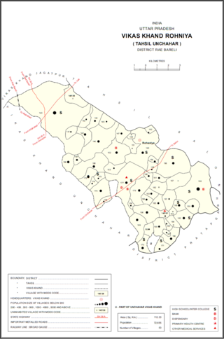
Rohaniya is a village and corresponding community development block in Unchahar tehsil of Rae Bareli district, Uttar Pradesh, India. It is located 43 km from Raebareli, the district headquarters. As of 2011, Rohaniya has a population of 3,880 people, in 751 households. It has one primary school and no healthcare facilities.

Bani is a village in Rahi block of Rae Bareli district, Uttar Pradesh, India. It is located 7 km from Rae Bareli, the district headquarters. As of 2011, it has a population of 672 people, in 136 households. It has no schools and no healthcare facilities.

Satwa is a village in Salon block of Rae Bareli district, Uttar Pradesh, India. It is located 35 km from Raebareli, the district headquarters. As of 2011, Satwa has a population of 418 people, in 74 households. It has a regular market, but not a periodic haat, and no healthcare facilities.

Madudpur is a village in Dalmau block of Rae Bareli district, Uttar Pradesh, India. The nearest large town is Lalganj, which is 11 km away. As of 2011, it has a population of 984 people, in 178 households. It has one primary school and no healthcare facilities.

Paraura is a village in Rahi block of Rae Bareli district, Uttar Pradesh, India. It is located 13 km from Rae Bareli, the district headquarters. As of 2011, it has a total population of 1,060 people, in 191 households. It has one primary school and no medical facilities and it does not host a weekly haat or a permanent market. It belongs to the nyaya panchayat of Bhaon.


