Rahwan is a village in Harchandpur block of Rae Bareli district, Uttar Pradesh, India. As of 2011, its population was 4,292, in 802 households. It has 3 primary schools and one medical clinic.

Baldupur is a village in Harchandpur block of Rae Bareli district, Uttar Pradesh, India. As of 2011, its population is 607, in 108 households. It has one primary school and no healthcare facilities.

Kondras Khurd is a village in Amawan block of Rae Bareli district, Uttar Pradesh, India. It is located 5 km from Raebareli, the district headquarters. As of 2011, its population is 296, in 61 households.

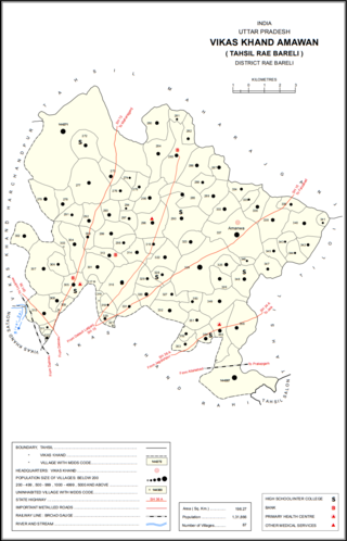
Pindari Kalan is a village in Amawan block of Rae Bareli district, Uttar Pradesh, India. As of 2011, its population is 3,960, in 671 households. It has one primary school and no healthcare facilities.

Pindari Khurd is a village in Amawan block of Rae Bareli district, Uttar Pradesh, India. It is located 9 km from Raebareli, the district headquarters. As of 2011, its population is 1,615, in 300 households. It has one primary school and no healthcare facilities.

Rasehta is a village in Amawan block of Rae Bareli district, Uttar Pradesh, India. It is located 14 km from Raebareli, the district headquarters. As of 2011, its population is 2,756, in 491 households. It has one primary school and no healthcare facilities.

Dusauti is a village in Amawan block of Rae Bareli district, Uttar Pradesh, India. As of 2011, its population is 1,562, in 233 households. It has one primary school and no healthcare facilities.

Rupamau is a village in Amawan block of Rae Bareli district, Uttar Pradesh, India. It is located 12 km from Raebareli, the district headquarters. As of 2011, its population is 6,098, in 1,053 households. It has 4 primary schools and no healthcare facilities.

Hilgi is a village in Amawan block of Rae Bareli district, Uttar Pradesh, India. It is located 18 km from Raebareli, the district headquarters. As of 2011, its population is 1,106, in 199 households. It has one primary school and no healthcare facilities.

Haibatmau is a village in Amawan block of Rae Bareli district, Uttar Pradesh, India. It is located 10 km from Raebareli, the district headquarters. As of 2011, its population is 854, in 142 households. It has one primary school and no healthcare facilities.

Garhi Dularai is a village located in Sataon block of Rae Bareli district, Uttar Pradesh, India. It is located 24 km from Raebareli, the district headquarters. As of 2011, its population is 1,300, in 232 households. It has one primary school and no healthcare facilities.

Kasehti is a village in Rahi block of Rae Bareli district, Uttar Pradesh, India. It is located 8 km from Rae Bareli, the district headquarters. As of 2011, it has a population of 1,400 people, in 271 households. It has one primary school and no healthcare facilities.

Tala Gopalpur is a village in Rahi block of Rae Bareli district, Uttar Pradesh, India. It is located 9 km from Rae Bareli, the district headquarters. As of 2011, it has a population of 1,902 people, in 347 households. It has one primary school and no healthcare facilities.

Fakhrul Hasan Khera is a village in Rahi block of Rae Bareli district, Uttar Pradesh, India. It is located 8 km from Rae Bareli, the district headquarters. As of 2011, it has a population of 731 people, in 117 households.

Lakhai Khera is a village in Sareni block of Rae Bareli district, Uttar Pradesh, India. It is located 22 km from Lalganj, the tehsil headquarters. As of 2011, it has a population of 327 people, in 48 households. It has no schools and no healthcare facilities.

Chhichhaura is a village in Deenshah Gaura block of Rae Bareli district, Uttar Pradesh, India. It is located 20 km from Raebareli, the district headquarters. As of 2011, it has a population of 862 people, in 157 households. It has one primary school and no healthcare facilities.

Tikaria is a village in Deenshah Gaura block of Rae Bareli district, Uttar Pradesh, India. It is located 30 km from Raebareli, the district headquarters. As of 2011, it has a population of 812 people, in 140 households. It has no schools and no healthcare facilities.

Gaura Khaspari is a village in Deenshah Gaura block of Rae Bareli district, Uttar Pradesh, India. It is located 31 km from Raebareli, the district headquarters. As of 2011, it has a population of 1,963 people, in 366 households. It has one primary school and no healthcare facilities.

Bani is a village in Rahi block of Rae Bareli district, Uttar Pradesh, India. It is located 7 km from Rae Bareli, the district headquarters. As of 2011, it has a population of 672 people, in 136 households. It has no schools and no healthcare facilities.

Dandanpur is a village in Khiron block of Rae Bareli district, Uttar Pradesh, India. It is located 20 km from Lalganj, the tehsil headquarters. As of 2011, it has a population of 537 people, in 109 households. It has 1 primary school and no healthcare facilities and it does not host a weekly haat or permanent market. It belongs to the nyaya panchayat of Atarhar.


