Harchandpur is a village and corresponding community development block in Raebareli district, Uttar Pradesh, India. It is located on the Baiti river, which is a tributary of the Sai, and it is northeast from the district headquarters on the road to Lucknow. Particularly since the coming of the railway in the 1800s, Harchandpur serves as one of the main commercial centres for the surrounding region; it is also a major exporter of local goods. As of 2011, its population is 4,348 people, in 833 households.

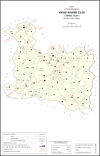
Tiloi is a Town and tehsil headquarters in Amethi district of Uttar Pradesh, India. Located near Mohanganj on the Jais-Inhauna road, Tiloi is notable as the historical seat of a major taluqdari estate held by the Kanhpurias. As of 2011, its population is 6,956, in 1,257 households.

Shahmau is a village panchayat in Tiloi block of district Amethi, Uttar Pradesh, India. It is located 22 km (14 mi) from Gauriganj the district headquarters Amethi, on the road from Mohanganj to Jais. Historically, Shahmau was the taluqdari held by a branch of the Kanhpuria Kshatriya (Rajput), the Ruler taluqdars bore the hereditary title of Raja. As of 2011, its population is 1,647, in 286 households.

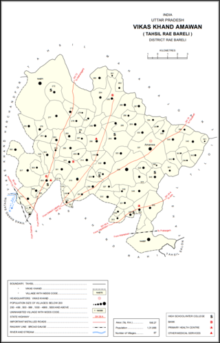
Amawan is a village and corresponding community development block in Rae Bareli district, Uttar Pradesh, India. It historically was the seat of a taluqdari estate held by a Pathan family and eventually split into two shares. As of 2011, its population is 5,245, in 973 households. It has 5 primary schools and no healthcare facilities.

Korihar is a village located in Sataon block of Rae Bareli district, Uttar Pradesh, India. Located 20 km from Raebareli, the district headquarters, Korihar was historically the seat of a taluqdari estate held by a branch of the Bais Rajputs. On the northwest is Sataon, and to the south is the village of Hajipur, which has the ruins of an old Bais fort. As of 2011, the population of Korihar is 12,351, in 2,240 households. It has one primary school and no healthcare facilities. The village hosts markets twice per week, on Mondays and Fridays.

Sultanpur Khera is a village in Sataon block of Rae Bareli district, Uttar Pradesh, India. As of 2011, its population is 7,619, in 1,384 households. It has 4 primary schools and no healthcare facilities. Sultanpur Khera hosts two festivals: one is dedicated to Parvin Devi and takes place on Chaitra Sudi 9, and the other is dedicated to Purvi Devi and takes place on Asvina Sudi 9. Vendors bring earthenware pottery, bangles, and various everyday items to sell at both festivals.

Ataura Khurd is a village in Sataon block of Rae Bareli district, Uttar Pradesh, India. It is located 15 km from Raebareli, the district headquarters. As of 2011, its population is 2,118, in 390 households. It has one primary school and no healthcare facilities. Ataura Khurd hosts a festival to Durga Devi on Vaisakha Badi 4-11 and Kartika Badi 4-11 dedicated to the worship of the goddess. Vendors bring sweets, toys, and various everyday items to sell at the fair.

Kilauli is a village in Sataon block of Rae Bareli district, Uttar Pradesh, India. It is located 8 km from Raebareli, the district headquarters. As of 2011, its population is 5,188, in 1,045 households. It has 6 primary schools and no healthcare facilities.

Bhaon is a village in Rahi block of Rae Bareli district, Uttar Pradesh, India. It is located 9 km south of Rae Bareli, the district headquarters, on the road to Allahabad. It is located on level ground and the soil is very fertile. As of 2011, it has a population of 4,161 people, in 758 households. It has one primary school and no healthcare facilities.

Lodhwari is a village in Rahi block of Rae Bareli district, Uttar Pradesh, India. It is located 12 km from Rae Bareli, the district headquarters, on the left bank of the Sai river. The road to Parshadepur runs through the northeastern part of the village lands. As of 2011, Lodhwari has a population of 10,592 people, in 2,019 households.

Murarmau is a village in Sareni block of Rae Bareli district, Uttar Pradesh, India. It is located 21 km from Lalganj, the tehsil headquarters. Murarmau historically served as the seat of the largest taluqdar estate in the district, held by the most senior branch of the Tilokchandi Bais. As of 2011, it has a population of 2,999 people, in 523 households. It has one primary school and no healthcare facilities. Murarmau serves as the headquarters of a nyaya panchayat which also includes 9 other villages.

Bahai is a village in Lalganj block of Rae Bareli district, Uttar Pradesh, India. It is located 8 km from Lalganj, the block and tehsil headquarters, to the east of the road to Dalmau. It is on high ground and is drained by two large streams that merge together further south before joining the Ganges.

Simarpaha is a village in Lalganj block of Rae Bareli district, Uttar Pradesh, India. It is located 3 km southwest of Lalganj on the road to Ralpur on the Ganges. In addition to the main site, the village also includes several dispersed hamlets. Simarpaha was historically the seat of a taluqdari estate held by a branch of the Bais Rajputs. As of 2011, it has a population of 8,391 people, in 1,501 households. It has two primary schools and no healthcare facilities.

Gaura Hardo, or just Gaura, is a village in Rae Bareli district, Uttar Pradesh, India. It serves as the headquarters of Deenshah Gaura block, in the tehsil of Dalmau. It is located 33 km from Raebareli, the district headquarters, on the road from Dalmau to Salon. As of 2011, Gaura Hardo has a population of 8,001 people, in 1,446 households. It has five primary schools and one maternity and child welfare centre.

Jagatpur is a village and corresponding community development block in Unchahar tehsil of Rae Bareli district, Uttar Pradesh, India. It is located 18 km from Raebareli, the district headquarters, on the road to Allahabad at the point where it intersects the road from Dalmau to Salon. There is a large Buddhist-era ruin site at Tanghan to the south. As of 2011, Jagatpur has a population of 7,267 people, in 1,336 households. It has 4 primary schools and 1 healthcare centre.

Nain is a village in Salon block of Rae Bareli district, Uttar Pradesh, India. It is located on the south bank of the Sai river, north of the main road from Salon to Raebareli. As of 2011, the village has a population of 2,028 people, in 372 households. It has one primary school and no healthcare facilities.

Nuruddinpur is a village in Salon block of Rae Bareli district, Uttar Pradesh, India. It is located 43 km from Raebareli, the district headquarters. As of 2011, Nuruddinpur has a population of 3,882 people, in 667 households. It has 2 primary schools and no healthcare facilities. It is connected to national highways and hosts a periodic haat but not a permanent market.

Paho, also spelled Pahu, is a village in Khiron block of Rae Bareli district, Uttar Pradesh, India. It is located near the road from Raebareli to Mauranwan and Unnao, close to the border with Unnao district. It is 18 km away from Lalganj, the tehsil headquarters. As of 2011, Paho has a population of 5,620 people, in 1,088 households. It has two primary schools and no healthcare facilities, and it hosts a weekly haat but not a permanent market. It is the seat of a nyaya panchayat which also includes 7 other villages.

Khajurgaon is a village in Lalganj block of Rae Bareli district, Uttar Pradesh, India. It is located on the bank of the Ganges, 12 km from Lalganj, the block and tehsil headquarters. As of 2011, it has a population of 5,916 people, in 1,067 households. It has 5 primary schools and 1 community health centre. It serves as the headquarters of a nyaya panchayat which also includes 12 other villages.

Pilkha is a village in Dalmau block of Rae Bareli district, Uttar Pradesh, India. It is located 9 km from Lalganj, the nearest large town. As of 2011, it has a population of 2,122 people, in 375 households. It has one primary school and no healthcare facilities and does not host a permanent market or weekly haat.


