Tanda is a village in Harchandpur block of Rae Bareli district, Uttar Pradesh, India. It is located 5 km from Raebareli, the district headquarters. As of 2011, its population is 1,559, in 312 households. It has one primary school and no healthcare facilities.

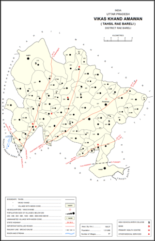
Gokulpur is a village in Amawan block of Rae Bareli district, Uttar Pradesh, India. As of 2011, its population is 228, in 41 households. It has no schools and no healthcare facilities.

Kondras Khurd is a village in Amawan block of Rae Bareli district, Uttar Pradesh, India. It is located 5 km from Raebareli, the district headquarters. As of 2011, its population is 296, in 61 households.

Pindari Khurd is a village in Amawan block of Rae Bareli district, Uttar Pradesh, India. It is located 9 km from Raebareli, the district headquarters. As of 2011, its population is 1,615, in 300 households. It has one primary school and no healthcare facilities.

Rasehta is a village in Amawan block of Rae Bareli district, Uttar Pradesh, India. It is located 14 km from Raebareli, the district headquarters. As of 2011, its population is 2,756, in 491 households. It has one primary school and no healthcare facilities.

Rasulpur is a village in Amawan block of Rae Bareli district, Uttar Pradesh, India. It is located 29 km from Raebareli, the district headquarters. As of 2011, its population is 514, in 94 households.

Garhi Dularai is a village located in Sataon block of Rae Bareli district, Uttar Pradesh, India. It is located 24 km from Raebareli, the district headquarters. As of 2011, its population is 1,300, in 232 households. It has one primary school and no healthcare facilities.

Mendauli is a village in Khiron block of Rae Bareli district, Uttar Pradesh, India. It is located 19 km from Lalganj, the tehsil headquarters. As of 2011, it has a population of 3,345 people, in 649 households. It has two primary schools and no healthcare facilities.

Fakhrul Hasan Khera is a village in Rahi block of Rae Bareli district, Uttar Pradesh, India. It is located 8 km from Rae Bareli, the district headquarters. As of 2011, it has a population of 731 people, in 117 households.

Sarai Muhammad Sharif is a village in Rahi block of Rae Bareli district, Uttar Pradesh, India. It is located 9 km from Rae Bareli, the district headquarters. As of 2011, it has a population of 1,400 people, in 271 households. It has one primary school and no healthcare facilities.

Sarai is a village in Lalganj block of Rae Bareli district, Uttar Pradesh, India. It is located 19 km from Lalganj, the block and tehsil headquarters. As of 2011, it has a population of 902 people, in 173 households. It has one primary school and no healthcare facilities.

Chhichhaura is a village in Deenshah Gaura block of Rae Bareli district, Uttar Pradesh, India. It is located 20 km from Raebareli, the district headquarters. As of 2011, it has a population of 862 people, in 157 households. It has one primary school and no healthcare facilities.

Tikaria is a village in Deenshah Gaura block of Rae Bareli district, Uttar Pradesh, India. It is located 30 km from Raebareli, the district headquarters. As of 2011, it has a population of 812 people, in 140 households. It has no schools and no healthcare facilities.

Sai is a village in Deenshah Gaura block of Rae Bareli district, Uttar Pradesh, India. It is located 30 km from Raebareli, the district headquarters. As of 2011, it has a population of 1,949 people, in 348 households. It has one primary school and no healthcare facilities.

Thulrai is a village in Deenshah Gaura block of Rae Bareli district, Uttar Pradesh, India. It is located 32 km from Raebareli, the district headquarters. As of 2011, it has a population of 4,215 people, in 763 households. It has one primary school and no healthcare facilities.

Gaura Khaspari is a village in Deenshah Gaura block of Rae Bareli district, Uttar Pradesh, India. It is located 31 km from Raebareli, the district headquarters. As of 2011, it has a population of 1,963 people, in 366 households. It has one primary school and no healthcare facilities.

Dhamdhama is a village in Deenshah Gaura block of Rae Bareli district, Uttar Pradesh, India. As of 2011, it has a population of 2,154 people, in 343 households. It has one primary school and no healthcare facilities. Dhamdhama hosts a small market once per week on Thursdays; vegetables and cloth are the main items traded.

Ambara Mathai is a village in Deenshah Gaura block of Rae Bareli district, Uttar Pradesh, India. As of 2011, it has a population of 3,615 people, in 648 households. It has three primary schools and no healthcare facilities.

Bani is a village in Rahi block of Rae Bareli district, Uttar Pradesh, India. It is located 7 km from Rae Bareli, the district headquarters. As of 2011, it has a population of 672 people, in 136 households. It has no schools and no healthcare facilities.

Dandanpur is a village in Khiron block of Rae Bareli district, Uttar Pradesh, India. It is located 20 km from Lalganj, the tehsil headquarters. As of 2011, it has a population of 537 people, in 109 households. It has 1 primary school and no healthcare facilities and it does not host a weekly haat or permanent market. It belongs to the nyaya panchayat of Atarhar.


