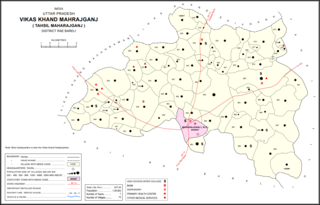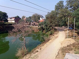
Maharajganj is a town and nagar panchayat in Rae Bareli district, Uttar Pradesh, India. It serves as the headquarters of a tehsil. As of 2011, its population is 6,673, in 1,037 households.

Rajamau is a village in Bachhrawan block of Rae Bareli district, Uttar Pradesh, India. As of 2011, its population is 5,044, in 927 households, and it has 5 primary schools and no healthcare facilities. It is located 10 km southwest of Bachhrawan, the block headquarters, and the main staple foods are wheat and rice. Rajamau hosts a Kalreshwar Mahadeo mela on Magha Sudi 5 dedicated to the worship of Shiva; vendors bring sweets, toys, and everyday items to sell at the fair.

Bahadurnagar is a village in Bachhrawan block of Rae Bareli district, Uttar Pradesh, India. Located 8 km from Bachhrawan, the block headquarters, Bahadurnagar hosts a market on Mondays and Thursdays. It was historically one of the main villages in the Bachhrawan pargana. As of 2011, Bahadurnagar's population is 4,508, in 964 households.

Atrehta is a village in Maharajganj block of Rae Bareli district, Uttar Pradesh, India. Located 1 km from Maharajganj, the block headquarters, it is the village whose lands the Maharajganj bazar was originally founded on. As of 2011, Atrehta has a population of 5,628, in 1,056 households. It has two primary schools and no healthcare facilities.

Muraini is a village in Maharajganj block of Rae Bareli district, Uttar Pradesh, India. As of 2011, its population is 3,028, in 545 households. It has one primary school and no healthcare facilities. It is located 8 km from Maharajganj, the block headquarters. The main staple foods are wheat and gram.

Domapur is a village in Maharajganj block of Rae Bareli district, Uttar Pradesh, India. As of 2011, its population is 2,254, in 404 households. It has two primary schools and no healthcare facilities. It is located 10 km from Maharajganj, the block headquarters. The main staple foods are wheat and rice. It belongs to the nyaya panchayat of Chandapur.

Janai is a village in Maharajganj block of Rae Bareli district, Uttar Pradesh, India. As of 2011, its population is 3,991, in 425 households. It has 3 primary schools and no healthcare facilities. It is located 10 km from Maharajganj, the block headquarters. The main staple foods are wheat and rice.

Balipur is a village in Maharajganj block of Rae Bareli district, Uttar Pradesh, India. As of 2011, its population is 407, in 71 households. It has one primary school and no healthcare facilities. It is located 4 km from Maharajganj, the block headquarters. The main staple foods are wheat and rice.

Asni is a village in Maharajganj block of Rae Bareli district, Uttar Pradesh, India. As of 2011, its population is 1,279, in 238 households. It has one primary school and no healthcare facilities. It is located 9 km from Maharajganj, the block headquarters. The main staple foods are wheat and rice.

Hasanpur is a village in Maharajganj block of Rae Bareli district, Uttar Pradesh, India. As of 2011, its population is 2,340, in 445 households. It has one primary school and no healthcare facilities. It is located 10 km from Maharajganj, the block headquarters. The main staple foods are wheat and rice.

Narayanpur is a village in Maharajganj block of Rae Bareli district, Uttar Pradesh, India. As of 2011, its population is 684, in 136 households. It has one primary school and no healthcare facilities. It is located 9 km from Maharajganj, the block headquarters. The main staple foods are wheat and rice.

Ramgaon is a village in Maharajganj block of Rae Bareli district, Uttar Pradesh, India. As of 2011, its population is 978, in 163 households. It is located 8 km from Maharajganj, the block headquarters. The main staple foods are wheat and rice.

Bhatsara is a village in Maharajganj block of Rae Bareli district, Uttar Pradesh, India. As of 2011, its population is 1,220, in 232 households. It has one primary school and no healthcare facilities. It is located 12 km from Maharajganj, the block headquarters. The main staple foods are wheat and rice.

Para Khurd is a village in Maharajganj block of Rae Bareli district, Uttar Pradesh, India. As of 2011, its population is 1,848, in 353 households. It has 4 primary schools and no healthcare facilities. It is located 8 km from Maharajganj, the block headquarters. The main staple foods are wheat and rice.

Kotwa is a village in Singhpur block of Rae Bareli district, Uttar Pradesh, India. As of 2011, its population is 4,832, in 854 households. It has one primary school and no healthcare facilities.

Mirzagarh is a village in Singhpur block of Rae Bareli district, Uttar Pradesh, India. As of 2011, its population is 2,596, in 454 households. It has one primary school and no healthcare facilities.

Khara is a village in Singhpur block of Rae Bareli district, Uttar Pradesh, India. As of 2011, its population is 7,320, in 1,339 households.

Panhauna is a village in Singhpur block of Rae Bareli district, Uttar Pradesh, India. As of 2011, its population is 7,075, in 1,307 households. It has one primary school and no healthcare facilities.

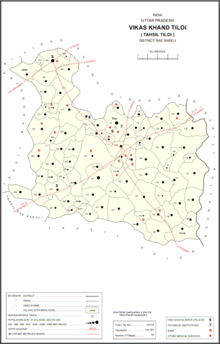
Semrauta is a village in Tiloi block of Rae Bareli district, Uttar Pradesh, India. It is located at the intersection of the Maharajganj-Inhauna and Mohanganj-Haidargarh roads, about 20 km from Maharajganj, the tehsil headquarters. Although now eclipsed by Maharajganj, Semrauta was historically a relatively important village that served as the headquarters of a pargana and the capital of a branch of the Kanhpuria Rajputs, who later became known as the Rajas of Chandapur. As of 2011, the population of Simrauta is 6,423, in 1,031 households.

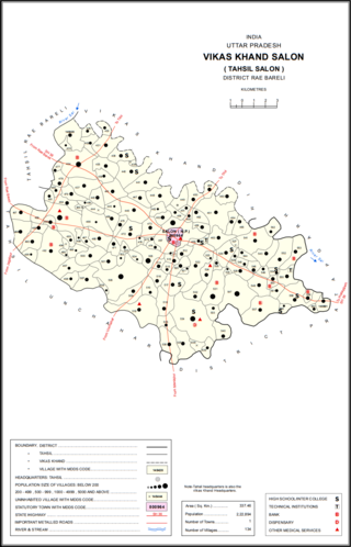
Nuruddinpur is a village in Salon block of Rae Bareli district, Uttar Pradesh, India. It is located 43 km from Raebareli, the district headquarters. As of 2011, Nuruddinpur has a population of 3,882 people, in 667 households. It has 2 primary schools and no healthcare facilities. It is connected to national highways and hosts a periodic haat but not a permanent market.


