Mainahar Katra is a village in Bachhrawan block of Rae Bareli district, Uttar Pradesh, India. As of 2011, its population is 2,197, in 382 households. It historically formed a taluqdar estate.

Saidpur Behta is a village in Bachhrawan block of Rae Bareli district, Uttar Pradesh, India. As of 2011, its population is 612, in 118 households. It historically belonged to the taluqdars of Tirbediganj.

Deopuri, also spelled Devpuri, is a village in Bachhrawan block of Rae Bareli district, Uttar Pradesh, India. As of 2011, its population is 1,188, in 244 households. Located 2 km from Bachhrawan, Deopuri was historically the last village held by the zamindars descended from Qazi Sultan, the first zamindar of the pargana of Thulendi in the 1400s.

Karanpur is a village in Bachhrawan block of Rae Bareli district, Uttar Pradesh, India. Located 23 km from the city of Raebareli, Karanpur was historically one of the main villages in the Bachhrawan pargana. As of 2011, Karanpur's population is 4,171, in 791 households.

Bahadurnagar is a village in Bachhrawan block of Rae Bareli district, Uttar Pradesh, India. Located 8 km from Bachhrawan, the block headquarters, Bahadurnagar hosts a market on Mondays and Thursdays. It was historically one of the main villages in the Bachhrawan pargana. As of 2011, Bahadurnagar's population is 4,508, in 964 households.

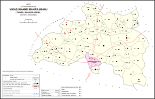
Atrehta is a village in Maharajganj block of Rae Bareli district, Uttar Pradesh, India. Located 1 km from Maharajganj, the block headquarters, it is the village whose lands the Maharajganj bazar was originally founded on. As of 2011, Atrehta has a population of 5,628, in 1,056 households. It has two primary schools and no healthcare facilities.

Kumhrawan is a village in Shivgarh block of Rae Bareli district, Uttar Pradesh, India. Formerly a pargana headquarters, it consists of a main village and several scattered hamlets. As of 2011, Kumhrawan has a population of 2,441, in 426 households.

Balipur is a village in Maharajganj block of Rae Bareli district, Uttar Pradesh, India. As of 2011, its population is 407, in 71 households. It has one primary school and no healthcare facilities. It is located 4 km from Maharajganj, the block headquarters. The main staple foods are wheat and rice.

Dundgarh is a village in Bachhrawan block of Rae Bareli district, Uttar Pradesh, India. As of 2011, its population is 1,397, in 270 households. It has one primary school and no healthcare facilities.

Konchi is a village in Singhpur block of Rae Bareli district, Uttar Pradesh, India. As of 2011, its population is 1,914, in 318 households.

Jijauli is a village in Singhpur block of Rae Bareli district, Uttar Pradesh, India. It is located 45 km from Raebareli, the district headquarters. As of 2011, its population is 1,664, in 324 households. It has one primary school and no healthcare facilities.

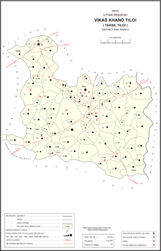
Chingahi is a village in Tiloi block of Rae Bareli district, Uttar Pradesh, India. As of 2011, its population is 1,768, in 303 households. It has one primary school and no healthcare facilities.

Satwa is a village in Tiloi block of Rae Bareli district, Uttar Pradesh, India. As of 2011, its population is 743, in 147 households. It has one primary school and no healthcare facilities.

Pure Manga is a village in Tiloi block of Rae Bareli district, Uttar Pradesh, India. As of 2011, its population is 294, in 52 households. It has no schools and no healthcare facilities.

Panhauna is a village in Singhpur block of Rae Bareli district, Uttar Pradesh, India. As of 2011, its population is 7,075, in 1,307 households. It has one primary school and no healthcare facilities.

Chak Dahiramau is a village in Bahadurpur block of Rae Bareli district, Uttar Pradesh, India. As of 2011, its population is 532, in 106 households. It has one primary school and no healthcare facilities.

Brahmani is a village in Bahadurpur block of Rae Bareli district, Uttar Pradesh, India. It includes the important bazar and railway station of Fursatganj. Fursatganj holds markets twice per week, on Thursdays and Sundays, where grain, vegetables, and cloth are the main items of trade. The place also hosts a large Dussehra festival annually on Asvina Sudi 15.

Chandwal is a village in Sataon block of Rae Bareli district, Uttar Pradesh, India. As of 2011, its population is 1,112, in 225 households. It has one primary school and no healthcare facilities.

Kilauli is a village in Sataon block of Rae Bareli district, Uttar Pradesh, India. It is located 8 km from Raebareli, the district headquarters. As of 2011, its population is 5,188, in 1,045 households. It has 6 primary schools and no healthcare facilities.

Tonk is a village in Dalmau block of Rae Bareli district, Uttar Pradesh, India. It is located 10 km from Dalmau, the block headquarters. As of 2011, it has a population of 642 people, in 120 households. It has no schools and no healthcare facilities.


