Rajapur Kanspur is a village in Maharajganj block of Rae Bareli district, Uttar Pradesh, India. As of 2011, its population is 964, in 160 households. It has one primary school and no healthcare facilities. It is located 9 km from Maharajganj, the block headquarters. The main staple foods are wheat and rice.

Gujarpur is a village in Bachhrawan block of Rae Bareli district, Uttar Pradesh, India. As of 2011, its population is 608, in 127 households. It is located 4 km from Bachhrawan, the block headquarters, and the main staple foods are wheat and rice. It has one primary school and no healthcare facilities.
Umarpur is a village in Bachhrawan block of Rae Bareli district, Uttar Pradesh, India. As of 2011, its population is 2,333, in 395 households. It is located 8 km from Bachhrawan, the block headquarters, and the main staple foods are wheat and rice. It has one primary school and no healthcare facilities.
Dostpur is a village in Bachhrawan block of Rae Bareli district, Uttar Pradesh, India. As of 2011, its population is 1,790, in 315 households. It is located 6 km from Bachhrawan, the block headquarters, and the main staple foods are wheat and rice.
Dundgarh is a village in Bachhrawan block of Rae Bareli district, Uttar Pradesh, India. As of 2011, its population is 1,397, in 270 households. It has one primary school and no healthcare facilities.
Rani Khera is a village in Bachhrawan block of Rae Bareli district, Uttar Pradesh, India. As of 2011, its population is 2,042, in 460 households. It is located 6 km from Bachhrawan, the block headquarters, and the main staple foods are wheat and rice. It has one primary school and no healthcare facilities.

Rajapur is a village in the Shivgarh block of Rae Bareli district, Uttar Pradesh, India. As of 2011, its population was 767, in 140 households. It has one primary school and no healthcare facilities. It is located 18 km from Maharajganj, the tehsil headquarters. The main staple foods are wheat and rice.

Ahuri is a village in Tiloi block of Rae Bareli district, Uttar Pradesh, India. As of 2011, its population is 1,647, in 286 households. It has one primary school and no healthcare facilities.

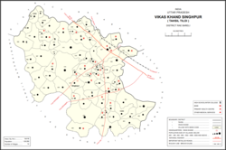
Konchi is a village in Singhpur block of Rae Bareli district, Uttar Pradesh, India. As of 2011, its population is 1,914, in 318 households.
Khara is a village in Singhpur block of Rae Bareli district, Uttar Pradesh, India. As of 2011, its population is 7,320, in 1,339 households.
Fatehpur is a village in Singhpur block of Rae Bareli district, Uttar Pradesh, India. As of 2011, its population is 5,348, in 856 households.
Jijauli is a village in Singhpur block of Rae Bareli district, Uttar Pradesh, India. It is located 45 km from Raebareli, the district headquarters. As of 2011, its population is 1,664, in 324 households. It has one primary school and no healthcare facilities.
Lauli is a village in Singhpur block of Rae Bareli district, Uttar Pradesh, India. As of 2011, its population is 2,864, in 543 households.
Chingahi is a village in Tiloi block of Rae Bareli district, Uttar Pradesh, India. As of 2011, its population is 1,768, in 303 households. It has one primary school and no healthcare facilities.
Bhadmar is a village in Tiloi block of Rae Bareli district, Uttar Pradesh, India. As of 2011, its population is 2,038, in 349 households.
Bhadsana is a village in Tiloi block of Rae Bareli district, Uttar Pradesh, India. As of 2011, its population is 1,862, in 343 households.
Ramnagar is a village in Tiloi block of Rae Bareli district, Uttar Pradesh, India. As of 2011, its population is 1,389, in 248 households.
Pakargaon is a village in Tiloi block of Rae Bareli district, Uttar Pradesh, India. As of 2011, its population is 6,266, in 1,156 households. It has two primary schools and no healthcare facilities.

Chak Dahiramau is a village in Bahadurpur block of Rae Bareli district, Uttar Pradesh, India. As of 2011, its population is 532, in 106 households. It has one primary school and no healthcare facilities.
Tarauna is a village in Bahadurpur block of Rae Bareli district, Uttar Pradesh, India. As of 2011, its population is 1,077, in 194 households. It has one primary school and no healthcare facilities.