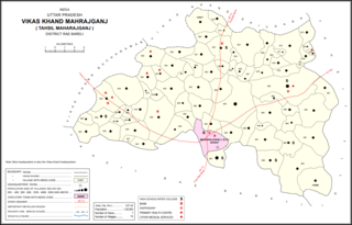
Pali is a village in Maharajganj block of Rae Bareli district, Uttar Pradesh, India. As of 2011, its population is 1,571, in 270 households. It has one primary school and no healthcare facilities. It is located 2 km from Maharajganj, the block headquarters.

Balipur is a village in Maharajganj block of Rae Bareli district, Uttar Pradesh, India. As of 2011, its population is 407, in 71 households. It has one primary school and no healthcare facilities. It is located 4 km from Maharajganj, the block headquarters. The main staple foods are wheat and rice.

Asni is a village in Maharajganj block of Rae Bareli district, Uttar Pradesh, India. As of 2011, its population is 1,279, in 238 households. It has one primary school and no healthcare facilities. It is located 9 km from Maharajganj, the block headquarters. The main staple foods are wheat and rice.

Hasanpur is a village in Maharajganj block of Rae Bareli district, Uttar Pradesh, India. As of 2011, its population is 2,340, in 445 households. It has one primary school and no healthcare facilities. It is located 10 km from Maharajganj, the block headquarters. The main staple foods are wheat and rice.

Ramgaon is a village in Maharajganj block of Rae Bareli district, Uttar Pradesh, India. As of 2011, its population is 978, in 163 households. It is located 8 km from Maharajganj, the block headquarters. The main staple foods are wheat and rice.

Alipur is a village in Maharajganj block of Rae Bareli district, Uttar Pradesh, India. As of 2011, its population is 3,461, in 600 households. It has one primary school and no healthcare facilities. It is located 14 km from Maharajganj, the block headquarters. The main staple foods are wheat and rice.

Rajapur Kanspur is a village in Maharajganj block of Rae Bareli district, Uttar Pradesh, India. As of 2011, its population is 964, in 160 households. It has one primary school and no healthcare facilities. It is located 9 km from Maharajganj, the block headquarters. The main staple foods are wheat and rice.

Kankhara is a village in Harchandpur block of Rae Bareli district, Uttar Pradesh, India. As of 2011, its population is 808, in 146 households. It has one primary school and no healthcare facilities.

Bargadha is a village in Harchandpur block of Rae Bareli district, Uttar Pradesh, India. As of 2011, its population is 847, in 141 households. It has one primary school and no healthcare facilities.

Ambahar is a village in Harchandpur block of Rae Bareli district, Uttar Pradesh, India. As of 2011, its population is 192, in 29 households. It has no schools and no healthcare facilities.

Kanhat is a village in Harchandpur block of Rae Bareli district, Uttar Pradesh, India. As of 2011, its population is 596, in 105 households. It has one primary school and no healthcare facilities.

Bala is a village in Harchandpur block of Rae Bareli district, Uttar Pradesh, India. As of 2011, its population is 4,123, in 801 households. It has one primary school and no healthcare facilities.

Datauli is a village in Harchandpur block of Rae Bareli district, Uttar Pradesh, India. As of 2011, its population is 1,980, in 357 households. It has one primary school and no healthcare facilities.

Pasi Tusi is a village in Harchandpur block of Rae Bareli district, Uttar Pradesh, India. As of 2011, its population is 645, in 125 households. It has no schools and no healthcare facilities.

Aghaura is a village in Harchandpur block of Rae Bareli district, Uttar Pradesh, India. As of 2011, its population is 1,836, in 347 households. It has one primary school and no healthcare facilities.

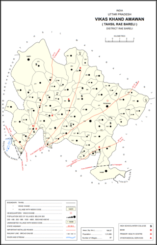
Khaira is a village in Amawan block of Rae Bareli district, Uttar Pradesh, India. It is located 18 km from Raebareli, the district headquarters. As of 2011, its population is 851, in 157 households. It has one primary school and no healthcare facilities.

Kasimpur Baghel is a village in Rahi block of Rae Bareli district, Uttar Pradesh, India. It is located 10 km from Rae Bareli, the district headquarters. As of 2011, it has a population of 410 people, in 74 households. It has no schools and no healthcare facilities.

Malpur is a village in Khiron block of Rae Bareli district, Uttar Pradesh, India. It is located 14 km from Lalganj, the tehsil headquarters. As of 2011, it has a population of 592 people, in 108 households. It has one primary school and no healthcare facilities.

Bharsana is a village in Dalmau block of Rae Bareli district, Uttar Pradesh, India. It is located 8 km from Dalmau, the block headquarters. As of 2011, it has a population of 1,550 people, in 285 households. It has one primary school and no healthcare facilities.

Rampur Barara is a village in Dalmau block of Rae Bareli district, Uttar Pradesh, India. It is located 11 km from Dalmau, the block headquarters. As of 2011, it has a population of 633 people, in 109 households. It has one primary school and no healthcare facilities.


