Pipri is a village in Shivgarh block of Rae Bareli district, Uttar Pradesh, India. As of 2011, its population is 1,263, in 222 households. It has one primary school and no healthcare facilities.

Kasna is a village in Shivgarh block of Rae Bareli district, Uttar Pradesh, India. As of 2011, its population is 1,191, in 222 households. It has one primary school and no healthcare facilities.

Bhausi is a village in Shivgarh block of Rae Bareli district, Uttar Pradesh, India. As of 2011, its population is 2,594 people, in 502 households. It has two primary schools and one small medical clinic. Bhausi hosts a Ramlila festival annually on Agrahayana Sudi 15 at the premises of the Temple of BhawshyareVeer Baba, the Grāmadevatā, lit. 'village deity', which involves a dramatic reenactment of the Ramayana. Vendors bring sweets, toys, and everyday items to sell at the festival.

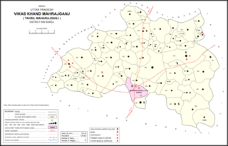
Hasanpur is a village in Maharajganj block of Rae Bareli district, Uttar Pradesh, India. As of 2011, its population is 2,340, in 445 households. It has one primary school and no healthcare facilities. It is located 10 km from Maharajganj, the block headquarters. The main staple foods are wheat and rice.

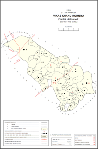
Kotiya Chitra is a village in Unchahar block of Raebareli district, Uttar Pradesh, India. It is located 42 km from Raebareli, the district headquarters. As of 2011, it has a population of 3,575 people, in 636 households. It has one primary school and no healthcare facilities.

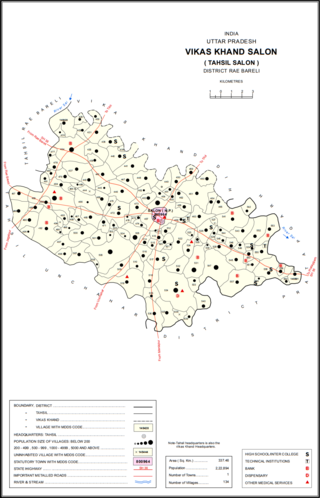
Chak Neknampur is a village in Salon block of Rae Bareli district, Uttar Pradesh, India. It is located 34 km from Raebareli, the district headquarters. As of 2011, Chak Neknampur has a population of 442 people, in 75 households. It has one primary school and no healthcare facilities.

Khwajapur is a village in Salon block of Rae Bareli district, Uttar Pradesh, India. It is located 38 km from Raebareli, the district headquarters. As of 2011, Khwajapur has a population of 2,305 people, in 399 households. It has one primary school and no healthcare facilities.

Aunanis is a village in Salon block of Rae Bareli district, Uttar Pradesh, India. It is located 2 km from Salon, the block and tehsil headquarters. As of 2011, Aunanis has a population of 1,115 people, in 209 households. It has one primary school and no healthcare facilities and is located on major district roads. It hosts neither a permanent market nor a periodic haat.

Paksarawan is a village in Salon block of Rae Bareli district, Uttar Pradesh, India. It is located 45 km from Raebareli, the district headquarters, and it is connected to state highways. As of 2011, Paksarawan has a population of 3,653 people, in 624 households. It has one primary school and one primary health sub centre. It does not have a permanent market, but it does host a weekly haat on Wednesdays.

Kemupur is a village in Salon block of Rae Bareli district, Uttar Pradesh, India. It is located 40 km from Raebareli, the district headquarters. As of 2011, Kemupur has a population of 1,426 people, in 226 households. It has no schools and no healthcare facilities. It has a permanent market and it does not host a periodic haat.

Fatehabad is a village in Salon block of Rae Bareli district, Uttar Pradesh, India. It is located 24 km from Raebareli, the district headquarters. As of 2011, Fatehabad has a population of 489 people, in 76 households. It has no schools and no healthcare facilities, and it does not host a permanent market or a periodic haat.

Parhari is a village in Salon block of Rae Bareli district, Uttar Pradesh, India. It is located 26 km from Raebareli, the district headquarters. As of 2011, Parhari has a population of 1,155 people, in 180 households. It has one primary school and no healthcare facilities, and it does not host a permanent market or a periodic haat.

Raipur is a village in Rohaniya block of Rae Bareli district, Uttar Pradesh, India. It is located 38 km from Raebareli, the district headquarters. As of 2011, it has a population of 1,256 people, in 242 households. It has one primary school and no healthcare facilities, and it does not host a permanent market or a weekly haat.

Matrampur is a village in Rohaniya block of Rae Bareli district, Uttar Pradesh, India. As of 2011, it has a population of 1,456 people, in 281 households. It has two primary schools and no healthcare facilities, and it hosts a weekly haat but not a permanent market.

Gaura is a village in Rohaniya block of Rae Bareli district, Uttar Pradesh, India. As of 2011, it has a population of 351 people, in 72 households. It has two primary schools and one primary health centre, and it does not host a permanent market or a weekly haat.

Bachhaiyapur is a village in Rohaniya block of Rae Bareli district, Uttar Pradesh, India. It is located 48 km from Raebareli, the district headquarters. As of 2011, it has a population of 505 people, in 100 households. It has two primary schools and no healthcare facilities, and it does not host a permanent market or a weekly haat.

Itaili is a village in Rohaniya block of Rae Bareli district, Uttar Pradesh, India. It is located 41 km from Raebareli, the district headquarters. As of 2011, it has a population of 1,171 people, in 205 households. It has one primary school and no healthcare facilities, and it does not host a permanent market or a weekly haat.

Nisgar is a village in Sareni block of Rae Bareli district, Uttar Pradesh, India. It is located on the bank of the Ganges, 23 km from the tehsil headquarters at Lalganj. Nisgar is mentioned in the late 16th-century Ain-i-Akbari as the seat of a mahal in the sarkar of Lucknow. It was later merged into the pargana of Sareni under the Nawabs of Awadh in the 1700s.

Dumtahar is a village in Khiron block of Rae Bareli district, Uttar Pradesh, India. It is located 16 km from Lalganj, the tehsil headquarters. As of 2011, it has a population of 2,577 people, in 540 households. It has 3 primary schools and no healthcare facilities and it hosts a weekly haat but not a permanent market. It belongs to the nyaya panchayat of Paho.

Dandanpur is a village in Khiron block of Rae Bareli district, Uttar Pradesh, India. It is located 20 km from Lalganj, the tehsil headquarters. As of 2011, it has a population of 537 people, in 109 households. It has 1 primary school and no healthcare facilities and it does not host a weekly haat or permanent market. It belongs to the nyaya panchayat of Atarhar.


