Pipri is a village in Shivgarh block of Rae Bareli district, Uttar Pradesh, India. As of 2011, its population is 1,263, in 222 households. It has one primary school and no healthcare facilities.

Rajapur Kanspur is a village in Maharajganj block of Rae Bareli district, Uttar Pradesh, India. As of 2011, its population is 964, in 160 households. It has one primary school and no healthcare facilities. It is located 9 km from Maharajganj, the block headquarters. The main staple foods are wheat and rice.

Gujarpur is a village in Bachhrawan block of Rae Bareli district, Uttar Pradesh, India. As of 2011, its population is 608, in 127 households. It is located 4 km from Bachhrawan, the block headquarters, and the main staple foods are wheat and rice. It has one primary school and no healthcare facilities.
Dostpur is a village in Bachhrawan block of Rae Bareli district, Uttar Pradesh, India. As of 2011, its population is 1,790, in 315 households. It is located 6 km from Bachhrawan, the block headquarters, and the main staple foods are wheat and rice.
Rani Khera is a village in Bachhrawan block of Rae Bareli district, Uttar Pradesh, India. As of 2011, its population is 2,042, in 460 households. It is located 6 km from Bachhrawan, the block headquarters, and the main staple foods are wheat and rice. It has one primary school and no healthcare facilities.
Rajapur is a village in Shivgarh block of Rae Bareli district, Uttar Pradesh, India. As of 2011, its population is 767, in 140 households. It has one primary school and no healthcare facilities. It is located 18 km from Maharajganj, the tehsil headquarters. The main staple foods are wheat and rice.
Shergarh is a village in Shivgarh block of Rae Bareli district, Uttar Pradesh, India. As of 2011, its population is 548, in 111 households. It has no schools and no healthcare facilities. It is located 11 km from Maharajganj, the tehsil headquarters. The main staple foods are wheat and rice.

Ahuri is a village in Tiloi block of Rae Bareli district, Uttar Pradesh, India. As of 2011, its population is 1,647, in 286 households. It has one primary school and no healthcare facilities.

Konchi is a village in Singhpur block of Rae Bareli district, Uttar Pradesh, India. As of 2011, its population is 1,914, in 318 households.
Fatehpur is a village in Singhpur block of Rae Bareli district, Uttar Pradesh, India. As of 2011, its population is 5,348, in 856 households.
Chingahi is a village in Tiloi block of Rae Bareli district, Uttar Pradesh, India. As of 2011, its population is 1,768, in 303 households. It has one primary school and no healthcare facilities.
Bhadmar is a village in Tiloi block of Rae Bareli district, Uttar Pradesh, India. As of 2011, its population is 2,038, in 349 households.
Bhadsana is a village in Tiloi block of Rae Bareli district, Uttar Pradesh, India. As of 2011, its population is 1,862, in 343 households.
Pakargaon is a village in Tiloi block of Rae Bareli district, Uttar Pradesh, India. As of 2011, its population is 6,266, in 1,156 households. It has two primary schools and no healthcare facilities.
Satwa is a village in Tiloi block of Rae Bareli district, Uttar Pradesh, India. As of 2011, its population is 743, in 147 households. It has one primary school and no healthcare facilities.

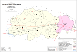
Bahadurpur, also called Bahadurpur Da Jayas, is a village and corresponding community development block in Tiloi tehsil of Rae Bareli district, Uttar Pradesh, India. It is located 3 km from the town of Jais. As of 2011, its population is 17,595, in 2,951 households. The main staple foods are wheat and rice.
Chak Mamha is a village in Bahadurpur block of Rae Bareli district, Uttar Pradesh, India. As of 2011, its population is 663, in 99 households. It has one primary school and no healthcare facilities.
Chak Dahiramau is a village in Bahadurpur block of Rae Bareli district, Uttar Pradesh, India. As of 2011, its population is 532, in 106 households. It has one primary school and no healthcare facilities.

Bargadha is a village in Harchandpur block of Rae Bareli district, Uttar Pradesh, India. As of 2011, its population is 847, in 141 households. It has one primary school and no healthcare facilities.

Bandramau is a village in Rahi block of Rae Bareli district, Uttar Pradesh, India. It is located 8 km from Rae Bareli, the district headquarters. As of 2011, it has a population of 3,101 people, in 543 households. It has one primary school and no healthcare facilities.