Chilauli Chiluli | |
|---|---|
Village | |
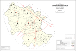 Map showing Chilauli (#059) in Singhpur CD block | |
 Chilauli Location in Uttar Pradesh, India | |
| Coordinates: 26°24′57″N81°27′22″E / 26.415893°N 81.456196°E [1] | |
| Country India | |
| State | Uttar Pradesh |
| District | Raebareli |
| Area | |
• Total | 5.293 km2 (2.044 sq mi) |
| Population (2011) [2] | |
• Total | 3,429 |
| • Density | 650/km2 (1,700/sq mi) |
| Languages | |
| • Official | Hindi |
| Time zone | UTC+5:30 (IST) |
| PIN | 229308 [2] |
| Vehicle registration | UP-35 |
Chilauli is a village in Singhpur block of Rae Bareli district, Uttar Pradesh, India. [2] As of 2011, its population is 3,429, in 627 households. [2] It has one primary school and no healthcare facilities. [2]
The 1961 census recorded Chilauli as comprising 11 hamlets, with a total population of 1,398 people (702 male and 696 female), in 321 households and 310 physical houses. [3] The area of the village was given as 1,416 acres. [3]
The 1981 census recorded Chilauli as having a population of 1,824 people, in 387 households, and having an area of 370.29 hectares. [4]