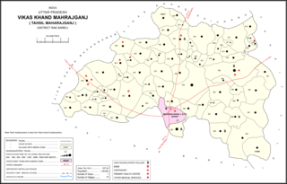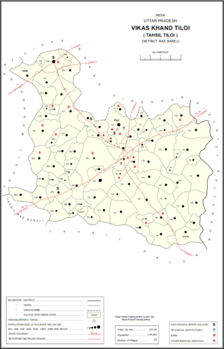
Maharajganj is a town and nagar panchayat in Rae Bareli district, Uttar Pradesh, India. It serves as the headquarters of a tehsil. As of 2011, its population is 6,673, in 1,037 households.
Parsadepur, also spelled Parshadepur, is a town and a nagar panchayat in Rae Bareli district in the Indian state of Uttar Pradesh. It is located on the north bank of the Sai river, at the crossroads between the road from Salon to Jais and the smaller road from Raebareli to Ateha. Historically noted for its large weaving industry, Parsadepur served as the headquarters of a pargana since the late 18th century. As of 2011, its population is 11,853 people, in 1,738 households.

Mainahar Katra is a village in Bachhrawan block of Rae Bareli district, Uttar Pradesh, India. As of 2011, its population is 2,197, in 382 households. It historically formed a taluqdar estate.

Saidpur Behta is a village in Bachhrawan block of Rae Bareli district, Uttar Pradesh, India. As of 2011, its population is 612, in 118 households. It historically belonged to the taluqdars of Tirbediganj.

Deopuri, also spelled Devpuri, is a village in Bachhrawan block of Rae Bareli district, Uttar Pradesh, India. As of 2011, its population is 1,188, in 244 households. Located 2 km from Bachhrawan, Deopuri was historically the last village held by the zamindars descended from Qazi Sultan, the first zamindar of the pargana of Thulendi in the 1400s.

Karanpur is a village in Bachhrawan block of Rae Bareli district, Uttar Pradesh, India. Located 23 km from the city of Raebareli, Karanpur was historically one of the main villages in the Bachhrawan pargana. As of 2011, Karanpur's population is 4,171, in 791 households.

Rampur Sudauli is a village in Bachhrawan block of Rae Bareli district, Uttar Pradesh, India. One of the main villages in the historical pargana of Bachhrawan, Rampur Sudauli is located at the corner of three districts: Raebareli, Lucknow and Unnao This spot is 15 km from Bachhrawan, at the point where the Sai river first enters the district.

Bahadurnagar is a village in Bachhrawan block of Rae Bareli district, Uttar Pradesh, India. Located 8 km from Bachhrawan, the block headquarters, Bahadurnagar hosts a market on Mondays and Thursdays. It was historically one of the main villages in the Bachhrawan pargana. As of 2011, Bahadurnagar's population is 4,508, in 964 households.

Sheikhpur Samodha is a village in Bachhrawan block of Rae Bareli district, Uttar Pradesh, India. Historically one of the main villages in the pargana of Bachhrawan, Sheikhpur Samodha hosts no market and is connected to minor district roads. It is located 4 km from Bachhrawan, the block headquarters. As of 2011, Sheikhpur Samodha's population is 6,931, in 1,376 households.

Atrehta is a village in Maharajganj block of Rae Bareli district, Uttar Pradesh, India. Located 1 km from Maharajganj, the block headquarters, it is the village whose lands the Maharajganj bazar was originally founded on. As of 2011, Atrehta has a population of 5,628, in 1,056 households. It has two primary schools and no healthcare facilities.

Thulendi is a village in Bachhrawan block of Rae Bareli district, Uttar Pradesh, India. It is located 6 km from Bachhrawan, the block headquarters, on an elevated plain with clayey soil. A historic village, Thulendi served as a pargana headquarters from the early 1400s until the late 1700s, and it has several old monuments including a fort built under the Jaunpur Sultanate and two large tanks othat are said to be even older. As of 2011, Thulendi's population was 6,616, in 1,195 households.

Kumhrawan is a village in Shivgarh block of Rae Bareli district, Uttar Pradesh, India. Formerly a pargana headquarters, it consists of a main village and several scattered hamlets. As of 2011, Kumhrawan has a population of 2,441, in 426 households.

Chandapur is a village in Maharajganj block of Rae Bareli district, Uttar Pradesh, India. Located 4 miles (6.4 km) east of Maharajganj, the block headquarters, it historically was the seat of the Kanhpuria rajas of Chandapur. In 2011, Chandapur had a population of 2,342, in 425 households. It has two primary schools and no healthcare facilities. It has a bazar known as Sheodarshanganj, which holds markets twice per week. The village also hosts the Anna Purna Devi fair on Phalguna Badi 13, which is associated with Maha Shivaratri. Vendors bring sweets, toys and everyday items to sell at the fair.

Hardoi is a village in Maharajganj block of Rae Bareli district, Uttar Pradesh, India. Located on the road from Maharajganj to Bachhrawan, Hardoi historically served as the seat of a pargana and has a now-ruined fort built in the early 1400s under the Jaunpur Sultanate. As of 2011, its population is 2,308, in 415 households.

Tiloi is a town and tehsil headquarters in Amethi district of Uttar Pradesh, India. Located near Mohanganj on the Jais-Inhauna road, Tiloi is notable as the historical seat of a major taluqdari estate held by the Kanhpurias. As of 2011, its population was 6,956, in 1,257 households.

Semrauta is a village in Tiloi block of Rae Bareli district, Uttar Pradesh, India. It is located at the intersection of the Maharajganj-Inhauna and Mohanganj-Haidargarh roads, about 20 km from Maharajganj, the tehsil headquarters. Although now eclipsed by Maharajganj, Semrauta was historically a relatively important village that served as the headquarters of a pargana and the capital of a branch of the Kanhpuria Rajputs, who later became known as the Rajas of Chandapur. As of 2011, the population of Simrauta is 6,423, in 1,031 households.

Khiron is a village and corresponding community development block in Rae Bareli district, Uttar Pradesh, India. Located on the main Raebareli-Unnao road,semari Khiron is an old Muslim town that historically served as the seat of a pargana. As of 2011, the village has a population of 9,955, in 1,714 households. It has six primary schools and one medical clinic. It serves as the headquarters of a nyaya panchayat that also includes 11 other villages.

Kahinjar is a village in Sareni block of Rae Bareli district, Uttar Pradesh, India. It is located 20 km from Lalganj, the tehsil headquarters. Kahinjar historically served as the headquarters of a mahal since at least the time of Akbar, before being merged into the pargana of Sareni under the Nawabs of Awadh. As of 2011, Kahinjar has a population of 2,099 people, in 354 households. It has one primary school and no healthcare facilities. It belongs to the nyaya panchayat of Rasulpur.

Nisgar is a village in Sareni block of Rae Bareli district, Uttar Pradesh, India. It is located on the bank of the Ganges, 23 km from the tehsil headquarters at Lalganj. Nisgar is mentioned in the late 16th-century Ain-i-Akbari as the seat of a mahal in the sarkar of Lucknow. It was later merged into the pargana of Sareni under the Nawabs of Awadh in the 1700s.

Singhaur Tara is a village in Sareni block of Rae Bareli district, Uttar Pradesh, India. It is located on the bank of the Ganges, 18 km from the tehsil headquarters at Lalganj. Singhaur Tara is probably identical with the mahal called "Tara Singhaur" Ain-i-Akbari in the late 16th century. This mahal was in the sarkar of Lucknow. It was later merged into the pargana of Sareni under the Nawabs of Awadh in the 1700s.


