Chak Dahiramau Chak Dahirāmau | |
|---|---|
Village | |
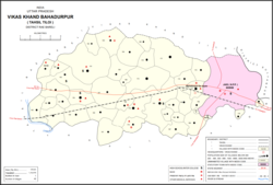 Map showing Chak Dahiramau (#166) in Bahadurpur CD block | |
 Chak Dahiramau Location in Uttar Pradesh, India | |
| Coordinates: 26°16′16″N81°26′53″E / 26.271106°N 81.448004°E [1] | |
| Country India | |
| State | Uttar Pradesh |
| District | Raebareli |
| Area | |
• Total | 0.686 km2 (0.265 sq mi) |
| Population (2011) [2] | |
• Total | 532 |
| • Density | 776/km2 (2,010/sq mi) |
| Languages | |
| • Official | Hindi |
| Time zone | UTC+5:30 (IST) |
| PIN | 229308 [2] |
| Vehicle registration | UP-35 |
Chak Dahiramau is a village in Bahadurpur block of Rae Bareli district, Uttar Pradesh, India. [2] As of 2011, its population is 532, in 106 households. [2] It has one primary school and no healthcare facilities. [2]
The 1961 census recorded Chak Dahiramau as comprising 1 hamlet, with a total population of 173 people (95 male and 78 female), in 41 households and 41 physical houses. [3] The area of the village was given as 178 acres. [3]
The 1981 census recorded Chak Dahiramau as having a population of 302 people, in 59 households, and having an area of 69.61 hectares. [4]