
Sareni is a village and corresponding community development block in Lalganj tehsil of Rae Bareli district, Uttar Pradesh, India. Historically the seat of a pargana, it is located 18 km from Lalganj, the tehsil headquarters, on the road to Daundia Khera in Unnao district. As of 2011, Sareni has a population of 4,819 people, in 792 households. It has 3 primary schools and no healthcare facilities. It serves as the headquarters of a nyaya panchayat which also includes 10 other villages.
Rasulpur is a village in Sareni block of Rae Bareli district, Uttar Pradesh, India. It is located 19 km from Lalganj, the tehsil headquarters. As of 2011, Rasulpur has a population of 1,343 people, in 257 households. It has two primary schools and no healthcare facilities. Rasulpur serves as the headquarters of a nyaya panchayat which also includes 12 other villages.
Pithupur is a village in Sareni block of Rae Bareli district, Uttar Pradesh, India. It is located 18 km from Lalganj, the tehsil headquarters. As of 2011, it has a population of 928 people, in 185 households. It has one primary school and no healthcare facilities. It belongs to the nyaya panchayat of Bhoremau.
Birnawan is a village in Sareni block of Rae Bareli district, Uttar Pradesh, India. It is located 19 km from Lalganj, the tehsil headquarters. As of 2011, it has a population of 485 people, in 92 households. It has two primary schools and no healthcare facilities. It belongs to the nyaya panchayat of Rasulpur.
Palti Khera is a village in Sareni block of Rae Bareli district, Uttar Pradesh, India. It is located 18 km from Lalganj, the tehsil headquarters. As of 2011, it has a population of 2,641 people, in 523 households. It has one primary school and no healthcare facilities. It belongs to the nyaya panchayat of Murarmau.
Kanjas is a village in Sareni block of Rae Bareli district, Uttar Pradesh, India. It is located 17 km from Lalganj, the tehsil headquarters. As of 2011, it has a population of 1,023 people, in 174 households. It has one primary school and no healthcare facilities. It belongs to the nyaya panchayat of Sagar Khera.
Raipur is a village in Sareni block of Rae Bareli district, Uttar Pradesh, India. It is located 21 km from Lalganj, the tehsil headquarters. As of 2011, it has a population of 1,672 people, in 408 households. It serves as the headquarters of a nyaya panchayat which also includes 11 other villages.
Musapur is a village in Sareni block of Rae Bareli district, Uttar Pradesh, India. It is located 15 km from Lalganj, the tehsil headquarters. As of 2011, it has a population of 1,944 people, in 340 households. It has one primary school and no healthcare facilities. It belongs to the nyaya panchayat of Sagar Khera.
Ranjitpur is a village in Sareni block of Rae Bareli district, Uttar Pradesh, India. It is located 20 km from Lalganj, the tehsil headquarters. As of 2011, it has a population of 1,122 people, in 196 households. It has 2 primary schools and no healthcare facilities, and it hosts a regular market but not a weekly haat. It belongs to the nyaya panchayat of Rasulpur.
Chhatauna is a village in Sareni block of Rae Bareli district, Uttar Pradesh, India. It is located 24 km from Lalganj, the tehsil headquarters. As of 2011, it has a population of 1,002 people, in 182 households. It has one primary school and no healthcare facilities, and it does not host a permanent market or a weekly haat. It belongs to the nyaya panchayat of Bhojpur.
Gonda is a village in Sareni block of Rae Bareli district, Uttar Pradesh, India. It is located 22 km from Lalganj, the tehsil headquarters. As of 2011, it has a population of 403 people, in 88 households. It has no schools and no healthcare facilities, and does not host a weekly haat or a permanent market. It belongs to the nyaya panchayat of Raipur.
Hamirgaon is a village in Sareni block of Rae Bareli district, Uttar Pradesh, India. It is located 16 km from Lalganj, the tehsil headquarters. As of 2011, it has a population of 2,700 people, in 476 households. It has one primary school and no healthcare facilities, and does not host a weekly haat or a permanent market. It belongs to the nyaya panchayat of Raipur.
Kasba Badlu is a village in Sareni block of Rae Bareli district, Uttar Pradesh, India. It is located 24 km from Lalganj, the tehsil headquarters. As of 2011, it has a population of 695 people, in 120 households. It has one primary school and a primary health centre, and it does not host a weekly haat or a permanent market. It belongs to the nyaya panchayat of Nibi.
Kashi Khera is a village in Sareni block of Rae Bareli district, Uttar Pradesh, India. It is located 28 km from Lalganj, the tehsil headquarters. As of 2011, it has a population of 708 people, in 126 households. It has one primary school and no healthcare facilities, and it does not host a weekly haat or a permanent market. It belongs to the nyaya panchayat of Nibi.
Madai Khera is a village in Sareni block of Rae Bareli district, Uttar Pradesh, India. It is located 14 km from Lalganj, the tehsil headquarters. As of 2011, it has a population of 1,322 people, in 269 households. It does hosts a permanent market as well as a weekly haat. It belongs to the nyaya panchayat of Sareni.
Dhanpalpur is a village in Sareni block of Rae Bareli district, Uttar Pradesh, India. It is located 17 km from Lalganj, the tehsil headquarters. As of 2011, it has a population of 2,552 people, in 454 households. It has one primary school and no healthcare facilities, and does not host a weekly haat or a permanent market. It belongs to the nyaya panchayat of Sareni.
Ramaipur Kalan is a village in Sareni block of Rae Bareli district, Uttar Pradesh, India. It is located 15 km from Lalganj, the tehsil headquarters. As of 2011, it has a population of 1,579 people, in 251 households. It has one primary school and no healthcare facilities, and does not host a weekly haat or a permanent market. It belongs to the nyaya panchayat of Sareni.
Rasigaon is a village in Sareni block of Rae Bareli district, Uttar Pradesh, India. As of 2011, it has a population of 1,727 people, in 340 households. It has one primary school and no healthcare facilities and does not host a weekly haat or a permanent market. It belongs to the nyaya panchayat of Malkegaon.
Singhaur Tara is a village in Sareni block of Rae Bareli district, Uttar Pradesh, India. It is located on the bank of the Ganges, 18 km from the tehsil headquarters at Lalganj. Singhaur Tara is probably identical with the mahal called "Tara Singhaur" Ain-i-Akbari in the late 16th century. This mahal was in the sarkar of Lucknow. It was later merged into the pargana of Sareni under the Nawabs of Awadh in the 1700s.
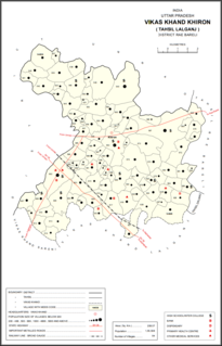
Manpur is a village in Khiron block of Rae Bareli district, Uttar Pradesh, India. It is located 13 km from Lalganj, the tehsil headquarters. As of 2011, it has a population of 1,188 people, in 192 households. It has 1 primary school and no healthcare facilities and it does not host a weekly haat or a permanent market. It belongs to the nyaya panchayat of Semari.


