List of natural parks of the Philippines

Last updated

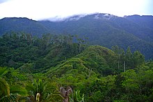
Mount Iglit, part of the Mounts Iglit-Baco Natural Park Mount Iglit - (Mounts Iglit - Baco National Park, Occidental Mindoro, Philippines) - panoramio.jpg
Mount Iglit, part of the Mounts Iglit–Baco Natural Park

In the Philippines, Natural Parks as defined by law are relatively large areas not materially altered by human activity. The extraction of natural resources is not allowed in these areas and they are maintained to protect outstanding natural and scenic areas of national or international significance for scientific, educational, and recreational use. [1]

Contents

Natural parks

   World Heritage Site or part of a World Heritage Site.

NameAreaEstablishedLocationCoordinates
ProvincesIsland Group
Kalbario-Patapat Natural Park [1] 3,903.19 ha
(9,645.0 acres)
April 20, 2007Luzon 18°31′57″N120°54′50″E / 18.53250°N 120.91389°E / 18.53250; 120.91389 (Kalbario-Patapat Natural Park)
Tumauini Watershed Natural Park [1] 6,509.38 ha
(16,085.0 acres)
April 20, 2007Luzon 17°18′N122°00′E / 17.3°N 122°E / 17.3; 122 (Tumauini Watershed Natural Park)
Bataan Natural Park [1] 20,004.17 ha
(49,431.4 acres)
April 20, 2007Luzon 14°39′N120°36′E / 14.650°N 120.600°E / 14.650; 120.600
Apo Reef Natural Park [1] 15,799.23 ha
(39,040.7 acres)
April 20, 2007Mindoro 12°42′N120°24′E / 12.7°N 120.4°E / 12.7; 120.4 (Apo Reef Natural Park)
Mounts Iglit–Baco Natural Park [1] 106,655.62 ha
(263,551.8 acres)
April 20, 2007Mindoro 12°54′N121°13′E / 12.900°N 121.217°E / 12.900; 121.217 (Mounts Iglit–Baco Natural Park)
Mount Guiting-Guiting Natural Park [1] 15,799.23 ha
(39,040.7 acres)
April 20, 2007Sibuyan 12°25′N122°30′E / 12.41°N 122.5°E / 12.41; 122.5 (Mount Guiting-Guiting Natural Park)
Bicol Natural Park [1] 5,466.35 ha
(13,507.6 acres)
April 20, 2007Luzon 13°55′32″N122°58′17″E / 13.92556°N 122.97139°E / 13.92556; 122.97139 (Bicol Natural Park)
Mount Isarog Natural Park [1] 10,090.89 ha
(24,935.1 acres)
April 20, 2007Luzon 13°39′33″N123°22′24″E / 13.65917°N 123.37333°E / 13.65917; 123.37333 (Mount Isarog Natural Park)
Catanduanes Natural Park [1] 48,924.09 ha
(120,894.1 acres)
April 20, 2007Catanduanes 13°48′N122°24′E / 13.8°N 122.4°E / 13.8; 122.4 (Catanduanes Natural Park)
Bongsanglay Natural Park [1] 518.90 ha
(1,282.2 acres)
April 20, 2007Masbate 12°23′9″N123°46′58″E / 12.38583°N 123.78278°E / 12.38583; 123.78278 (Bongsanglay Natural Park)
Bulusan Volcano Natural Park [1] 3,641.47 ha
(8,998.3 acres)
April 20, 2007Luzon 12°46′12″N124°0′0″E / 12.77000°N 124.00000°E / 12.77000; 124.00000 (Bulusan Volcano Natural Park)
Northwest Panay Peninsula Natural Park [1] 12,009.29 ha
(29,675.6 acres)
April 20, 2007Panay 11°40′25″N121°59′55″E / 11.67361°N 121.99861°E / 11.67361; 121.99861 (Northwest Panay Peninsula Natural Park)
Sibalom Natural Park [1] 6,778.44 ha
(16,749.9 acres)
April 20, 2007Panay 18°31′57″N120°54′50″E / 18.53250°N 120.91389°E / 18.53250; 120.91389 (Sibalom Natural Park)
Northern Negros Natural Park [1] 70,826.16 ha
(175,015.3 acres)
April 20, 2007Negros 10°38′00″N123°13′00″E / 10.63333°N 123.21667°E / 10.63333; 123.21667 (Northern Negros Natural Park)
Balinsasayao Twin Lakes Natural Park [1] 8,016.05 ha
(19,808.1 acres)
April 20, 2007Negros 9°21′16″N123°10′46″E / 9.35444°N 123.17944°E / 9.35444; 123.17944 (Balinsasayao Twin Lakes Natural Park)
Lake Danao Natural Park [1] 8,016.05 ha
(19,808.1 acres)
April 20, 2007Leyte 11°06′N124°42′E / 11.1°N 124.7°E / 11.1; 124.7 (Lake Danao Natural Park)
Mahagnao Volcano Natural Park [1] 340.82 ha
(842.2 acres)
April 20, 2007Leyte 10°52′26″N124°51′35″E / 10.87389°N 124.85972°E / 10.87389; 124.85972 (Mahagnao Volcano Natural Park)
Samar Island Natural Park [1] 335,105.57 ha
(828,063.9 acres)
April 20, 2007Samar 12°2′10″N125°12′40″E / 12.03611°N 125.21111°E / 12.03611; 125.21111 (Samar Island Natural Park)
Pasonanca Natural Park [1] 12,102.08 ha
(29,904.9 acres)
April 20, 2007Mindanao 7°4′16″N122°4′32″E / 7.07111°N 122.07556°E / 7.07111; 122.07556 (Pasonanca Natural Park)
Mount Kalatungan Range Natural Park [1] 22,225.11 ha
(54,919.4 acres)
April 20, 2007Mindanao 7°54′N124°48′E / 7.9°N 124.8°E / 7.9; 124.8 (Mount Kalatungan Range Natural Park)
Mount Inayawan Range Natural Park [1] 4,236.19 ha
(10,467.9 acres)
April 20, 2007Mindanao 7°49′10″N123°55′34″E / 7.81944°N 123.92611°E / 7.81944; 123.92611 (Mount Inayawan Range Natural Park)
Mount Balatukan Range Natural Park [1] 8,437.86 ha
(20,850.4 acres)
April 20, 2007Mindanao 8°48′N124°54′E / 8.8°N 124.9°E / 8.8; 124.9 (Mount Balatukan Range Natural Park)

See also

Related Research Articles

<span class="mw-page-title-main">Davao Oriental</span> Province of Davao Region, Philippines

Davao Oriental, officially the Province of Davao Oriental, is a province in the Philippines located in the Davao Region in Mindanao. Its capital is the city of Mati which is the most populous, and it borders the province of Davao de Oro to the west, and Agusan del Sur and Surigao del Sur to the north. The province is the traditional homeland of the Mandaya and Kalagan/Kaagan.

<span class="mw-page-title-main">Mount Makiling</span> Inactive volcano in the Philippines

Mount Makiling is an inactive stratovolcano located in the provinces of Laguna and Batangas on the island of Luzon in the Philippines. The mountain rises to an elevation of 1,090 meters (3,580 ft) above mean sea level and is the highest feature of the Laguna Volcanic Field. The volcano has no recorded historic eruption but volcanism is still evident through geothermal features like mud spring and hot springs. South of the mountain is the Makiling–Banahaw Geothermal Plant. The Philippine Institute of Volcanology and Seismology (PHIVOLCS) classifies the volcano as "Inactive".

<span class="mw-page-title-main">Ancient Monuments Protection Act 1882</span> Act of the Parliament of the United Kingdom

The Ancient Monuments Protection Act 1882 was an Act of the Parliament of the United Kingdom of Great Britain and Ireland. It was introduced by John Lubbock, 1st Baron Avebury, recognising the need for a governmental administration on the protection of ancient monuments, and was finally passed after a number of failed attempts on heritage protection acts. The gradual change towards a state-based authority responsible for the safeguarding of the Kingdom's national heritage manifested itself through the appointment of the first Inspector of Ancient Monuments in 1882, General Pitt Rivers.

<span class="mw-page-title-main">National Heritage List (Australia)</span> National heritage register of Australia

The Australian National Heritage List or National Heritage List (NHL) is a heritage register, a list of national heritage places deemed to be of outstanding heritage significance to Australia, established in 2003. The list includes natural and historic places, including those of cultural significance to Indigenous Australians such as Aboriginal Australian sacred sites. Having been assessed against a set list of criteria, once a place is put on the National Heritage List, the provisions of the Environment Protection and Biodiversity Conservation Act 1999 apply.

<span class="mw-page-title-main">Apo Reef</span> Coral reef in the Philippines

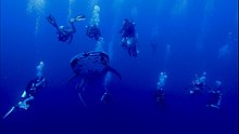
Apo Reef is a coral reef system in the Philippines situated in the western waters of Occidental Mindoro province in the Mindoro Strait. Encompassing 34 km2 (13 sq mi), it is considered the world's second-largest contiguous coral reef system, and is the largest in the country. The reef and its surrounding waters are protected areas administered as the Apo Reef Natural Park (ARNP). It is one of the best known and most popular diving regions in the country, and is on the tentative list for UNESCO World Heritage Sites.

<span class="mw-page-title-main">Mounts Iglit–Baco Natural Park</span> Nature reserve in Mindoro island, Philippines

The Mounts Iglit–Baco Natural Park (MIBNP) is a legislated protected area of the Philippines and an ASEAN Heritage Park located in the island of Mindoro in the central Philippines. It was first established in 1970 by virtue of Republic Act No. 6148 as a national park that covered an area of 75,445 hectares surrounding Mount Iglit and Mount Baco in the interior of Mindoro. The park is the home of the largest remaining population of the critically endangered tamaraw. In 2003, the Association of Southeast Asian Nations listed it as one of its four heritage parks in the Philippines. The park has also been nominated to the Tentative List of UNESCO World Heritage Sites in 2006. In 2018, the park was designated as a "Natural Park" under the Republic Act No. 11038 or the Expanded National Integrated Protected Areas Systems (ENIPAS) Act of 2018, which increased the area to 106,656 hectares.

<span class="mw-page-title-main">Mayon Volcano Natural Park</span> Natural park in Bicol Region, Philippines

The Mayon Volcano Natural Park is a protected area of the Philippines located in the Bicol Region on southeast Luzon Island, the largest island of the country. The Natural park covers an area of 5,775.7 hectares, which includes its centerpiece Mayon Volcano, the most active volcano in the Philippines, and its adjacent surroundings. The volcano is also renowned for having an almost perfect cone. First protected as a National Park in 1938, it was reclassified as a Natural Park in the year 2000.

A Historic Site or Monument (HSM) is a protected location of historic interest on the continent of Antarctica, or on its adjacent islands. The list of historic sites was first drawn up in 1972, and has since expanded to cover 95 sites, with the most recent listed in 2021. Five sites have been removed from the list for various reasons.

A Regional Reserve is a type of protected area used in South Australia that allows the use of natural resources in conjunction with the protected area's conservation function. This class of protected area was first used in 1988 for the Innamincka Regional Reserve and as of 2015, there are seven regional reserves that cover an area of 93,400 square kilometres (36,062 sq mi) or 9.5% of South Australia's land area.

Natural Habitat Conservation Areas or Natural Habitat Protection Areas in Japan are designated by the Ministry of the Environment to protect species of flora and fauna designated National Endangered Species, in accordance with the 1992 Act on Conservation of Endangered Species of Wild Fauna and Flora. Both managed protection zones and buffer monitoring zones are established.

Protected Forests are areas of national forest in Japan so designated in an effort to conserve biodiversity. Japan's Protected Forest system includes three categories of protected forests: Forest Biosphere Reserves; Biotic Community Protection Forests; and Rare Population Protection Forests. Some of these national forests are linked by a network of Green Corridors that are also included in the system. Established in 1915, the system was overhauled in 2015 and expanded in 2019.

References

  1. 1 2 3 4 5 6 7 8 9 10 11 12 13 14 15 16 17 18 19 20 21 22 23 Republic Act No. 11038 (March 21, 2018), Expanded National Integrated Protected Areas System Act of 2018

>!-- while editing in userspace -->