List of unincorporated communities in Alabama

Last updated

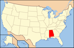
Map of the United States with Alabama highlighted Map of USA AL.svg
Map of the United States with Alabama highlighted

Unincorporated communities lacking elected municipal officers and boundaries with legal status, but are not classified as Census-designated places (CDPs). [1]

Place Name County(ies)
Abel Clay County
Abernant Tuscaloosa County
Acmar St. Clair County
Ada Montgomery County
Adger Jefferson County
Alabama City Etowah County
Alabama Port Mobile County
Alberta Wilcox County
Alden Jefferson County
Allen Clarke County
Alma Clarke County
Almond Randolph County
Alpine Talladega County
Alton Jefferson County
Anne Manie Wilcox County
Aquilla Washington County
Arkadelphia Cullman County
Arlington Wilcox County
Armstrong Macon County
Awin Wilcox County
Bangor Blount County
Bankston Fayette County
Barfield Clay County
Barnett's Crossroads Escambia County
Barlow Washington County
Barney Walker County
Bassetts Creek Washington County
Battens Crossroads Geneva County
Bazemore Fayette County
Belle Mina Limestone County
Belleville Conecuh County
Bellwood Geneva County
Beulah Lee County
Big Cove Madison County
Bigbee Washington County
Birmingport Jefferson County
Bladon Springs Choctaw County
Blount Springs Blount County
Bluff Fayette County
Bolinger Choctaw County
Bolling Butler County
Bon Secour Baldwin County
Booth Autauga County
Bradford Jefferson County
Bradley Escambia County
Braggs Lowndes County
Bremen Cullman County
Branchville St. Clair County
Brierfield Bibb County
Bromley Baldwin County
Brooklyn Conecuh County
Brooksville Blount County
Browns Dallas County
Brownsboro Madison County
Bryant Jackson County
Buena Vista Monroe County
Buhl Tuscaloosa County
Bull Slough Conecuh County
Burkville Lowndes County
Bermuda Conecuh County
Burgreen Gin Limestone County
Burningtree Mountain Morgan County
Burnt Corn Monroe County
Burntout Franklin County
Burnwell Walker County
Caddo Lawrence County
Cahaba Dallas County
Campbell Clarke County
Capshaw Limestone County
Cecil Montgomery County
Centerville Conecuh County
Chancellor Geneva County
Chapman Butler County
Claud Elmore County
Clopton Dale County
Cloverdale Lauderdale County
Coden Mobile County
Cook Springs St. Clair County
Corner Jefferson County
Cottondale Tuscaloosa County
Cottonton Russell County
Coy Wilcox County
Cragford Clay County
Crane Hill Cullman County
Crawford Russell County
Cromwell Choctaw County
Cropwell St. Clair County
Crosston Jefferson County
Dallas Blount County
Danville Morgan County
Dawson DeKalb County
De Armanville Calhoun County
Delmar Winston County
Dickinson Clarke County
Dixiana Jefferson County
Dixons Mills Marengo County
Docena Jefferson County
Dolomite Jefferson County
Duncanville Tuscaloosa County
Eastaboga Calhoun County
Eight Mile Mobile County
Elgin Lauderdale County
Empire Walker County
Equality Coosa County
Flat Rock Jackson County
Fort McClellan Calhoun County
Fort Mitchell Russell County
Fort Morgan Baldwin County
Franklin Monroe County
French Mill Limestone County
Gallion Hale County
Gorham's Bluff Jackson County
Grady Montgomery County
Greenhill Lauderdale County
Green Pond Bibb County
Grove Oak DeKalb County
Gum Springs Blount County
Hatchechubbee Russell County
Higdon Jackson County
Highland Home Crenshaw County
Holy Trinity Russell County
Hoods Crossroads Blount County
Hope Hull Montgomery County
Houston Winston County
Hulaco Morgan County
Inverness Bullock County
Inverness Shelby County
Irvington Mobile County
Jack Coffee County
Java Coffee County
Kellerman Tuscaloosa County
Kent Elmore County
Kimbrough Wilcox County
Knoxville Greene County
Lacey's Spring Morgan County
Lacon Morgan County
Lake Purdy Shelby County
Le Moyne Mobile County
Lenox Conecuh County
Letohatchee Lowndes County
Lillian Baldwin County
Lower Peachtree Wilcox County
Majestic Jefferson County
Marion Junction Dallas County
Marvyn Lee County
Masseyline Jefferson County
McCalla Jefferson County
Mellow Valley Clay County
Millers Ferry Wilcox County
Mon Louis Mobile County
Montrose Baldwin County
Morgan City Morgan County
Moulton Heights Morgan County
Mount High Blount County
Mount Hope Lawrence County
Mount Meigs Montgomery County
Mountain Creek Chilton County
Newell Randolph County
Normal Madison County
Oak Grove Jefferson County
Oakville Lawrence County
Orion Pike County
Palmerdale Jefferson County
Perote Bullock County
Peterson Tuscaloosa County
Plantersville Dallas County
Prairieville Hale County
Quinton Walker County
Ralph Tuscaloosa County
Ramer Montgomery County
Range Conecuh County
Red Hill Blount County
Remlap Blount County
Safford Dallas County
Saginaw Shelby County
Salem Lee County
Samantha Tuscaloosa County
Sawyerville Hale County
Sayre Jefferson County
Seale Russell County
Selfville Blount County
Seminole Baldwin County
Semmes Mobile County
Snow Hill Wilcox County
Spring Hill Barbour County
Spring Valley Colbert County
Sprott Perry County
St. Clair Springs St. Clair County
Stapleton Baldwin County
Stockton Baldwin County
Straight Mountain Blount County
Summit Blount County
Tannehill Tuscaloosa County
Tanner Limestone County
Tensaw Baldwin County
Valhermoso Springs Morgan County
Verbena Chilton County
Village Springs Jefferson County
Vineland Marengo County
Vinemont Cullman County
Wagarville Washington County
Wallace Escambia County
Watson Jefferson County
Waugh Montgomery County
Wilmer Mobile County
Winterboro Talladega County
Wren Lawrence County
Yellow Pine Washington County

See also

Related Research Articles

<span class="mw-page-title-main">Baldwin County, Alabama</span> County in Alabama, United States

Baldwin County is a county located in the southwestern part of the U.S. state of Alabama, on the Gulf coast. It is one of only two counties in Alabama that border the Gulf of Mexico, along with Mobile County. As of the 2020 census, the population was 231,767, making it the fourth-most populous county in Alabama. The county seat is Bay Minette. The county is named after the founder of the University of Georgia, Senator Abraham Baldwin.

<span class="mw-page-title-main">Edgewater, Alabama</span> CDP in Alabama, United States

Edgewater is a census-designated place in Jefferson County, Alabama, United States. It is northeast from the Birmingham suburb of Pleasant Grove. Its population was 883 at the 2010 census. This area was damaged by tornadoes on April 15, 1956 and April 8, 1998. The 1998 tornado was rated F5 on the Fujita scale.

<span class="mw-page-title-main">Rock Creek, Alabama</span> CDP in Alabama, United States

Rock Creek is a census-designated place in Jefferson County, Alabama, United States. Its location is northwest of Hueytown. At the 2020 census, the population was 1,471. This area was damaged by an F5 tornado on April 8, 1998. An EF2 tornado struck northwest from here on January 23, 2012.

The following is a set–index article, providing a list of lists, for the cities, towns and villages within the jurisdictional United States. It is divided, alphabetically, according to the state, territory, or district name in which they are located.

<span class="mw-page-title-main">Tuscaloosa, Alabama metropolitan area</span> Metropolitan Statistical Area in Alabama, United States

The Tuscaloosa metropolitan area, as defined by the United States Census Bureau, is an area consisting of three counties in west central Alabama, anchored by the city of Tuscaloosa. As of the 2020 census, the MSA had a population of 268,674.

<span class="mw-page-title-main">Equality, Alabama</span> Census-designated place in Alabama, United States

Equality is a census-designated place in Coosa County, Alabama, United States. It was first named as a CDP in the 2020 Census which listed a population of 150. The Equality post office serves the ZIP Code of 36026, and its delivery area includes rural land to the south in Elmore County.

<span class="mw-page-title-main">Fredonia, Alabama</span> Census-designated place in Alabama, United States

Fredoniafree-DOH-nia is an unincorporated community and census-designated place in Chambers County, Alabama, United States. Its elevation is 794 feet (242 m), and it is located at 32°59′23″N85°17′19″W. As of the 2010 census, its population was 199. Other names for the community have included "Freedona" and "Hursts Store". It is the location of the New Hope Rosenwald School, which is listed on the National Register of Historic Places.

<span class="mw-page-title-main">Chunchula, Alabama</span> Census-designated place in Alabama, United States

Chunchula is an unincorporated community and census-designated place (CDP) in Mobile County, Alabama, United States. As of the 2020 census, its population was 195. It has a post office with the 36521 ZIP code. The community has one site listed on the Alabama Register of Landmarks and Heritage, the Chunchula School.

<span class="mw-page-title-main">Joppa, Alabama</span> Census-designated place in Alabama, United States

Joppa is a census-designated place (CDP) and unincorporated community in Cullman and Marshall counties, Alabama, United States. As of the 2020 census, its population was 556.

<span class="mw-page-title-main">Abanda, Alabama</span> Place in Alabama, United States

Abanda is a census-designated place and unincorporated community in Chambers County, Alabama, United States. Its population was 133 as of the 2020 census.

<span class="mw-page-title-main">Vandiver, Alabama</span> Census-designated place & Unincorporated community in Alabama, United States

Vandiver is a census-designated place (CDP) and unincorporated community in Shelby County, Alabama, United States. Its population was 1,084 as of the 2020 census. One structure in Vandiver, the Falkner School, is listed on the Alabama Register of Landmarks and Heritage.

<span class="mw-page-title-main">Shelby, Alabama</span> Census-designated place in Alabama, United States

Shelby is a census-designated place and unincorporated community in Shelby County, Alabama, United States. Its population was 1,044 as of the 2010 census. The area is near Lay Lake and Waxahatchee Creek. Shelby Iron Park is located at the heart of the area. Two sites in Shelby, The Brick House and the Old Shelby Hotel, are listed on the Alabama Register of Landmarks and Heritage.

<span class="mw-page-title-main">Sterrett, Alabama</span> Census-designated place in Alabama, United States

Sterrett is a census-designated place and unincorporated community in Shelby County, Alabama, United States. Its population was 712 as of the 2010 census.

Remlap is a census-designated place in Blount County, Alabama, United States, located along Alabama State Route 75, 11.7 miles (18.8 km) southwest of Oneonta. Remlap has a post office with ZIP code 35133.

Nixburg is a census-designated place in Coosa County, Alabama, United States.

Eagle Point is a census-designated place in Shelby County, Alabama, United States. It was first listed as a CDP prior to the 2020 census and is part of the Birmingham Metropolitan Area. The area was struck by a long-tracked low-end EF3 tornado on March 25, 2021, damaging or destroying several homes and downing trees. Five people were injured by the tornado.

References

  1. "Geographic Terms and Concepts– Place". United States Census Bureau. United States Department of Commerce. Retrieved February 24, 2014.