List of unincorporated communities in Oklahoma

Last updated

This innovative grain elevator was built circa 1920 near the small community of Ingersoll. Ingersoll Tile Grain Elevator.png
This innovative grain elevator was built circa 1920 near the small community of Ingersoll.

Unincorporated communities in Oklahoma do not have a formally organized municipal government. Rather, residents rely on the county government for services. State law allows unincorporated communities, under certain conditions, to incorporate or join another municipality

Contents

Many unincorporated communities were at one time incorporated but for various reasons no longer have a municipal government. Depopulation during the 1930s and 40s caused the loss of many communities and some no longer exist even as unincorporated communities. In Oklahoma, incorporated municipalities may petition for dissolution [1] or be declared dissolved after missing two concurrent municipal elections [2] (held April of odd numbered years). Platted unincorporated communities do have some right under the laws of Oklahoma that non-platted communities do not enjoy. A town plat is also one of the conditions required for incorporation.

Driving Cattle to Pasture near Bliss. Edison film Cattle Bliss OK 1904.png
Driving Cattle to Pasture near Bliss.

Although unincorporated communities have no municipal governments, they may organize their own water districts [3] or fire districts [4] and tax citizens to support them. Additionally, many communities have school districts with elected school boards. [5] Also, several unincorporated communities still have their own post offices. [6]

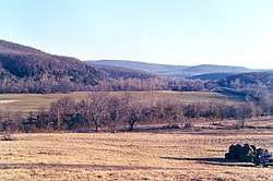
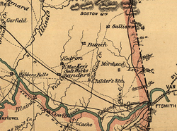
Many unincorporated communities (such as Boggy Depot, Tuskahoma, and Skullyville) played important roles in the development of Oklahoma and others, especially those with schools and post offices, continue to be important centers in rural Oklahoma.

"Oklahoma Municipal Government" from the Oklahoma Almanac published by the Oklahoma Department of Libraries is the source document for this list. Additional communities have been added using Wikipedia articles which cite authoritative sources. Geographic coordinates, if known, are provided for those place names which are unlikely to be communities.

List of unincorporated communities

A

CommunityCountyComments
Acme Grady 34°47′56″N98°01′09″W / 34.79889°N 98.01917°W / 34.79889; -98.01917
Adams Texas
Adamson Pittsburg
Adel Pushmataha 34°47′56″N98°01′09″W / 34.79889°N 98.01917°W / 34.79889; -98.01917
Agawan Grady
Ahloso Pontotoc
Ahpeatone Cotton 34°20′52″N98°33′04″W / 34.34778°N 98.55111°W / 34.34778; -98.55111
Akins Sequoyah
Albany Bryan
Albert Caddo
Alden Caddo 34°58′31″N98°35′07″W / 34.97528°N 98.58528°W / 34.97528; -98.58528
Aledo Dewey
Alfalfa Caddo
Allison Bryan
Alma Stephens
Alpers Carter 34°29′33″N97°23′14″W / 34.49250°N 97.38722°W / 34.49250; -97.38722
Alsuma Tulsa
Altona Kingfisher 35°46′59″N98°10′16″W / 35.78306°N 98.17111°W / 35.78306; -98.17111
Alwinn Stephens
Anchor Wagoner 35°50′08″N95°24′11″W / 35.83556°N 95.40306°W / 35.83556; -95.40306
Antioch Garvin
Apperson Osage
Apple Choctaw 34°07′39″N95°25′03″W / 34.12750°N 95.41750°W / 34.12750; -95.41750
Arlington Lincoln
Arpelar Pittsburg
Artillery Village Comanche
Atlee Jefferson 34°05′37″N97°37′57″W / 34.09361°N 97.63250°W / 34.09361; -97.63250
Aubrey Creek
Avery Lincoln
Avoca Pottawatomie
Aydelotte Pottawatomie
Geographic or historic reference undetermined.
Identified as abandoned by at least one source.

B

Bunch, Oklahoma, sets in the background near Sallisaw Creek in the Cookson Hills. Bunch, Oklahoma.jpg
Bunch, Oklahoma, sets in the background near Sallisaw Creek in the Cookson Hills.
CommunityCountyComments
Babbs Kiowa
Bache Pittsburg
Bacone Muskogee
Bailey Grady
Baker Texas
Baldhill Okmulgee 35°44′25″N95°50′14″W / 35.74028°N 95.83722°W / 35.74028; -95.83722
Balko Beaver
Ballard Adair
Banner Canadian
Banty Bryan
Barber Cherokee 35°45′26″N94°52′04″W / 35.75722°N 94.86778°W / 35.75722; -94.86778
Barnes Logan(Locale-USGS)
Baron Adair
Bartlett Okmulgee
Battiest McCurtain
Baugh Pawnee
Baum Carter
Beachton McCurtain
Beckett Stephens(Alternate name for Sunray, Oklahoma.)
Bee Johnston
Beland Muskogee
Bell Adair
Bellemont Pottawatomie
Belva Woodward 36°29′56″N98°58′30″W / 36.49889°N 98.97500°W / 36.49889; -98.97500
Belvue Creek
Belzoni Pushmataha 34°11′08″N95°27′56″W / 34.18556°N 95.46556°W / 34.18556; -95.46556
Bengal Latimer
Bentley Atoka
Berlin Roger Mills
Berwyn Carter(Present day Gene Autry, Oklahoma.)
Bethel Comanche
Bethel McCurtain
Bidding Springs Adair(See Golda's Mill.)
Big Cedar Le Flore(Stream-USGS)
Big Spring Hughes 35°10′27″N96°14′50″W / 35.17417°N 96.24722°W / 35.17417; -96.24722 (Church)
Binkley Lincoln(Railroad siding and switch.)
Bison Garfield
Blackgum Sequoyah
Blanco Pittsburg
Bliss Noble(Now known as Old Bliss, Oklahoma.)
Blocker Pittsburg
Blue Bryan
Bluff Choctaw
Boatman Mayes
Boehler Atoka 34°10′15″N95°53′01″W / 34.17083°N 95.88361°W / 34.17083; -95.88361
Boggy Depot Atoka
Bois D'Arc Kay(Stream-USGS.)
Bokhoma McCurtain
Bond McIntosh
Boone Caddo
Boss McCurtain
Boulevard Cleveland
Bowden Creek
Bowlin Spring Craig
Bowring Osage
Boyd Beaver
Box Sequoyah
Braden Le Flore
Brady Garvin 34°37′22″N97°16′57″W / 34.62278°N 97.28250°W / 34.62278; -97.28250
Brent Sequoyah
Briartown Muskogee
Briggs Cherokee
Brinkman Greer
Britton Oklahoma(Incorporated part of Oklahoma City.)
Brock Carter
Brooken Haskell
Brown Bryan
Broxton Caddo
Brush Hill McIntosh
Brushy Sequoyah
Bryant Okmulgee
Buffalo McCurtain
Buffalo Valley Latimer
Bugtussle Pittsburg
Bunch Adair
Burmah Dewey
Burneyville Love
Burns Washita
Burwell McCurtain 34°11′09″N95°09′05″W / 34.18583°N 95.15139°W / 34.18583; -95.15139
Bushyhead Rogers
Butner Seminole.
Geographic or historic reference undetermined.
Identified as abandoned by at least one source.

C

This abandoned W.S. Kelly gas station and general store in Cogar was used in a scene from the 1988 movie, Rainman. Cogar Kelly.jpg
This abandoned W.S. Kelly gas station and general store in Cogar was used in a scene from the 1988 movie, Rainman .
CommunityCountyComments
Cade Bryan
Cairo Coal 34°35′26″N96°07′55″W / 34.59056°N 96.13194°W / 34.59056; -96.13194
Calhoun Le Flore
Calida Pawnee 36°11′35″N96°17′53″W / 36.19306°N 96.29806°W / 36.19306; -96.29806
Cambria Latimer
Cambridge Kiowa 35°04′22″N99°12′19″W / 35.07278°N 99.20528°W / 35.07278; -99.20528
Camp Houston Woods
Canadian Shores Pittsburg
Caney Ridge Cherokee
Capitol Hill Oklahoma(Incorporated as part of Oklahoma City.)
Cardin Ottawa
Carlton Blaine 36°00′52″N98°30′55″W / 36.01444°N 98.51528°W / 36.01444; -98.51528
(Also spelled Carleton.)
Carpenter Roger Mills
Carson Hughes
Carters Corner McIntosh
Carters Landing Cherokee
Cartersville Haskell
Cartwright Bryan
Casey Pawnee 36°16′57″N96°40′27″W / 36.28250°N 96.67417°W / 36.28250; -96.67417
Castaneda Cimarron 36°52′52″N102°31′17″W / 36.88111°N 102.52139°W / 36.88111; -102.52139
Catale Rogers 36°33′39″N95°22′19″W / 36.56083°N 95.37194°W / 36.56083; -95.37194
(Railroad sidingPO closed in 1933.)
Catesby Ellis
Cayuga Delaware
Cedar Crest Mayes
Cedar Lake Canadian
Center Pontotoc
Center City Oklahoma
Center Point Atoka
Centerview Pottawatomie
Centralia Craig
Ceres Noble
Cerrogordo McCurtain(PO closed in 1958.)
Cestos Dewey
Chance Adair
Charleston Harper(See abandoned communities-USGS.)
Chase Muskogee(See Beland.)
Cherry Tree Adair
Chester Major
Chewey Adair
Cheyenne Valley Major
Chigley Murray
Childers Nowata
Chilli Latimer
Chilocco Kay(See Chilocco Indian School.)
Chisney Pottawatomie
Chitwood Grady
Chloeta Delaware
Chockie Atoka
Choska Wagoner
Christie Adair
Cimarron City Logan
Cisco McCurtain(PO closed in 1916.)
Citra Hughes
Clarita Coal
Clarksville Wagoner
Clayton Lake Pushmataha(Reservoir-Clayton Lake (Oklahoma)-USGS)
Clear Lake Beaver(PO closed in 1944.)
Clebit McCurtain
Clemscot Carter
Cleora Delaware
Clothier Cleveland
Cloud Chief Washita
Cloudy Pushmataha
Clyde Grant
Coalton Okmulgee
Cobb Bryan
Cogar Caddo
Coleman Johnston
Concho Canadian
Connerville Johnston
Conrad Cimarron(Railroad siding and switch.)
Conser Le Flore
Cookietown Cotton
Cookson Cherokee
Copeland Delaware
Corbett Cleveland
Corinne Pushmataha
Corum Stephens
Cottonwood Coal
Cottonwood Sequoyah
Council Oklahoma(See Council Grove.)
Countyline Stephens/ Carter
Courtney Love
Cove Acres Comanche
Cowden Washita 35°14′52″N98°42′43″W / 35.24778°N 98.71194°W / 35.24778; -98.71194
(PO closed in 1908.)
Cox City Grady
Craig McCurtain 34°02′18″N94°37′44″W / 34.03833°N 94.62889°W / 34.03833; -94.62889
Craig Pittsburg 34°50′25″N95°37′39″W / 34.84028°N 95.62750°W / 34.84028; -95.62750
Cravens Latimer(PO closed 1916.)
Crawford Roger Mills
Crekola Muskogee
Creosote Choctaw
Creta Jackson 34°31′00″N99°32′59″W / 34.51667°N 99.54972°W / 34.51667; -99.54972
Criner McClain
Crusher Murray
Crutcho Oklahoma
Crystal Atoka
Crystal Lakes Major
Cumberland Marshall
Curchece Pawnee
Curtis Woodward
Geographic or historic reference undetermined.
Identified as abandoned by at least one source.

D

The Antelope Hill, a National Historic Place, lie just north of Durham. AntelopeHills.jpg
The Antelope Hill, a National Historic Place, lie just north of Durham.
CommunityCountyComments
Daisy Atoka
Dale Pottawatomie
Damon Latimer
Dane Major 36°13′01″N98°37′10″W / 36.21694°N 98.61944°W / 36.21694; -98.61944
Darrow Blaine 36°05′53″N98°23′18″W / 36.09806°N 98.38833°W / 36.09806; -98.38833
Darwin Pushmataha
Dawson Tulsa(Incorporated as part of Tulsa.)
Degnan Latimer 34°56′50″N95°21′12″W / 34.94722°N 95.35333°W / 34.94722; -95.35333
Dela Pushmataha
Delhi Beckham
Dempsey Roger Mills 35°31′03″N99°49′22″W / 35.51750°N 99.82278°W / 35.51750; -99.82278
Dennis Delaware
Dewright Seminole 35°05′15″N96°39′31″W / 35.08750°N 96.65861°W / 35.08750; -96.65861
Dighton Okmulgee
Dillard Carter
Dixon Seminole
Doby Springs Harper
Dodge Delaware
Dotyville Ottawa
Dow Pittsburg
Doyle Stephens
Drake Murray 34°23′52″N96°57′03″W / 34.39778°N 96.95083°W / 34.39778; -96.95083
Driftwood Alfalfa
Dripping Springs Carter
Dripping Springs Delaware
Drumb Latimer 34°55′47″N95°28′52″W / 34.92972°N 95.48111°W / 34.92972; -95.48111
Dunbar Love
Dunjee Park Oklahoma
Durham Roger Mills
Durwood Carter
Identified as abandoned by at least one source.

E

CommunityCountyComments
Eagle City Blaine
Eagletown McCurtain
Earl Johnston
Eastborough Wagoner
East Duke Jackson(Variant name for town of Duke.)
East Jesse Coal/ Pontotoc
East Ninneka Grady(Variant name for town of Ninnekah.)
Eastside Custer
Eddy Kay 36°43′54″N97°27′31″W / 36.73167°N 97.45861°W / 36.73167; -97.45861
(PO closed in 1957.)
EdenPayne36.2028259, -97.0919822

Dissolved mid-century

Edgewater Park Comanche
Edna Creek
Eldon Cherokee
Elk PlazaStephans
Elmwood Beaver
Emerson Center Cotton
Emet Johnston
Empy Pawnee
Enos Marshall
Enterprise Haskell
Enville Love
Eram Okmulgee
Estella Craig
Ethel Pushmataha
Etna Garfield(Railroad siding.)
Etta Cherokee
Eucha Delaware
Eva Texas
Ewing Custer
Geographic or historic reference undetermined.

F

CommunityCountyComments
Falconhead Love
Falfa Latimer
Fame McIntosh
Farmers Hill McCurtain
Farris Atoka
Fay Dewey
Featherston Pittsburg
Felker McCurtain
Felt Cimarron
Fewell Pushmataha
Fillmore Johnston
Finley Pushmataha
Fisher Tulsa
Fittstown Pontotoc
Fivemile Corner Cotton
Fleetwood Jefferson 33°53′48″N97°51′04″W / 33.89667°N 97.85111°W / 33.89667; -97.85111
(PO closed in 1961.)
Floris Beaver
Flynn Oklahoma(Incorporated as part of Oklahoma City.)
Foley Custer(Railroad siding and switch.)
Folsom Johnston
Forest Hill Le Flore
Forney Choctaw
Forrester Le Flore
Fort Reno Canadian(See Fort Reno (Oklahoma) for the fort.)
Four Corners (Localename of several in Oklahoma.)
Fox Carter
Franklin Cleveland
Fransen Custer
Frisco Pontotoc
Frogville Choctaw
Fugate Atoka

G

CommunityCountyComments
Gaar Corner Pontotoc
Gansel Noble(Railroad siding and switch.)
Garden Grove Pottawatomie
Garland Haskell
Gay Choctaw
Georgetown Muskogee
Gerlach Woodward(Railroad siding and switch.)
Gibbon Grant 36°56′34″N97°58′56″W / 36.94278°N 97.98222°W / 36.94278; -97.98222
(PO closed in 1945.)
Gibson Wagoner
Gideon Cherokee
Gilmore Le Flore
Glendale Le Flore
Glover McCurtain
Golden McCurtain
Goodland Choctaw
Goodwater McCurtain
Goodwin Ellis 36°11′48″N99°56′06″W / 36.19667°N 99.93500°W / 36.19667; -99.93500
(PO closed in 1916.)
Gowen Latimer
Grady Jefferson
Graham Carter
Grandview Heights Muskogee
Grant Choctaw
Gray Beaver
Gray Horse Osage
Greasy Adair
Green Pastures Oklahoma
Greenville Love
Greenwood Pushmataha
Griggs Cimarron
Grimes Roger Mills
Gulftown Okmulgee
Gyp Blaine(Historical community-USGS.)
Gypsy Creek
Geographic or historic reference undetermined.

H

Haywood, Oklahoma, in the coal mining district of Pittsburg County, was named for radical labor leader, Big Bill Haywood. Bill haywood headshot.jpg
Haywood, Oklahoma, in the coal mining district of Pittsburg County, was named for radical labor leader, Big Bill Haywood.
CommunityCountyComments
Hale Tulsa(See abandoned communities-USGS.)
Hammon Junction Roger Mills(Abandoned railroad siding and switch.)
Hanson Sequoyah
Happyland Pontotoc
Harden City Pontotoc
Hardy Kay
Harjo Pottawatomie
Harmon Ellis
Harmony Star Rogers
Harris McCurtain
Harrison Sequoyah(See abandoned communities-Shirk.)
Haw Creek Le Flore
Hawley Grant
Hazel Dell Pottawatomie 35°26′56″N97°00′01″W / 35.44889°N 97.00028°W / 35.44889; -97.00028
Hayward Garfield
Haywood Pittsburg
Heman Woods 36°32′06″N98°56′38″W / 36.53500°N 98.94389°W / 36.53500; -98.94389
Hennepin Garvin
Herring Roger Mills 35°36′36″N99°31′04″W / 35.61000°N 99.51778°W / 35.61000; -99.51778
Hess Jackson
Hester Greer
Hewitt Carter
Hext Beckham
Higgins Latimer 34°48′41″N95°26′01″W / 34.81139°N 95.43361°W / 34.81139; -95.43361
Hill Le Flore
Hilltop Hughes 34°56′05″N96°10′54″W / 34.93472°N 96.18167°W / 34.93472; -96.18167
Hockerville Ottawa
Hodgen Le Flore
Hogshooter Washington
Holley Creek McCurtain 33°58′41″N94°49′00″W / 33.97806°N 94.81667°W / 33.97806; -94.81667
Hollow Craig 36°53′15″N95°16′12″W / 36.88750°N 95.27000°W / 36.88750; -95.27000
Hollywood Corners Cleveland
Homer Pontotoc
Homestead Blaine
Honobia Le Flore
Hontubby Le Flore
Hopeton Woods
Hough Texas
Houston Creek
Hoyt Haskell
Hulen Cotton
Humphreys Jackson
Hyde Park Muskogee
Identified as abandoned by at least one source.

I

Ingalls, Oklahoma, was the site of a famous shoot-out between U.S. Marshals and the Doolin-Dalton Gang depicted in this scene from the 1915 silent film, The Passing of the Oklahoma Outlaws. Arkansas Tom film.png
Ingalls, Oklahoma, was the site of a famous shoot-out between U.S. Marshals and the Doolin-Dalton Gang depicted in this scene from the 1915 silent film, The Passing of the Oklahoma Outlaws .
CommunityCountyComments
Imo Garfield
Independence Custer
Indian Meadows Cherokee
Ingalls Payne
Ingersoll Alfalfa
Iona Murray
Iron Post Creek 35°43′35″N96°24′20″W / 35.72639°N 96.40556°W / 35.72639; -96.40556
Iron Stob Corner McCurtain
Irving Jefferson
Isabella Major

J

CommunityCountyComments
Jackson Bryan
Jacktown Lincoln
Jesse Pontotoc
Jimtown Love
Joburn Atoka
Joe Tulsa(NOTE: Joe Station in Tulsa, Co. no longer exists per USGS.)
Jollyville Murray
Joy Murry
Jumbo Pushmataha.
Geographic or historic reference undetermined.
Identified as abandoned by at least one source.

K

CommunityCountyComments
Keefeton Muskogee
Keetonville Rogers
Kellond Pushmataha
Kellyville Ottawa
Kengle Tulsa
Kent Choctaw 34°06′47″N95°37′23″W / 34.11306°N 95.62306°W / 34.11306; -95.62306
Kenton Cimarron
Kenwood Delaware
Kiamichi Pushmataha
Kiersey Bryan
Kosoma Pushmataha
Kullituklo McCurtain
Kusa Okmulgee

L

CommunityCountyComments
Lacey Kingfisher
Lafayette Haskell
Lake Tulsa(Incorporated place in Tulsa County.)
Lake Creek Greer
Lake Ellsworth Addition Comanche
Lake Hiwasse Oklahoma
Lake HumphreysStephans(Reservoir Lake Humphreys (Oklahoma).)
Lakeside Bryan
Lakeside Village Comanche
Lake Station Tulsa(Historical-USGS.)
Lake Valley Washita
Lake West Bryan 33°53′45″N95°53′08″W / 33.89583°N 95.88556°W / 33.89583; -95.88556
Lane Atoka
Lark Marshall
Last Chance Okfuskee
Latta Pontotoc
Leach Delaware
Leader Pontotoc
Lebanon Marshall
Lecox Oklahoma(Railroad siding.)
Lefeber Tulsa
Lela Pawnee
Lenna McIntosh
Lenora Dewey
Leonard Tulsa
Lequire Haskell
Lenox Le Flore
Lewisville Haskell
Liberty (Different communities in Bryan, Sequoyah, and Stephens counties).
Limestone Latimer
Limestone Rogers
Limestone Gap Atoka
Lincolnville Ottawa
Little Seminole
Little Axe Cleveland
Little Chief Osage
Little City Marshall
Little Ponderosa Beaver
Loder Oklahoma(Railroad siding-USGS.)
Lodi Latimer 35°00′33″N95°02′32″W / 35.00917°N 95.04222°W / 35.00917; -95.04222
Logan Beaver
Lona Haskell 35°09′21″N95°17′23″W / 35.15583°N 95.28972°W / 35.15583; -95.28972
Lone Oak Sequoyah
Lone Tree Okmulgee
Long Sequoyah
Longtown Pittsburg
Lookout Woods
Lost City Cherokee
Lovedale Harper(Railroad siding-Shirk.)
Lovell Logan
Loving Le Flore
Lowrey Cherokee
Lucien Noble
Lugert Kiowa
Lula Pontotoc
Lutie Latimer
Lynn Addition Osage
Lynn Lane Tulsa
Lyons Adair
Geographic or historic reference undetermined.
Identified as abandoned by at least one source.

M

Salt, an important commodity in Indian Territory, was produced near the present community of McKey. Map of MacKey Salt Works 1887.png
Salt, an important commodity in Indian Territory, was produced near the present community of McKey.
CommunityCounty
MacArthur Park Comanche(Housing addition in Lawton.)
McBride Marshall
McCord Osage
McKey Sequoyah
McKiddyville Cleveland
McKnight Harmon
McLain Muskogee
McMillan Marshall
McWillie Alfalfa
Madge Harmon
Maguire Cleveland
Manard Cherokee
Maple Sequoyah
Martin Muskogee
Marty Jackson
Mason Okfuskee
Matthew Choctaw
Matoy Bryan
Maxwell Pontotoc
Mayfield Beckham
May Ridge Oklahoma
Mazie Mayes
Medio Tulsa
Meers Comanche
Mehan Payne
Mellette McIntosh
Melvin Cherokee
Meridian Stephens
Merrick Lincoln
Merritt Beckham
Messer Choctaw
Micawber Okfuskee
Middleberg Grady
Midlothian Lincoln
Midway Atoka/ Coal
Milfay Creek
Miller Pushmataha
Milo Carter
Milton Le Flore
Mingo Tulsa
Monroe Le Flore
Montclair Addition Le Flore
Moodys Cherokee
Moon McCurtain
Moorewood Custer
Moseley Delaware
Mound Grove McCurtain
Mount Herman McCurtain
Mount Zion McCurtain
Mouser Texas
Moyers Pushmataha
Mudsand Choctaw
Mule Barn Pawnee
Murphy Mayes
Muse Le Flore
Geographic or historic reference undetermined.

N

CommunityCounty
Nani-chito McCurtain
Narcissa Ottawa
Nardin Kay
Nashoba Pushmataha
Natura Okmulgee
Navina Logan
Nebo Murray
Needmore Cleveland
Neff Le Flore
Nelagony Osage
Neodesha Wagoner
Newalla Oklahoma
New Cordell Washita(Official name of Cordell, Oklahoma.)
New Liberty Beckham
New Lima Seminole
New Mannford Creek
New Oberlin Choctaw
Newport Carter
New Ringold McCurtain
New Woodville Marshall(Variant name for Woodville-USGS.)
Nicut Sequoyah
Nida Johnston
Niles Canadian
Nobletown Seminole
Noel Woods(Railroad siding.)
Non Hughes
Norris Latimer
Northeast Tulsa
North McAlester Pittsburg
Northside Tulsa
North Valliant McCurtain
Northwest Oklahoma
Nowhere Caddo(NOTE: Located at the SE end of Fort Cobb Reservoir, 8.9 km(5.5 mi) SSW of Albert and 22 km(14 mi) NW of Anadarko. U.S. Board on Geographic Names decisions, either decisions referenced after Phase I data compilation, or staff research on non-controversial names.-USGS.)
Numa Grant
Nuyaka Okmulgee
Geographic or historic reference undetermined.

O

CommunityCounty
Oak Grove Murray
Oak Grove Pawnee
Oak Grove Payne
Oak Hill McCurtain
Oakhurst Tulsa and Creek
Oakman Pontotoc
Oakridge Creek
Oberlin Bryan
Octavia Le Flore
Oglesby Washington
Oil Center Pontotoc
Oil City Carter
Okesa Osage
Okfuskee Okfuskee
Oleta Pushmataha
Olive Creek
Olney Coal
Omega Kingfisher
Onapa McIntosh
Oneta Wagoner
Oney Caddo
Ord Choctaw
Orienta Major
Orin Grant
Orion Major
Orr Love
Osage Kay
Oscar Jefferson
Oswalt Love
Otoe Noble
Overbrook Love
Owanda Oklahoma
Geographic or historic reference undetermined.

P

CommunityCounty
Page Le Flore
Panola Latimer
Panoma Texas
Paradise View Mayes
Parker Coal
Park Hill Cherokee
Parkland Lincoln
Parkview Tulsa
Parthena Creek
Patterson Latimer
Paw Paw Sequoyah
Payne McClain
Payson Lincoln
Pearson Pottawatomie
Pearsonia Osage
Peckham Kay
Peggs Cherokee
Pernell Garvin
Pershing Osage
Peterman Ridge Pawnee
Petersburg Jefferson
Petros Le Flore
Pettit Cherokee
Pettit Bay Cherokee
Pharoah Okfuskee
Phelps Caddo
Pickens McCurtain
Pickett Pontotoc
Pierce McIntosh
Pine Ridge Caddo
Piney Adair
Pin Oaks Acres Mayes
Platter Bryan
Pleasant Hill McCurtain
Plucketville McCurtain
Pocasset Grady
Pollard McCurtain
Pontotoc Johnston
Pooleville Carter
Port Washita
Porter Hill Comanche
Powell Marshall
Prattville Tulsa
Preston Okmulgee
Price Tulsa
Proctor Adair
Pruitt Carter
Pumpkin Center Comanche
Pumpkin Center Muskogee
Pumpkin Center Okmulgee
Purdy Garvin
Pyramid Corners Craig
Geographic or historic reference undetermined.

Q

CommunityCounty
Quail Creek Oklahoma(Incorporated as part of Oklahoma City)
Qualls Cherokee
Quick Sequoyah
Quinlan Woodward
Geographic or historic reference undetermined.

R

CommunityCounty
Rabornville Pawnee
Raiford McIntosh
Rayford Murray
Reagan Johnston
Reck Carter
Red Fork Tulsa
Red Hill Haskell
Redland Sequoyah
Reed Greer
Regal Comanche
Reichert Le Flore
Remus Pottawatomie/ Seminole
Retrop Beckham/ Washita
Rhea Dewey
Richards Spur Comanche
Richland Canadian
Richville Pittsburg
Rigsby Pawnee
Ringold McCurtain
Roberta Bryan
Rock Island Le Flore
Rocky Mountain Adair
Rocky Point Wagoner
Roll Roger Mills
Rose Mayes
Rossville Lincoln
Rubottom Love
Rufe McCurtain
Russell Greer
Russellville Pittsburg
Russett Johnston
Ryder Johnston
Geographic or historic reference undetermined.

S

Sacred Heart, Oklahoma, the birthplace of author Tony Hillerman, was established in 1879 as a mission for the Pottawatomie Indians. SA Church web.jpg
Sacred Heart, Oklahoma, the birthplace of author Tony Hillerman, was established in 1879 as a mission for the Pottawatomie Indians.
CommunityCounty
Sacred Heart Pottawatomie
Saddle Mountain Kiowa
Sageeyah Rogers
Salem McIntosh and Okmulgee
Salt Fork Grant
Sams Point Pittsburg
Sandbluff Choctaw
Sand Point Bryan
Sans Bois Haskell
Santa Fe Stephens
Sardis Pushmataha
Saundra Woodward
Sawyer Choctaw
Schulter Okmulgee
Scipio Pittsburg
Scraper Cherokee
Scullin Murray
Scullyville Le Flore
Sedan Kiowa
Selman Harper
Sequoyah Rogers
Seward Logan
Shady Grove Sequoyah
Shay Marshall
Shea Garfield(Railroad switch.)
Sheridan Comanche
Sheridan Tulsa
Sherwood McCurtain
Shinewell McCurtain
Shirk Tulsa(Railroad siding and switch.)
Shopton Muskogee
Short Sequoyah
Shults McCurtain
Sickles Caddo
Silver City Creek
Slapout Beaver
Smithville McCurtain
Snow Pushmataha
Sobol Pushmataha
Southard Blaine
Southeast Oklahoma
Southeast Tulsa
South Haven Tulsa
Southside Tulsa
Southwest Oklahoma
Spaulding Hughes
Speer Choctaw
Spelter City Okmulgee
Spencerville Choctaw
Spring Creek Caddo
Springlake Oklahoma
Stafford Custer
Stanley Pushmataha
Stapp Le Flore
Star Haskell
Stealy McClain
Stecker Caddo
Steedman Pontotoc
Steel Junction McCurtain
Steen Garfield
Stella Cleveland
Stockyards City Oklahoma
Stonebluff Wagoner
Stones Corner Wagoner
Stony Point Adair
Stony Point Le Flore
Story Garvin
Straight Texas
Sturgis Cimarron
Sullivan Village Comanche
Summerfield Le Flore
Sumner Noble
Sumpter Kay
Sungate Comanche
Sunkist Choctaw
Sunray Stephens
Sunrise Okmulgee
Sunshine Valley Ottawa
Supply Woodward
Sutton Osage
Survey Hills Texas
Svoboda Kiowa
Sweethome Lincoln
Sweetwater Roger Mills/ Beckham
Geographic or historic reference undetermined.

T

In this aerial view Tiawah nestles in the Tiawah Hills along State Highway 88 in Rogers County. Tiawah aerial photo.png
In this aerial view Tiawah nestles in the Tiawah Hills along State Highway 88 in Rogers County.
CommunityCounty
Tabler Grady
Tablerville McCurtain
Tahona Le Flore
Tailholt Cherokee
Tallant Osage
Tangier Woodward
Taupa Comanche
Taylor Beckham
Taylor Cotton
Teresita Cherokee
Texanna McIntosh
Texola Beckham
Ti Pittsburg
Tiawah Rogers
Timber Brook Wagoner
Timberlane Pawnee
Tiner McCurtain
Titanic Adair
Tom McCurtain
Topsy Delaware(Variant name for Chloeta, Oklahoma-USGS)
Tracy Seminole
Trousdale Pottawatomie
Troy Johnston
Tucker Le Flore
Turkey Ford Delaware
Turley Tulsa
Turner Love
Turpin Beaver
Tuskahoma Pushmataha
Tuskegee Creek
Tussy Carter/ Garvin
Twin Hills Okmulgee
Twin Oaks Delaware
Tyler Marshall
Geographic or historic reference undetermined.

U

CommunityCounty
UlanPittsburg.
Ultima Thule McCurtain
Unger Choctaw
Union Cleveland
Union Kingfisher
Union Tulsa
Union Hill Pontotoc
Union Valley Pontotoc
Uniroyal Carter
Utica Bryan
Geographic or historic reference undetermined.

V

CommunityCounty
Vamoosa Seminole
Vanoss Pontotoc
Vernon McIntosh
Victory Jackson
Vinco Payne
Vinson Harmon
Virgil Choctaw
Vista Pottawatomie
Vivian McIntosh
Geographic or historic reference undetermined.

W

CommunityCounty
Wade Bryan
Wallville Garvin
Ward Springs Pittsburg
Wardville Atoka
Warner Muskogee
Warren Jackson
Washita Caddo
Waterloo Logan/ Oklahoma
Watova Nowata
Watson McCurtain
Wauhillau Adair
Weathers Pittsburg
Webb Dewey
Welling Cherokee
Welon Jackson(Railroad switch.)
Welty Okfuskee
Wes Pawnee
West Park Oklahoma
West Seneca Ottawa
Westside Muskogee
Westside Oklahoma
Wheatland Oklahoma
Wheeless Cimarron
Whippoorwill Osage
White Bead Garvin
White Eagle Kay
Whitefield Haskell
White Oak Cherokee
White Oak Craig
Whitesboro Le Flore
Whittier Tulsa
Wildcat Point Cherokee
Wild Horse Osage
Williams Le Flore
Williams Rogers
Willis Marshall
Willow Springs Oklahoma
Wilson [7] Okmulgee
Wilzetta Lincoln
Winganon Rogers
Wirt Carter
Wolco Osage
Wolf Seminole
Woodford Carter
Woodland View Tulsa
Woodville Marshall
Woods Oklahoma
Woody Chapel McClain
Wybark Muskogee and Wagoner
Wye Pottawatomie
Geographic or historic reference undetermined.

Y

CommunityCounty
Yanush Latimer
Yarnaby Bryan
Yewed Alfalfa
Yost Lake Payne(Lakeside community, called Yost, or Youst-Shirk.)
Yuba Bryan

Z

CommunityCounty
Zafra Le Flore
Zaneis Carter
Zeb Cherokee
Zena Delaware
Zincville Ottawa
Zion Adair
Zoe Le Flore

Related Research Articles

<span class="mw-page-title-main">ZIP Code</span> Numeric postal code used in the United States and its territories

A ZIP Code is a postal code used by the United States Postal Service (USPS). Introduced on July 1, 1963, the basic format consisted of five digits. In 1983, an extended ZIP+4 code was introduced; it included the five digits of the ZIP Code, followed by a hyphen and four digits that designated a more specific location.

<span class="mw-page-title-main">Springfield Township, Burlington County, New Jersey</span> Township in Burlington County, New Jersey, United States

Springfield Township is a township in Burlington County, New Jersey, United States. As of the 2010 United States Census, the township's population was 3,414 reflecting an increase of 187 (+5.8%) from the 3,227 counted in the 2000 Census, which had in turn increased by 199 (+6.6%) from the 3,028 counted in the 1990 Census.

<span class="mw-page-title-main">Berlin Township, New Jersey</span> Township in Camden County, New Jersey, United States

Berlin Township is a township in Camden County, New Jersey. As of the 2010 U.S. census, the township's population was 5,357, reflecting an increase of 67 (+1.3%) from the 5,290 counted in the 2000 census.

<span class="mw-page-title-main">Waterford Township, New Jersey</span> Township in Camden County, New Jersey, United States

Waterford Township is a township in Camden County, New Jersey. As of the 2010 United States Census, the township's population was 10,649. reflecting an increase of 155 (+1.5%) from the 10,494 counted in the 2000 census.

<span class="mw-page-title-main">Hanover Township, New Jersey</span> Township in Morris County, New Jersey, United States

Hanover Township is a township in Morris County, New Jersey, United States. At the 2010 United States Census, the township's population was 13,712, reflecting an increase of 814 (+6.3%) from the 12,898 counted in the 2000 Census, which had in turn increased by 1,360 (+11.8%) from the 11,538 counted in the 1990 Census. The township comprises the unincorporated communities of Whippany and Cedar Knolls.

<span class="mw-page-title-main">Okmulgee, Oklahoma</span> City in Oklahoma, United States

Okmulgee is a city in, and the county seat of, Okmulgee County, Oklahoma. The name is from the Mvskoke word okimulgee, which means "boiling waters". The site was chosen because of the nearby rivers and springs. Okmulgee is 38 miles south of Tulsa and 13 miles north of Henryetta via US-75. Okmulgee is part of the Tulsa Metropolitan Area.

<span class="mw-page-title-main">Unincorporated area</span> Region of land not governed by own local government

An unincorporated area is a region that is not governed by a local municipal corporation. Widespread unincorporated communities and areas are a distinguishing feature of the United States and Canada. Most other countries of the world either have no unincorporated areas at all or these are very rare: typically remote, outlying, sparsely populated or uninhabited areas.

Dulles is an unincorporated area in Loudoun County, Virginia, United States, and is part of the Washington metropolitan area. The headquarters of Northrop Grumman Innovation Systems and ODIN Technologies, as well as the former headquarters of MCI Inc. and AOL are located in Dulles. The National Weather Service Baltimore/Washington forecast office and the National Weather Service's Sterling Field Support Center are also both in Dulles.

<span class="mw-page-title-main">Judiciary of Oklahoma</span>

The Oklahoma Court System is the judicial system for the U.S. State of Oklahoma. Based in Oklahoma City, the court system is a unified state court system that functions under the Chief Justice of Oklahoma who is its administrator-in-chief.

<span class="mw-page-title-main">Village (United States)</span> Administrative division at the local government level in the United States

In the United States, the meaning of village varies by geographic area and legal jurisdiction. In many areas, "village" is a term, sometimes informal, for a type of administrative division at the local government level. Since the Tenth Amendment to the United States Constitution prohibits the federal government from legislating on local government, the states are free to have political subdivisions called "villages" or not to and to define the word in many ways. Typically, a village is a type of municipality, although it can also be a special district or an unincorporated area. It may or may not be recognized for governmental purposes.

<span class="mw-page-title-main">Porter, Texas</span> Unincorporated community in Texas, United States

Porter is an unincorporated community in Montgomery County in southeastern Texas within the Houston–The Woodlands–Sugar Land metropolitan area. In 2010, its population was estimated at 25,769. Porter is north of the Kingwood area of Houston.

<span class="mw-page-title-main">Coal Run, Ohio</span> United States historic place

Coal Run is an unincorporated community in northeastern Waterford Township, Washington County, Ohio, United States. It has a post office with the ZIP code 45721. It is located along State Route 60 between the villages of Beverly and Lowell. The Muskingum River flows past the community.

John F. Reif is a former justice of the Oklahoma Supreme Court, serving from 2007 until he retired in 2009. Previously, he had served for 20 years on the Oklahoma Court of Civil Appeals.

<span class="mw-page-title-main">Butlerville, Indiana</span> Census-designated place in Indiana, United States

Butlerville is an unincorporated community and census-designated place (CDP) in central Campbell Township, Jennings County, Indiana, United States. As of the 2010 census it had a population of 282.

Chapin is an unincorporated community and census-designated place in northern Franklin County, Iowa, United States. It lies along local roads just off U.S. Route 65, north of the city of Hampton, the county seat of Franklin County. Its elevation is 1,155 feet (352 m), and it is located at 42°50′1″N93°13′20″W. Although Chapin is unincorporated, it has a post office with the ZIP code of 50427, which opened on 29 February 1860. As of the 2010 census, its population was 87.

Waka is an unincorporated community in western Ochiltree County, Texas, United States. It lies along State Highway 15 southwest of the city of Perryton, the county seat of Ochiltree County. Its elevation is 3,045 feet (928 m). Although Waka is unincorporated, it has a post office, with the ZIP code of 79093; the ZCTA for ZIP code 79093 had a population of 76 at the 2000 census.

Local government in Pennsylvania is government below the state level in Pennsylvania. There are six types of local governments listed in the Pennsylvania Constitution: county, township, borough, town, city, and school district. All of Pennsylvania is included in one of the state's 67 counties, which are in total subdivided into 2,560 municipalities. There are currently no independent cities or unincorporated territories within Pennsylvania. There is only one incorporated town in Pennsylvania, Bloomsburg, but it is effectively a borough as it is governed under the same set of laws.

<span class="mw-page-title-main">Administrative divisions of Florida</span>

Local governments are established by the government of Florida and are given varying amounts of non-exclusive authority over their jurisdictions. The law governing the creation of these governments is contained both within the Florida Constitution and Florida Statutes. Local governments are incorporated in Florida by special acts of the Florida Legislature. There are four types of local governments in Florida: counties, municipalities, school districts, and special districts.

Wilson, is an unincorporated community in Okmulgee County, Oklahoma, located about 7 miles northwest of the center of Henryetta, Oklahoma, located off Wilson Road. This is not to be confused with the Wilson in Carter County, Oklahoma southeast of Healdton nor the Wilson in Pushmataha County, Oklahoma.

References

Bibliography