Pittsburg County is a county located in the U.S. state of Oklahoma. As of the 2020 census, the population was 43,773. Its county seat is McAlester. The county was formed from part of the Choctaw Nation in Indian Territory in 1907. County leaders believed that its coal production compared favorably with Pittsburgh, Pennsylvania at the time of statehood.

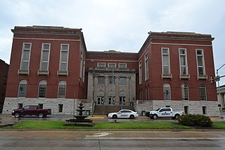
Ottawa County is a county located in the northeastern corner of the U.S. state of Oklahoma. As of the 2020 census, the population was 30,285. Its county seat is Miami. The county was named for the Ottawa Tribe of Oklahoma. It is also the location of the federally recognized Modoc Nation and the Quapaw Nation, which is based in Quapaw.

Treece is a ghost town in Cherokee County, Kansas, United States, and part of the historic Tri-State Mining District. As of the 2010 census, the city population was 138. As of May 2012 the city was abandoned and most buildings and other facilities demolished due to pervasive problems with lead pollution resulting from past mining. Two people who had refused an Environmental Protection Agency (EPA) buyout remained in 2012, then one died in 2016.

Cardin is a ghost town in Ottawa County, Oklahoma, United States. The population was 150 at the 2000 census, but plummeted to 3 at the 2010 census in April 2010.

Peoria is a town in Ottawa County, Oklahoma, United States. It was named for the Peoria people, a tribe of Native Americans who were removed to Indian Territory from east of the Mississippi River during the 19th century. The territory had been occupied by the Quapaw people, who sold some of their land to the Peoria. The population was 131 at the 2010 U. S. Census, down from 141 at the 2000 census. The long decline of mining meant that jobs moved elsewhere.

Picher is a ghost town and former city in Ottawa County, northeastern Oklahoma, United States. It was a major national center of lead and zinc mining for more than 100 years in the heart of the Tri-State Mining District.

ASARCO is a mining, smelting, and refining company based in Tucson, Arizona, which mines and processes primarily copper. The company has been a subsidiary of Grupo México since 1999.

The Joplin, Missouri-Kansas, Metropolitan Statistical Area (MSA), as defined by the United States Census Bureau, is an area consisting of Jasper, Newton, and Cherokee counties in southwest Missouri and southeast Kansas anchored by the city of Joplin. The estimated 2023 population of the Joplin, MO-KS (MSA) is 204,787. As of March 2023, The U.S. Census Bureau MSA delineation report added Cherokee County, Kansas to the Joplin, MO MSA making it the Joplin, MO-KS MSA.

Tar Creek Superfund site is a United States Superfund site, declared in 1983, located in the cities of Picher, Douthat and Cardin, Ottawa County, in northeastern Oklahoma. From 1900 to the 1960s lead mining and zinc mining companies left behind huge open chat piles that were heavily contaminated by these metals, cadmium, and others. Metals from the mining waste leached into the soil, and seeped into groundwater, ponds, and lakes. Because of the contamination, Picher children have suffered elevated lead, zinc and manganese levels, resulting in learning disabilities and a variety of other health problems. The EPA declared Picher to be one of the most toxic areas in the United States.
J.D. Strong is a civil servant from the U.S. state of Oklahoma and the current executive director of the Oklahoma Water Resources Board (OWRB). As executive director of the OWRB, Strong is responsible for carrying out the agency's mission to protect and enhance the quality of life for Oklahomans by managing and improving the state's water resources to ensure clean and reliable water supplies, a strong economy, and a safe and healthy environment. Under Strong's leadership, the OWRB updated the Oklahoma Comprehensive Water Plan, a 50-year water supply assessment and policy strategy to meet Oklahoma's future water needs. Strong also oversees administration of Oklahoma's AAA-rated $3 billion Financial Assistance Program, which assists more than two-thirds of Oklahoma communities and rural water districts in financing water infrastructure projects. Other significant programs under Strong's direction include the administration of almost 13,000 water rights permits allocating some 6 million acre-feet of stream and groundwater, hydrologic studies, licensure of water well drillers, floodplain management, dam safety, and a water quality management program that includes establishment of standards and statewide monitoring of lakes and streams. Strong represents Oklahoma on the Western States Water Council and Chairs its Water Quality Committee, and also serves as Oklahoma's Commissioner on four congressionally approved interstate water Compact Commissions.
Brian C. Griffin is an American businessman from Oklahoma who currently serves as the Chairman of the Board of Directors for Clean Energy Systems, a private Rancho Cordova, California-based energy technology innovations firm.
EaglePicher Technologies is a privately held American manufacturing company known for its battery technology, energetic devices, and battery management systems. The company started in 1843 as the White Lead Company in Cincinnati, Ohio. A merger with the Picher Lead Company of Joplin, Missouri occurred in 1906, becoming Eagle–Picher Lead, which evolved into Eagle–Picher Industries, Inc. and finally EaglePicher Technologies. With its merger with the lead mining company owned by Oliver Picher, it was the second largest producer of lead and zinc products in the world. The company has provided lithium-ion batteries to military aircraft and high altitude unmanned aerial vehicles. EaglePicher also developed the first human-implantable lithium-ion battery. The company has nine North American manufacturing and research and development sites and over 900 employees.

The Tri-State district was a historic lead-zinc mining district located in present-day southwest Missouri, southeast Kansas and northeast Oklahoma. The district produced lead and zinc for over 100 years. Production began in the 1850s and 1860s in the Joplin - Granby area of Jasper and Newton counties of southwest Missouri. Production was particularly high during the World War I era and continued after World War II, but with declining activity. As jobs left the area, the communities declined in population.
Douthat is a ghost town in Ottawa County, Oklahoma, United States. Douthat is 2 miles (3.2 km) south of Picher. Douthat once had a post office, which opened on March 17, 1917. The community was named after Zahn A. Douthat, the owner of the townsite. Douthat is now abandoned and part of the Tar Creek Superfund site.
Picher-Cardin Public Schools was a school district headquartered in Picher, Oklahoma.
Quapaw Public Schools is a school district headquartered in Quapaw, Oklahoma. Its area includes, in addition to Quapaw, Cardin, Peoria, Picher, and Hockerville.
Commerce School Public Schools is a school district headquartered in Commerce, Oklahoma.
Zincville is a ghost town in Ottawa County, Oklahoma, United States.
The Miami Mineral Belt Railroad (MMBR) served the Miami and Picher lead mining areas in that portion of the Tri-state mining district located in far northeastern Oklahoma. It was closely associated with the St. Louis-San Francisco Railway (Frisco) for its entire history, and was eventually absorbed into the Frisco.


