Oak Island is a 57-hectare (140-acre) privately owned island in Lunenburg County on the south shore of Nova Scotia, Canada. The tree-covered island is one of about 360 small islands in Mahone Bay and rises to a maximum of 11 metres above sea level. The island is located 200 metres from shore and connected to the mainland by a causeway and gate. The nearest community is the rural community of Western Shore which faces the island, while the nearest village is Chester.

Cumberland County is a county in the U.S. state of Maine. As of the 2010 census, the population was 281,674, making it the most populous county in Maine. Its county seat is Portland. Cumberland County was founded in 1760 from a portion of York County, Province of Massachusetts Bay, and named for William, Duke of Cumberland, a son of King George II.
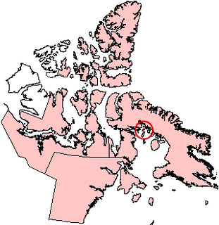
Koch Island is one of the Canadian Arctic islands in Qikiqtaaluk Region, Nunavut, Canada. Located in Foxe Basin, it is an uninhabited Baffin Island offshore island. Located at 69°38'N 78°20'W, it has an area of 458 km2 (177 sq mi).
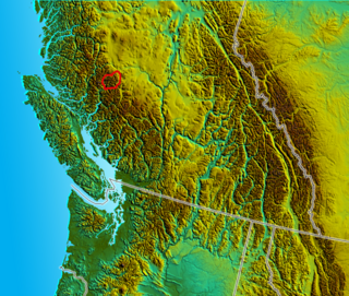
The Niut Range is 3600 km² in area. It is a subrange of the Pacific Ranges of the Coast Mountains of British Columbia, although in some classifications it is considered part of the Chilcotin Ranges. The Niut is located in the angle of the Homathko River and its main west fork, Mosley Creek. It is isolated, island-like, by those rivers from its neighbour ranges, as both streams have their source on the Chilcotin Plateau in behind the range. Razorback Mountain is its highest peak.

Lot 50 is a township in Queens County, Prince Edward Island, Canada. It is part of St. John's Parish. Lot 50 was awarded to Henry Gladwin and Captain Peter Innes in the 1767 land lottery. One quarter of the lot was granted to Loyalists in 1783.
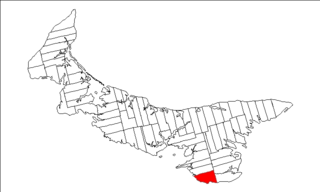
Lot 62 is a township in Queens County, Prince Edward Island, part of St. John's Parish. Lot 62 was awarded to Richard Spry, Esquire in the 1767 Land Lottery, and came to be settled through the efforts of Thomas Douglas, The 5th Earl of Selkirk in 1803. Richard Spry, Esquire, was then Commodore, Commander-in-Chief, Mediterranean Fleet at Gibraltar 1766–1769. Becoming the proprietor, he would be familiar with then the Island of St. John, having first come out to North America in 1754, with the English naval blockade of Ile Royal and the Fortress of Louisbourg in 1756, and then serving off Quebec and in the St. Lawrence into 1759. In 1762, he returned as Commander-in-Chief, North America, quartered in Halifax.

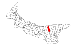
Lot 41 is a township in Kings County, Prince Edward Island, Canada. It is part of St. Patrick's Parish. Lot 41 was one of four lots awarded to the officers of the 78th Fraser Highlanders in the 1767 land lottery.

Lot 42 is a township in Kings County, Prince Edward Island, Canada. It is part of St. Patrick's Parish. Lot 42 was one of four lots awarded to the officers of the 78th Fraser Highlanders in the 1767 land lottery.

St. Patrick's Parish was created as a civil parish in Kings County, Prince Edward Island, Canada, during the 1764-1766 survey of Samuel Holland.

Morden Colliery Historic Provincial Park is a 4 hectare historic provincial park in the Regional District of Nanaimo in British Columbia, Canada.

King Christian Island is an uninhabited member of the Canadian Arctic Archipelago in the Sverdrup Islands, a part of the Queen Elizabeth Islands archipelago, in the Qikiqtaaluk Region of Nunavut, Canada. It lies in the Arctic Ocean, 13.5 km (8.4 mi) from the southwestern coast of Ellef Ringnes Island, separated by the Danish Strait.

Charlottetown is the capital and largest city of the Canadian province of Prince Edward Island, and the county seat of Queens County. Named after Charlotte of Mecklenburg-Strelitz, queen consort of King George III of the United Kingdom, Charlottetown was originally an unincorporated town that incorporated as a city in 1855.

Kilian Island formerly Elvira Island is an uninhabited island in the Qikiqtaaluk Region, Nunavut, Canada. It is located in the Viscount Melville Sound, west of Stefansson Island, and north of Victoria Island.
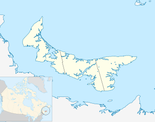
Tignish Shore is a municipality that holds community status in Prince Edward Island, Canada. It is located in the Lot 1 township.

Tryon is an unincorporated area in Prince County, Prince Edward Island, Canada. Situated on Route 1 and Route 10, it lies within the township of Lot 28 which in 2006 had a population of 880 people. Tryon is not far from Crapaud, Prince Edward Island.

The Municipality of Lot 11 and Area is a municipality that holds community status in Prince Edward Island, Canada. It is located within Prince County.

Resort Municipality, officially named the Resort Municipality of Stanley Bridge, Hope River, Bayview, Cavendish and North Rustico, is the lone municipality in Prince Edward Island, Canada that holds resort municipality status. It was established in 1990.

Long River is an unincorporated community, in Queens County. Long River is in Lot 20 of Statistics Canada

The 2020 Canadian Premier League season was the second season of the Canadian Premier League, the top level of Canadian soccer.
